La Manga is a seaside spit separating the Mediterranean Sea from the Mar Menor lagoon, running 21 km (& 100m wide) from Cabo de Palos to the Punta del Mojón. It’s a popular visitor destination for the golf on La Manga and water sports in the Mar Menor (“small sea”). The best running in this area is the loop around Cape Pelos.
Cape Pelos Loop
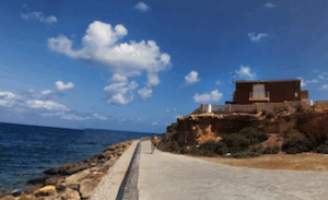
Cabo Pelos Path. Google Street View
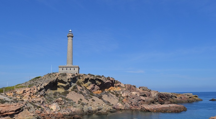
The loop around Cape Palos is 5.6 km. The rocky Cape is very scenic, with its cliffs, caves, coves, and sea views. Starting from Cala Medina, run on the coastal path, Sendero Cabo Palos a Cala Reona/Po de la Barra, along the south side of the Cape. It’s a mainly gravel trail, with a couple of sections of paved promenade. There are nice water views. At Calafría Beach, you can take a jaunt out to the lighthouse (faro), and then wind around to the north end. The concrete path runs by a couple of coves, and then is a wider promenade along Playa de Levante. The last section is around a scenic marina.
La Manga Running Options
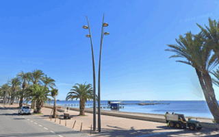
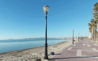
The running on La Manga isn’t great. There’s one main road, Gran Vía de la Manga, which runs along the spit. It’s mainly interior, with a few scenic sections along the water. However, there is are separate cycle and pedestrian paths along the Gran Vía, so it’s runnable — just not that scenic. The nicest section is toward the northern end.
La Manga is a seaside spit separating the Mediterranean Sea from the Mar Menor lagoon, running 21 km (& 100m wide) from Cabo de Palos to the Punta del Mojón. It’s a popular visitor destination for the golf on La Manga and water sports in the Mar Menor (“small sea”). The best running in this area is the loop around Cape Pelos.
Cape Pelos Loop
Cabo Pelos Path. Google Street View
The loop around Cape Palos is 5.6 km. The rocky Cape is very scenic, with its cliffs, caves, coves, and sea views. Starting from Cala Medina, run on the coastal path, Sendero Cabo Palos a Cala Reona/Po de la Barra, along the south side of the Cape. It’s a mainly gravel trail, with a couple of sections of paved promenade. There are nice water views. At Calafría Beach, you can take a jaunt out to the lighthouse (faro), and then wind around to the north end. The concrete path runs by a couple of coves, and then is a wider promenade along Playa de Levante. The last section is around a scenic marina.
La Manga Running Options
The running on La Manga isn’t great. There’s one main road, Gran Vía de la Manga, which runs along the spit. It’s mainly interior, with a few scenic sections along the water. However, there is are separate cycle and pedestrian paths along the Gran Vía, so it’s runnable — just not that scenic. The nicest section is toward the northern end.
An enjoyable run on a wide waterfront promenade between Los Cuarteros and Santiago de la Ribera. There are open views of the Mar Menor and a festive scene. Also in this area is the Camino Quintin, a scenic 4.2 km dyke path.
Scenic run on a coastal promenade path in Los Alcázares, a coastal spa town and former fishing village on the western side of the Mar Menor. The wide, palm-lined path runs for 5.6 km from Playa de la Concha north to Playa de Palo.
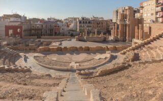
A 'runseeing' tour of Casco Antiguo section of the port city of Cartagena, known for its Roman ruins. Includes the Teatro Romano, Castillo de la Concepción, port area, old city walls, Cuesta del Batel, and a running track.
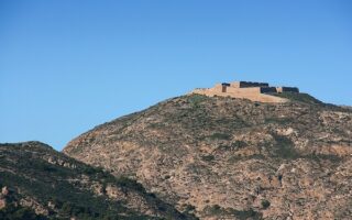
Get your heart rate up on these steep, hilly runs to hilltop castles. They're on steep paved roads/concrete paths. Great views of the city and port area. They're nearby but are two separate route.
In Bolnuevo, known for its eroded sandstone formations and famous "mushroom rocks", there's nice running on a ~3 km boardwalk and then a runnable section of the Camino de las Calas, a wide gravel path along the coast to almost Playa de Percheles.
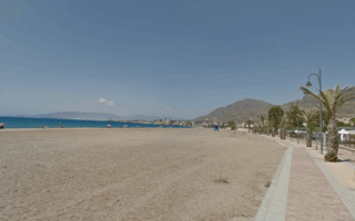
Águilas is a coastal town at the southwestern end of the Costa Cálida, known for its numerous beaches. There's nearly 6 km of running on a waterfront promenade/sidewalk, with good beach & water views. We've added the 0.5 km Tunel del embarcadero del Hornillo.
Share your feedback on this route and see that of other Great Runs users. Click on the image icon to upload a photo. And please let us know if there are notes or changes we should incorporate!
Review or Comment on This Route/Share a Photo!
Share your feedback on this route and see that of other Great Runs users. Click on the image icon to upload a photo. And please let us know if there are notes or changes we should incorporate!