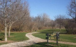
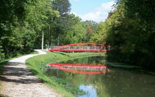
Formerly a military installation, Fort Ben, as it’s called, is now a state park and nature preserve. The park is located 14 miles northeast of downtown Indianapolis. The entrance is at the intersection of Post and 59th Street. There are several trails to choose from. None of the individual trails is more than three miles, but many of them connect so you can create your own. The loop around the Duck Pond is paved and has some good hills. The Fall Creek Trail is scenic and has a couple of very steep hills. The Lawrence Creek trail is a bit more friendly with its wide path and moderate terrain.
Park Info Trail Map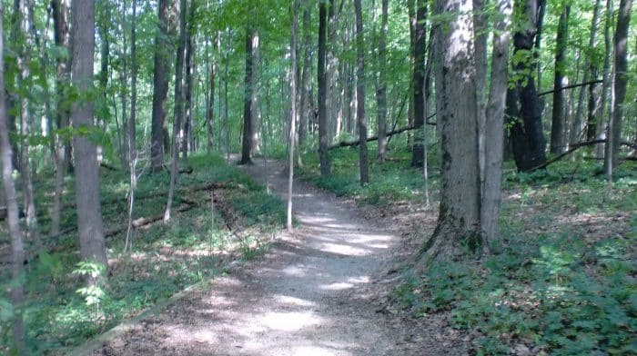
Features:
Scroll Down For Route Maps
Essentials
Current Weather & Forecast

Indianapolis, US
2:15 pm,
Jun 8, 2026
L: 25°
H: 26°
Daily ForecastHourly Forecast
Today
5:00 pm
25° / 26°°C
0.2 mm
20%
13 mph
81 %
1014 mb
0 mm/h
Tomorrow
5:00 pm
25° / 34°°C
0 mm
0%
15 mph
92 %
1016 mb
0 mm/h
Wednesday
5:00 pm
23° / 31°°C
0 mm
0%
16 mph
82 %
1013 mb
0 mm/h
Thursday
5:00 pm
23° / 31°°C
0 mm
0%
17 mph
85 %
1009 mb
0 mm/h
Friday
5:00 pm
17° / 28°°C
1 mm
100%
14 mph
99 %
1017 mb
0 mm/h
Today
5:00 pm
26° / 29°°C
0.2 mm
20%
13 mph
81 %
1014 mb
0 mm/h
Today
8:00 pm
29° / 31°°C
0 mm
0%
11 mph
77 %
1013 mb
0 mm/h
Today
11:00 pm
26° / 26°°C
0 mm
0%
7 mph
87 %
1013 mb
0 mm/h
Tomorrow
2:00 am
25° / 25°°C
0 mm
0%
7 mph
92 %
1014 mb
0 mm/h
Tomorrow
5:00 am
25° / 25°°C
0 mm
0%
7 mph
92 %
1014 mb
0 mm/h
Tomorrow
8:00 am
25° / 25°°C
0 mm
0%
11 mph
89 %
1016 mb
0 mm/h
Tomorrow
11:00 am
30° / 30°°C
0 mm
0%
15 mph
78 %
1016 mb
0 mm/h
Other Routes in Indianapolis, IN


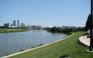
A terrific option for running in the heart of Indianapolis. The paved multi-use path runs for up to 7 miles along the White River from Raymond St. north to Riverside Park. Parks, skyline & water views, and some key Indy sites.
A popular race route, but it is also a great "Heart of the City" run. There are 2 routes: a 3.3 and a 5 mile loop.

One of the best downtown spots to run, no matter the time of day. It's safe, quiet, and uninterrupted by traffic for an almost 2 mile loop.

A ten-mile pedestrian and cycle friendly trail connecting six cultural districts in downtown Indianapolis. Good connections to other multi-use trails.
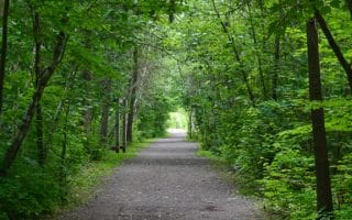
A popular paved trail that runs along Fall Creek. Starts at Kessler Park, ~2.5 miles north of downtown, and runs 9.5 northeast to Skiles Test Nature Park. Water views as you pass century-old bridges and established neighborhoods.

A popular running spot and one of the largest metropolitan green spaces in the nation. There are 10 miles of trails and certified road courses of 5K, 8K, and 10K. Combination of wooded & waterside trails, with some rolling hills.

Run along the inaugural 'rails to trails' trail! This paved, multi-use path stretches from near downtown, north for 25+ miles to Sheridian, with numerous connections to other area trails. There are several 'sections' of the trail.

A new addition to the Indy running scene. This 3.7 mile trail follows Pogue's Run (creek), just east of I-70, for 3.7 miles. Mix of residential, parks, and wetlands. Connect to the Monon Traiil @ 10th St.

There are some lovely residential neighborhoods for running just north of downtown. Start in Meridian Hills, using the spectacular North Meridian St. as an anchor, and work your way north to Nora and Carmel.
Explore the eastern and southern edges of the city with the Pleasant Run Trail. The south end is at Garfield Park, the north end is Ellenberger Park.
This scenic and mostly dirt and crushed limestone path parallels the White River
User Ratings
Leave A Review or Comment
Review or Comment on This Route/Share a Photo!
Share your feedback on this route and see that of other Great Runs users. Click on the image icon to upload a photo. And please let us know if there are notes or changes we should incorporate!