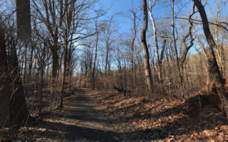
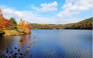
Oregon Ridge Park located 20 miles north of Baltimore, is a good spot for some trail running. The 1,000-acre park features a nice variety of mainly wooded trails. Some are easier, others are more rocky and steep. This park is a particular treat in autumn. This trail map features a good number of suggested loops.

Features:
Scroll Down For Route Maps
Essentials
Current Weather & Forecast

Baltimore, US
8:13 pm,
Jul 12, 2026
L: 26°
H: 27°
Daily ForecastHourly Forecast
Tomorrow
5:00 pm
26° / 27°°C
0 mm
0%
10 mph
84 %
1016 mb
0 mm/h
Tuesday
5:00 pm
15° / 25°°C
0 mm
0%
10 mph
85 %
1018 mb
0 mm/h
Wednesday
5:00 pm
14° / 23°°C
0 mm
0%
12 mph
83 %
1018 mb
0 mm/h
Thursday
5:00 pm
12° / 21°°C
0 mm
0%
12 mph
78 %
1024 mb
0 mm/h
Friday
5:00 pm
11° / 23°°C
0 mm
0%
5 mph
70 %
1025 mb
0 mm/h
Today
11:00 pm
19° / 21°°C
0 mm
0%
6 mph
84 %
1013 mb
0 mm/h
Tomorrow
2:00 am
22° / 23°°C
0 mm
0%
10 mph
66 %
1013 mb
0 mm/h
Tomorrow
5:00 am
26° / 26°°C
0 mm
0%
10 mph
45 %
1014 mb
0 mm/h
Tomorrow
8:00 am
28° / 28°°C
0 mm
0%
10 mph
43 %
1014 mb
0 mm/h
Tomorrow
11:00 am
27° / 27°°C
0 mm
0%
9 mph
46 %
1014 mb
0 mm/h
Tomorrow
2:00 pm
21° / 21°°C
0 mm
0%
9 mph
65 %
1014 mb
0 mm/h
Tomorrow
5:00 pm
17° / 17°°C
0 mm
0%
9 mph
75 %
1016 mb
0 mm/h
Other Routes in Baltimore, MD
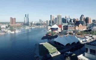
The signature Baltimore waterfront run. The Baltimore Waterfront Promenade runs along the water for 5.4 miles between the Museum of Industry on the western side to Canton Waterfront Park on the southeastern side.

Historic fort that's the birthplace of the “The Star-Spangled Banner". Designed by the Olmsteds and run by the National Park Service. Loop around the Fort is ~1 mile. We've also created a route from the Charm City Running Store.
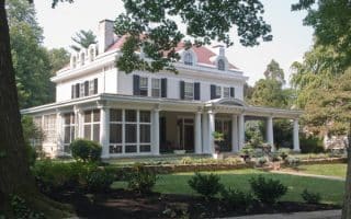

Terrific running combining the gorgeous, Olmsted-designed Roland Park neighborhood, the Stony Brook Trail, and the attractive campus of Johns Hopkins University. Each of those elements can be a standalone route, or can be combined.
Druid Hill Park is known for its shady lawns, picturesque water features, majestic forest, Baltimore Zoo, botanic gardens, and conservatory. Great if you’re looking for a hill workout.

This park, located on Lake Roland in the northwestern part of Baltimore, features several miles of trails around meadows, wetlands, and mature hardwood forests. Accessible via light rail!
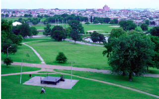
Attractive, 155-acre park in Baltimore's east side known for greenery, large trees, & paved walkways. A perimeter loop is ~2 miles. Can also be combined with our Inner Harbor route.
Lake Montebello has a scenic 1.3 mile paved lake loop. Also connects to Herring Run Park, which features a 4-mile mainly wooded loop trail around Herring Run stream. The adjacent residential areas are also nice for running.
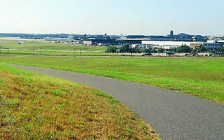
One of the only trails that loops around an airport, that we know of! The paved 10.7 mile path loops around BWI Airport, with some surprisingly nice sections. Good access from airport hotels & transit. Can also connect to the B&A Trail.

The B&A Trail is 13.3-mile paved mutli-use path stretching from Glen Burnie, near BWI, south to Annapolis. It's one of the the best spots in the area for a long off-road run. It's mainly wooded, and quite flat. There are half-mile markers along the way. Choose a section!
This old railroad trail is 15 miles north of Baltimore and has a crushed limestone path that will goes all the way to Pennsylvania, where it becomes the Ma & Pa Trail. Flat, with mileage markers.
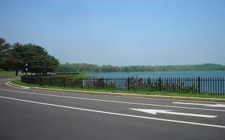
Large reservoir park 20 miles north of Baltimore that's popular for hiking, trail running, and mountain biking. Good trail running options -- some more technical. On weekends, a 1.7-mile section of Loch Raven Drive is closed to cars!

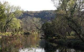
Great trail running spot 10 miles west of Baltimore. The park is situated along 32 miles of the Patapsco River, and features 200 miles of mainly wooded trails. Something for everyone! There are five 'areas', each with its own trail map.
User Ratings
Leave A Review or Comment
Review or Comment on This Route/Share a Photo!
Share your feedback on this route and see that of other Great Runs users. Click on the image icon to upload a photo. And please let us know if there are notes or changes we should incorporate!