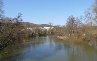
The narrow Svitava River runs east of Brno. It’s possible to run alongside the Svitava, particularly headed north from Židenice area, on a path called the Svitavské nábř. We’ve mapped 5 km one-way. There are views of the water most of the way.
Starting at the military hospital, the Svitavské nábř is a combination of dedicated multi-use path and small road, mostly paved. In some sections, there are path options on both sides, with small pedestrian bridges connecting them. Our route ends at the railway bridge in Obřany. It’s possible to continue further north for many km on a path that feels more remote and is a mix of surface types.


Review or Comment on This Route/Share a Photo!
Share your feedback on this route and see that of other Great Runs users. Click on the image icon to upload a photo. And please let us know if there are notes or changes we should incorporate!