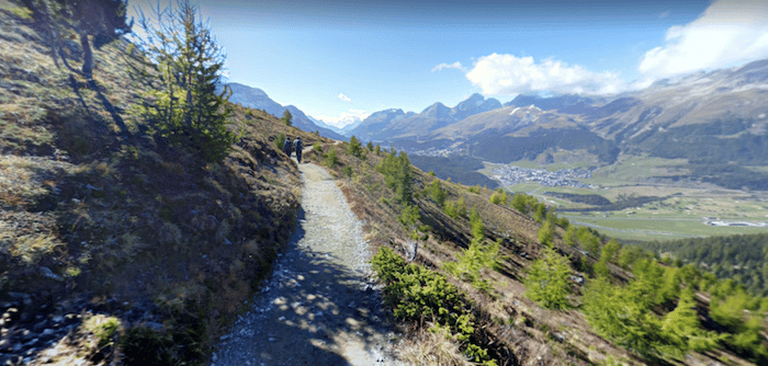
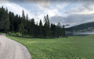
Trail runners will salivate over the endless variety of trails in the St. Moritz area. It’s a massive network, with well-waymarked paths and something for runners of all abilities. One good option, in summer, is to take the funicular to the 2,456m summit of Muragl, where trails extend in all directions. This is some of the most scenic day hiking in Europe. Some of the trails are wide, not too steep, and with good footing, while others are more steeper and more challenging trail running. We suggest picking up a map and finding a route that suits your ability.
Google Street View
Features:
Essentials
- Many distance options
- There are options for somewhat hilly and very hilly!
- Funicular station is in Punt Muragl
- 5 km northeast of St. Moritz
Current Weather & Forecast

St. Moritz, CH
8:51 am,
Jul 14, 2026
L: 16°
H: 16°
Daily ForecastHourly Forecast
Today
11:00 pm
29° / 33°°C
0 mm
0%
12 mph
70 %
1014 mb
0 mm/h
Tomorrow
11:00 pm
28° / 37°°C
0 mm
0%
13 mph
70 %
1014 mb
0 mm/h
Thursday
11:00 pm
26° / 33°°C
0 mm
0%
12 mph
70 %
1014 mb
0 mm/h
Friday
11:00 pm
26° / 34°°C
0.92 mm
92%
12 mph
72 %
1013 mb
0 mm/h
Saturday
11:00 pm
26° / 33°°C
1 mm
100%
11 mph
82 %
1013 mb
0 mm/h
Today
11:00 am
33° / 33°°C
0 mm
0%
12 mph
56 %
1010 mb
0 mm/h
Today
2:00 pm
30° / 31°°C
0 mm
0%
11 mph
61 %
1011 mb
0 mm/h
Today
5:00 pm
30° / 30°°C
0 mm
0%
10 mph
64 %
1014 mb
0 mm/h
Today
8:00 pm
30° / 30°°C
0 mm
0%
7 mph
68 %
1013 mb
0 mm/h
Today
11:00 pm
29° / 29°°C
0 mm
0%
6 mph
70 %
1012 mb
0 mm/h
Tomorrow
2:00 am
28° / 28°°C
0 mm
0%
6 mph
70 %
1014 mb
0 mm/h
Tomorrow
5:00 am
33° / 33°°C
0 mm
0%
7 mph
50 %
1014 mb
0 mm/h
Other Routes in St. Moritz, Switzerland
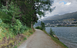
The signature run in St. Moritz is the 4k loop around its principal lake, Lej da San Murezzan. The wide, gravel path runs right along the edge of the lake, featuring beautiful water, mountain, and valley views.
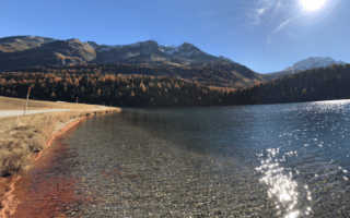
Lovely 5k loop around Lake Champfèr, just south of St. Moritz. The wide gravel path features attractive lake and mountain views. Can be combined with other lake loops and forested trails in the area.
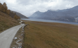
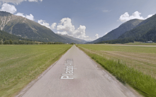
A wonderful opportunity for a longer run in St. Moritz, combining paths along the Inn river and three lakes: Lake Champfèr, Lake Silvaplana, and Lake Sils. The total is up to 17 km one-way between St. Moritz and Maloja, with bus return options.
A network of forest trails runs between St. Moritz and Pontresina, with something for runners of all abilities -- from challenging single-track trails to wider gravel paths. Head east toward Pontresina, north to Celerina, or southwest to Champfèr.
The 5 km loop around Airport Samedan is popular with runners, as it's one of the better bets in the St. Moritz area for a flat tempo run on a paved surface. Also one of the most scenic routes in proximity to an airport we've ever taken!
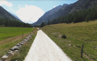
A scenic run along a quiet gravel road, with steep mountains on both sides. The Via Val Roseg runs out of Pontresina, for 6.6 km to Samedan, through a pretty valley with fantastic mountain views. It's steady climb, with modest grades.
User Ratings
Leave A Review or Comment
Review or Comment on This Route/Share a Photo!
Share your feedback on this route and see that of other Great Runs users. Click on the image icon to upload a photo. And please let us know if there are notes or changes we should incorporate!