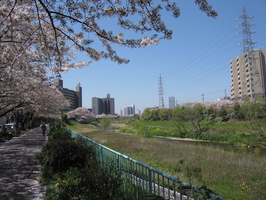
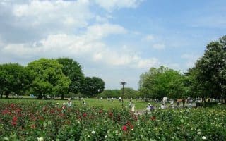
In the Tenpaku Ward of Nagoya, there are paths along the east side of the Tenpaku River that provide an opportunity for a longer off-road run. The paths are a combination of paved and gravel, in some spots on dike above the river, and in some spots alongside the water, paralleling the road. Some sections are pleasant and tree-lined, while others are a bit busier and more industrial.
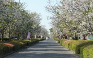
We’ve mapped a route, from Shimadabashi Park, south for 7.5 km. One must cross over to the west bank of the river at Tsurusato Park (4.3 km mark), and then back over to the east bank at Katahira Nursery (6 km mark). Choose any section of the path you like! If you’d prefer to not do an out and back, there are transport options. The Sakuradori Line crosses the route at the ~4.5 km mark, near Tsurusato Park.
In the Tenpaku Ward of Nagoya, there are paths along the east side of the Tenpaku River that provide an opportunity for a longer off-road run. The paths are a combination of paved and gravel, in some spots on dike above the river, and in some spots alongside the water, paralleling the road. Some sections are pleasant and tree-lined, while others are a bit busier and more industrial.
We’ve mapped a route, from Shimadabashi Park, south for 7.5 km. One must cross over to the west bank of the river at Tsurusato Park (4.3 km mark), and then back over to the east bank at Katahira Nursery (6 km mark). Choose any section of the path you like! If you’d prefer to not do an out and back, there are transport options. The Sakuradori Line crosses the route at the ~4.5 km mark, near Tsurusato Park.


Review or Comment on This Route/Share a Photo!
Share your feedback on this route and see that of other Great Runs users. Click on the image icon to upload a photo. And please let us know if there are notes or changes we should incorporate!