There are some excellent options for running in the historic seaport town of Bristol, located 15 miles south of Providence. Run a section of the East Bay Bike Path, the scenic trails of Colt State Park, the town’s historic streets, or the pedestrian paths of the waterfront Roger Williams University.
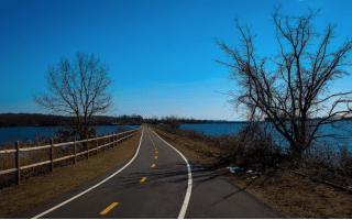
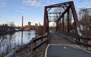
East Bay Bike Path. The southern terminus of the 15-mile East Bay Bike Path is located at Independence Park in Bristol. There’s parking here. Run north on this paved multi-use trail toward Warren, Barrington, & Providence. This southern section is a mix of waterfront & inland. FULL ROUTE
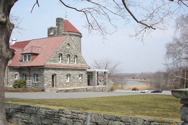
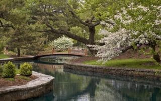
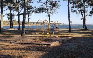
Colt State Park. This park is a gem for running. There are ~4 miles of paved pathways around the park’s 464 acres of lawns, stone walls, and curving drives along one of the state’s most spectacular shorelines. Admission and parking are free. TRAIL MAP
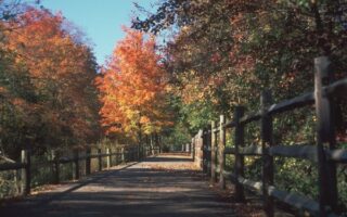
- Longer Option. From Colt State Park, connect to the East Bay Bike Path. It’s 0.5 miles using Asylum Rd. or Poppasquash Rd. (more scenic). For a scenic 1.5 mile extension from Colt State Park, take Poppasquash Rd. to the East Bay Bike Path and run south to the end. Then, continue Independence Park and along a short waterfront path to Church St. in central Bristol. Add even more with the scenic streets of historic Bristol.
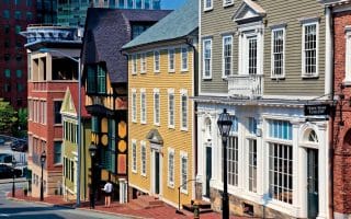
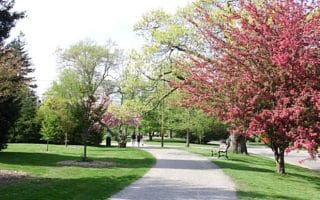
Central Bristol. Small, compact town has numerous has lovely, tree-lined streets with historic homes and shops. Enjoy the streets between Hope St. (Rt. 114) and Metacom Ave. (Rt. 136).
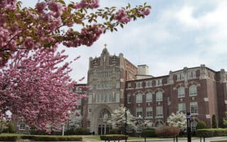
Roger Williams University Campus. Enjoy the pedestrian paths around this scenic waterfront campus. It’s ~0.6 miles from the north to south end of campus. A highlight is the 0.7 mile Shell Path, accessed from Parking Lot H/I.
- Road Connection from central Bristol: It’s ~1.4 miles from central Bristol to the University. Ferry Rd. is more scenic but lacks a sidewalk/shoulder. Metacom Rd. has a good shoulder but is less scenic.
There are some excellent options for running in the historic seaport town of Bristol, located 15 miles south of Providence. Run a section of the East Bay Bike Path, the scenic trails of Colt State Park, the town’s historic streets, or the pedestrian paths of the waterfront Roger Williams University.
East Bay Bike Path. The southern terminus of the 15-mile East Bay Bike Path is located at Independence Park in Bristol. There’s parking here. Run north on this paved multi-use trail toward Warren, Barrington, & Providence. This southern section is a mix of waterfront & inland. FULL ROUTE
Colt State Park. This park is a gem for running. There are ~4 miles of paved pathways around the park’s 464 acres of lawns, stone walls, and curving drives along one of the state’s most spectacular shorelines. Admission and parking are free. TRAIL MAP
- Longer Option. From Colt State Park, connect to the East Bay Bike Path. It’s 0.5 miles using Asylum Rd. or Poppasquash Rd. (more scenic). For a scenic 1.5 mile extension from Colt State Park, take Poppasquash Rd. to the East Bay Bike Path and run south to the end. Then, continue Independence Park and along a short waterfront path to Church St. in central Bristol. Add even more with the scenic streets of historic Bristol.
Central Bristol. Small, compact town has numerous has lovely, tree-lined streets with historic homes and shops. Enjoy the streets between Hope St. (Rt. 114) and Metacom Ave. (Rt. 136).
Roger Williams University Campus. Enjoy the pedestrian paths around this scenic waterfront campus. It’s ~0.6 miles from the north to south end of campus. A highlight is the 0.7 mile Shell Path, accessed from Parking Lot H/I.
- Road Connection from central Bristol: It’s ~1.4 miles from central Bristol to the University. Ferry Rd. is more scenic but lacks a sidewalk/shoulder. Metacom Rd. has a good shoulder but is less scenic.


Review or Comment on This Route/Share a Photo!
Share your feedback on this route and see that of other Great Runs users. Click on the image icon to upload a photo. And please let us know if there are notes or changes we should incorporate!