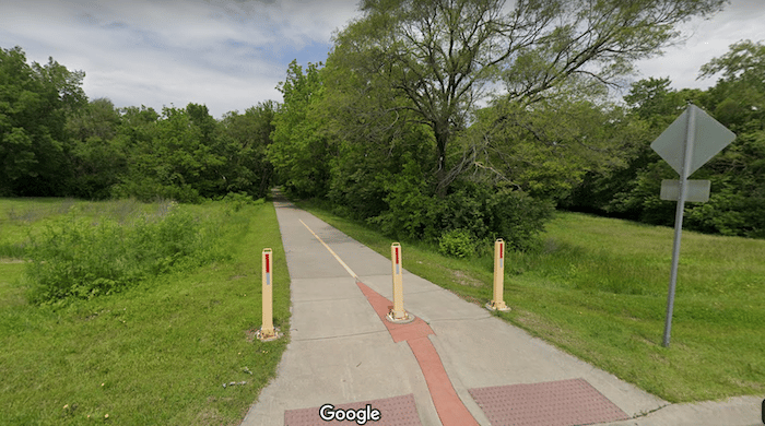
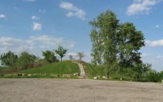
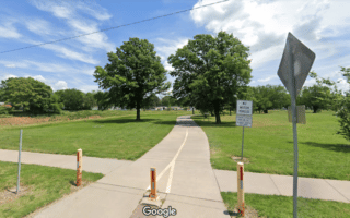
Another fantastic Topeka multi-use trail is the Landon Nature Trail, a concrete pathway that bisects the city north to south for up to 24 miles. The north end starts at 17th Street (Cushinberry Park). It continues for 3.8 miles to SE 45th Street, where the terrain shifts to gravel. The mostly gravel path runs for an additional 20 miles to W 157 Street near Overbrook. Near Topeka, the best sections to run is near Lakewood Park. The rural dirt sections near the Topeka Regional Airport are also quite beautiful.
Features:
Categories:
Scroll Down For Route Maps
Essentials
- Up to 24 miles (39 km) one-way
- 566 feet (173 meters)
- Cushinberry Park
- 17th @ Jefferson WB Bus Stop
Current Weather & Forecast

Topeka, US
3:26 pm,
Jul 8, 2026
L: 32°
H: 34°
Daily ForecastHourly Forecast
Today
4:00 pm
32° / 34°°C
0.2 mm
20%
3 mph
60 %
1014 mb
0 mm/h
Tomorrow
4:00 pm
25° / 35°°C
0.9 mm
90%
17 mph
95 %
1014 mb
0 mm/h
Friday
4:00 pm
25° / 36°°C
0.2 mm
20%
13 mph
64 %
1014 mb
0 mm/h
Saturday
4:00 pm
24° / 31°°C
0.2 mm
20%
9 mph
78 %
1016 mb
0 mm/h
Sunday
4:00 pm
22° / 30°°C
1 mm
100%
14 mph
98 %
1017 mb
0 mm/h
Today
4:00 pm
30° / 34°°C
0.2 mm
20%
3 mph
60 %
1014 mb
0 mm/h
Today
7:00 pm
26° / 31°°C
0.58 mm
58%
9 mph
68 %
1014 mb
0 mm/h
Today
10:00 pm
25° / 28°°C
0.9 mm
90%
8 mph
82 %
1014 mb
0 mm/h
Tomorrow
1:00 am
25° / 25°°C
0.78 mm
78%
3 mph
95 %
1014 mb
0 mm/h
Tomorrow
4:00 am
25° / 25°°C
0 mm
0%
4 mph
90 %
1013 mb
0 mm/h
Tomorrow
7:00 am
27° / 27°°C
0 mm
0%
6 mph
81 %
1014 mb
0 mm/h
Tomorrow
10:00 am
31° / 31°°C
0 mm
0%
11 mph
42 %
1014 mb
0 mm/h
Other Routes in Topeka, KS
This manmade lake in the southeast of Topeka is the local favorite running route. A beautiful concrete pathway encircles the lake for a ~7 mile loop.
The Shunga Trail follows the Shunganunga Creek across the city from East Topeka North to Southwest Topeka. It’s an 8 mile paved multi-use path.
There is a large trail network at MacLennan Park, an area of Kaw River State Park. The “Yellow Trail” is the best easy running option.
The Azura Trails of Skyline Park span nearly 5 miles around and over Burnett’s Mound, which is the highest elevation in Shawnee County.
The best running option in North Topeka is the Soldier Creek Trail, a 2 mile pathway along the eponymous waterway. Start from Garfield Park.

The University town of Lawrence has several running options, including Clinton Lake, the Lawrence Loop, and the Old West Lawrence neighborhood.
User Ratings
Leave A Review or Comment
Review or Comment on This Route/Share a Photo!
Share your feedback on this route and see that of other Great Runs users. Click on the image icon to upload a photo. And please let us know if there are notes or changes we should incorporate!