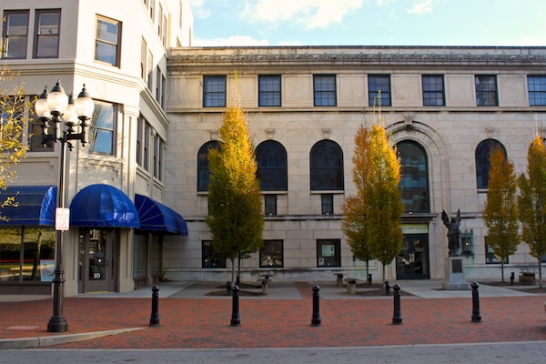
The Asheville Urban Trail is a self guided tour of downtown Asheville’s architecture, history, and art, covering some of the hippest streets in town. Put together by the Asheville Dept. of Community and Economic Development, this 1.7 mile route utilizes wide sidewalks where you can run traffic free, although there are a few busy street crossings. Start out at Pack Place, just off Patton Ave. Highlights along the way include sculptures, plaques, basilicas, antique hotels, and more. The routes is lined with fun shops, bars, and music venues as well. Follow the map and legend to decipher the sites as you go along.
Payton Chung
Features:
Categories:
Scroll Down For Route Maps
Essentials
- 1.7 mile loop
- 88 feet
- Pack Square
- College Street
Current Weather & Forecast

Asheville, US
4:46 am,
Jun 19, 2026
L: 18°
H: 20°
Daily ForecastHourly Forecast
Today
5:00 pm
18° / 20°°C
1 mm
100%
13 mph
97 %
1016 mb
0 mm/h
Tomorrow
5:00 pm
14° / 26°°C
1 mm
100%
7 mph
94 %
1017 mb
0 mm/h
Sunday
5:00 pm
15° / 24°°C
1 mm
100%
14 mph
97 %
1014 mb
0 mm/h
Monday
5:00 pm
12° / 22°°C
0.04 mm
4%
12 mph
96 %
1017 mb
0 mm/h
Tuesday
5:00 pm
14° / 18°°C
0.36 mm
36%
8 mph
91 %
1022 mb
0 mm/h
Today
5:00 am
13° / 13°°C
0 mm
0%
7 mph
97 %
1015 mb
0 mm/h
Today
8:00 am
14° / 15°°C
0 mm
0%
3 mph
94 %
1015 mb
0 mm/h
Today
11:00 am
18° / 20°°C
0 mm
0%
4 mph
79 %
1016 mb
0 mm/h
Today
2:00 pm
25° / 25°°C
0 mm
0%
6 mph
63 %
1015 mb
0 mm/h
Today
5:00 pm
24° / 24°°C
1 mm
100%
13 mph
71 %
1014 mb
0 mm/h
Today
8:00 pm
17° / 17°°C
1 mm
100%
2 mph
90 %
1015 mb
0 mm/h
Today
11:00 pm
17° / 17°°C
0.2 mm
20%
5 mph
92 %
1016 mb
0 mm/h
Other Routes in Asheville, NC
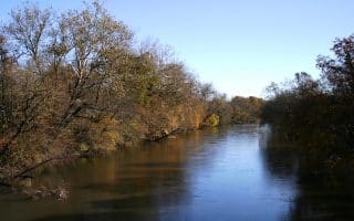
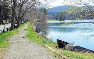
Spanning from French Broad River Park through Carrier Park and ending at Hominy Creek River Park, the French Broad River Greenway is a 2.7 mile asphalt multi-use path following Asheville’s most major river.
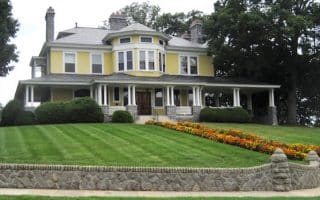
The Montford Historic District of northwest Asheville is a great choice for a tour of some of Asheville's prettiest streets and homes. Starting from the Asheville Visitors Center, an out and back is about 3 miles. Add or vary using side streets.
A 3.8 mile paved out and back follows Reed Creek from Pine Points to the University of North Carolina Asheville campus and botanical gardens.
This lovely jogging trail forms a part-asphalt, part-dirt loop around Beaver Lake and the surrounding neighborhood. Nice water and mountain views.
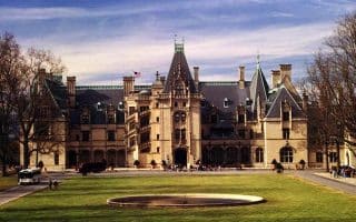
This beautiful chateau, with gardens and grounds designed by Frederick Law Olmsted, has over 22 miles of trails spread over 8,000 acres lining the French Broad River and surrounding forests. Note: Set hours and very steep admission fee required.
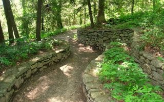
This top outdoor destination in Asheville has a variety of trails from easy to challenging, including a series of dirt Forest Service Roads. Start at the North Carolina Arboretum or Lake Powhatan Recreation Area. Part of the Pisgah National Forest.
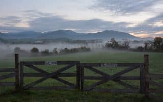
The 5 mile out and back of Warren Wilson College’s River Trail covers pastoral meadows and farmland with lots of swimming opportunities. Add on with a jaunt around the pretty campus of this small liberal arts college.
A 1 mile jogging loop around shady Fletcher Community Park, can be combined with the Cane Creek Greenway for more mileage. There is also outdoor exercise equipment for strength training.
A great destination run 25 miles west of Asheville. This popular recreation retreat and conference center has a paved path that encircles the lake. There are loop options of 2.3 and 3.8 miles, with lovely lake and mountain views.
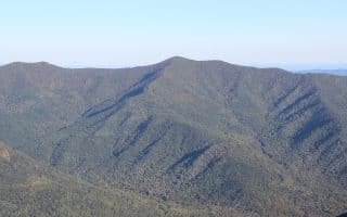
A challenging trail run in this area 30 miles south of Asheville. The 10 mile loop up Black Mountain features incredible views of Pisgah National Forest. Popular with mountain bikers, too.
A tough trail run up to the summit of Greybeard Mountain and over the Seven Sisters range.

The beautiful Snooks Nose Trail is part of Asheville’s tough 100 mile spring trail race. There are good, challenging 4 and 8 mile out and back routes that will challenge trail runners in their own right.
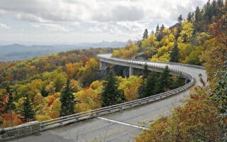
The closest point of the Parkway to Asheville is the Asheville Visitor Center, at Milepost 382, 6 miles away. See our guide to running on the Blue Ridge Parkway for the most runner-friendly sections and trails, as well as more challenging opportunities for trail runners.
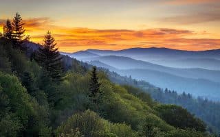
America's most visited National Park is 70 miles west of Asheville. Two good running options are the Cades Cove Loop Road, and the Greenbrier Cove area. Blue Ridge Parkway's southern terminus is 2 miles from Great Smoky NP.
User Ratings
Leave A Review or Comment
Review or Comment on This Route/Share a Photo!
Share your feedback on this route and see that of other Great Runs users. Click on the image icon to upload a photo. And please let us know if there are notes or changes we should incorporate!