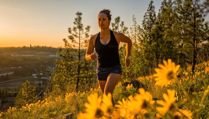
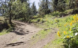
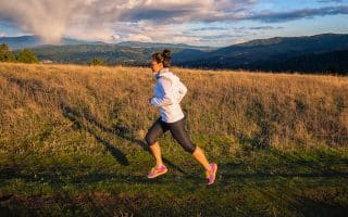
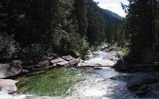
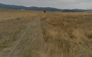
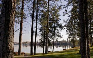
High Drive is one of loveliest neighborhoods in Spokane, perched atop a high hill between Hangman Creek and Comstock. There are terrific road and trail options here. A nice asphalt sidewalk/path runs alongside alongside High Drive Parkway for about 2.6 miles, starting from Cedar Street/High Drive Conservation Area and heading southwest to South Grand Boulevard. Our favorite section, with the best cliff side views and nicest houses, is the first 1.7 miles from High Drive Conservation Area to Bernard Street. Runners can also find over 22 miles of singletrack trail between High Drive and Hangman Creek. These rolling trails flow around Qualchan Golf Course on the south end, and connect to the Highbridge Park River Path in the north. Runners willing to tackle both trails and pavement can form a High Drive loop of almost any length. The area off South Hatch Dr. near East 57th Ave. is also known as ‘The Bluff’.
Aaron Thiesen
Features:
Scroll Down For Route Maps
Essentials
- Depends on option chosen
- 232 feet
- High Drive Conservation Area
- High Drive Parkway: 2-3 miles south of downtown
Current Weather & Forecast

Spokane, US
8:00 pm,
Jun 22, 2026
L: 22°
H: 26°
Daily ForecastHourly Forecast
Tomorrow
2:00 pm
22° / 26°°C
0 mm
0%
5 mph
97 %
1021 mb
0 mm/h
Wednesday
2:00 pm
16° / 25°°C
0 mm
0%
7 mph
96 %
1020 mb
0 mm/h
Thursday
2:00 pm
18° / 25°°C
0 mm
0%
11 mph
91 %
1016 mb
0 mm/h
Friday
2:00 pm
15° / 19°°C
0.39 mm
39%
13 mph
96 %
1012 mb
0 mm/h
Saturday
2:00 pm
13° / 17°°C
0.29 mm
29%
15 mph
97 %
1011 mb
0 mm/h
Today
8:00 pm
17° / 18°°C
0 mm
0%
4 mph
97 %
1021 mb
0 mm/h
Today
11:00 pm
17° / 18°°C
0 mm
0%
3 mph
94 %
1021 mb
0 mm/h
Tomorrow
2:00 am
20° / 21°°C
0 mm
0%
4 mph
76 %
1020 mb
0 mm/h
Tomorrow
5:00 am
26° / 26°°C
0 mm
0%
4 mph
58 %
1020 mb
0 mm/h
Tomorrow
8:00 am
26° / 26°°C
0 mm
0%
5 mph
56 %
1019 mb
0 mm/h
Tomorrow
11:00 am
24° / 24°°C
0 mm
0%
4 mph
68 %
1019 mb
0 mm/h
Tomorrow
2:00 pm
21° / 21°°C
0 mm
0%
4 mph
91 %
1019 mb
0 mm/h
Other Routes in Spokane, WA
This 65-mile paved trail is the cream of running in Spokane. We've included a full map. Highlights include the bustling World’s Fair grounds of downtown’s Riverfront Park, and beautiful Riverside State Park nine miles northwest of the city.
In addition to Riverfront Park and Riverside State Park, other highlights along the Spokane section of the Centennial Trail are the Kendall Yards section and Mirabeau Point Park.
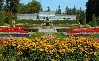
Not only does Manito Park feature a gorgeous expanse of botanical gardens, the area features some of the nicest neighborhood streets in Spokane. We’ve mapped a 2.7 mile tour.
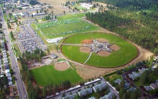
The Dwight Merkel Sports Complex features a variety of athletic fields, and two great running paths: the 5K Perimeter Trail and Connector Trail to Riverside State Park.
The Beacon Hill and Camp Sekani trails are popular singletrack for mountain biking, but runners will also enjoy the rolling terrain and nice scenery close to the city.
A lovely, close to town conservation area, the Iller Creek Trail is a nice 5 mile trail loop with great views from the Rocks of Sharon.
A scenic paved multi-use path between West Spokane and Fish Lake, where it connects with the Columbia Plateau Trail. Up to 10 miles one-way.
Trail runners with some extra time may find it worthwhile to travel an hour northeast to Mount Spokane State Park. Some favorite running suitable trails include the Burping Brook and Hay Ridge Loops. Options for easier or challenging.
550-acre preserve located 17 miles west of Spokane has 7 miles of trails through shrub steppe habitat. Great views of Liberty Lake, Mt. Spokane, Saltese Flats. The main ~4 mile Uplands Loop is fairly flat, with good footing. Summit Loop adds 2 steep miles.
The Liberty Lake neighborhood just east of Spokane is a great area for running. Enjoy the pleasant residential neighborhood, or a more challenging 8.5 mile trail run through Liberty Lake Regional Park.
User Ratings
Leave A Review or Comment
Review or Comment on This Route/Share a Photo!
Share your feedback on this route and see that of other Great Runs users. Click on the image icon to upload a photo. And please let us know if there are notes or changes we should incorporate!