Saint-Andrews-by-the-Sea is one of the top vacation destinations in New Brunswick, just 100 km (1 hour) down the coast from Saint John. The area is known as an opportunity to view some of the highest tides in the world. It’s an attractive and historic spot, and very walker friendly. Runners will find some good options here, including the opportunity to not only view but benefit from the tidal phenomenon! The routes below can be run standalone or in combination. NOTE: Consult the tidal charts. You could get caught!
Google Street View
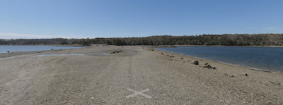
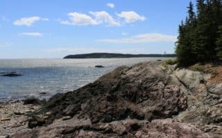
Ministers Island: This run is only accessible at low tide, but that’s what makes it so unique! Follow Bar Road out of town to the 1 km Ministers Island Gravel Bar that appears when the dramatic Bay of Fundy tide goes out. The bar will take you to Ministers Island, which boasts the Van Horne Estate and a 7 km gravel perimeter path. Water views some of the way. Be sure to also plan your return trip for low tide. Overall, there are 20 km of trails on Ministers Island. ROUTE MAP. TIDE SCHEDULE.
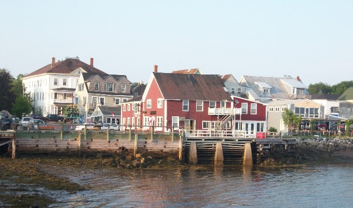
Water Street: Water Street is a historic street in St. Andrews, looping from the St. Andrews Blockhouse National Historic Site through downtown and along the shoreline to Pagan Point Nature Reserve. Starting from Centennial Park and combined with Prince of Wales Street and Harriet Street, the route forms a perfect 5 km around town. For a longer run, use the Saint Andrews Trail/Van Horne Trail or run out to Ministers Island. ROUTE MAP.
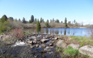
Saint Andrews Trails. There’s a nice network of trails and paths in St. Andrews, as shown in this trail map. Enjoy the Van Horn Trail from Water St. to Katy’s Cove and then to Bar Rd. Here, you can head east to Ministers Island or connect to some other public trails. Further north, there’s also lovely 2 km public path along Chamcook Lake. TRAIL MAP. TRAIL INFO.
Note:Google Maps shows a ‘St. Andrews Trail’ along former rail tracks headed north from St. Andrews as far as Lawrence Station, but several sections pass through private land and it is not actually a continuous trail as it appears on Google Maps.
Saint-Andrews-by-the-Sea is one of the top vacation destinations in New Brunswick, just 100 km (1 hour) down the coast from Saint John. The area is known as an opportunity to view some of the highest tides in the world. It’s an attractive and historic spot, and very walker friendly. Runners will find some good options here, including the opportunity to not only view but benefit from the tidal phenomenon! The routes below can be run standalone or in combination. NOTE: Consult the tidal charts. You could get caught!
Google Street View
Ministers Island: This run is only accessible at low tide, but that’s what makes it so unique! Follow Bar Road out of town to the 1 km Ministers Island Gravel Bar that appears when the dramatic Bay of Fundy tide goes out. The bar will take you to Ministers Island, which boasts the Van Horne Estate and a 7 km gravel perimeter path. Water views some of the way. Be sure to also plan your return trip for low tide. Overall, there are 20 km of trails on Ministers Island. ROUTE MAP. TIDE SCHEDULE.
Water Street: Water Street is a historic street in St. Andrews, looping from the St. Andrews Blockhouse National Historic Site through downtown and along the shoreline to Pagan Point Nature Reserve. Starting from Centennial Park and combined with Prince of Wales Street and Harriet Street, the route forms a perfect 5 km around town. For a longer run, use the Saint Andrews Trail/Van Horne Trail or run out to Ministers Island. ROUTE MAP.
Saint Andrews Trails. There’s a nice network of trails and paths in St. Andrews, as shown in this trail map. Enjoy the Van Horn Trail from Water St. to Katy’s Cove and then to Bar Rd. Here, you can head east to Ministers Island or connect to some other public trails. Further north, there’s also lovely 2 km public path along Chamcook Lake. TRAIL MAP. TRAIL INFO.
Note:Google Maps shows a ‘St. Andrews Trail’ along former rail tracks headed north from St. Andrews as far as Lawrence Station, but several sections pass through private land and it is not actually a continuous trail as it appears on Google Maps.
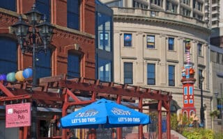
This sprawling tour of Saint John is a great long distance run on its own, but runners can also use the map to pick and choose some of the best road running in the city. Up to 21 km.
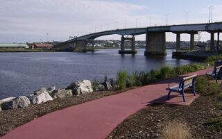
Experience the working waterfront of Saint John on this paved multi-use path along the Saint John River. Great water views! The trail is 3.7 km out and back. Longer option extends to Reversing Falls Bridge and a brief downtown tour with a good hill!
One of the largest municipal parks in Canada, and the go-to spot for recreation in Saint John, is Rockwood Park. More than 50 km of paved, stone, and dirt trails to choose from.
Just a ten minute drive west of Saint John, Irving Nature Park highlights the beautiful marshes and coastline of the Bay of Fundy. There are 8 trails of various length. The main loop trail using Irving Park Nature Road is about 9 km. Good trail running opps as well.
A well-maintained gravel lakeside loop in the eastern neighborhoods of Saint John. A loop around the “Rez Trail” is 4 km, with opportunities for extensions.
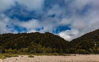
A great destination run in the Saint Martins area, 50 km up coast from Saint John. Visit the Fundy Parkway and jog along the coastal multi-use path or any segment of the expansive trail network.
Share your feedback on this route and see that of other Great Runs users. Click on the image icon to upload a photo. And please let us know if there are notes or changes we should incorporate!


Review or Comment on This Route/Share a Photo!
Share your feedback on this route and see that of other Great Runs users. Click on the image icon to upload a photo. And please let us know if there are notes or changes we should incorporate!