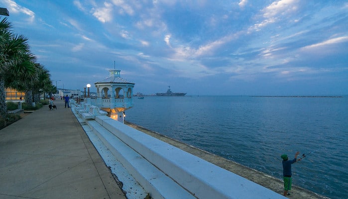
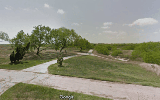
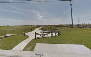
Choose a section or run the whole ~9 mile stretch of the Corpus Christi Bay Trail, a waterfront route from the Barge Docks to Cayo del Oso. There is more of the trail still to come, but the existing route features some of the most scenic spots in the city, including views of the sparkling Corpus Christi Bay. From the north, runners can start on North Shoreline Boulevard, near the Art Museum of Southern Texas. Head south through Bayfront Park to the Corpus Christi Marina and McGee Beach. Then, follow South Shoreline Boulevard and Ocean Drive to Cole Park and Oleander Point. The Ocean Drive sidewalk wraps around the gorgeous Bay Area Neighborhood and its regal homes on its way to Texas A&M University. Runners can continue along the campus Hike and Bike Trail, or turn right on Ennis Joslin Road. Here, the trail will eventually connect to the Holly Hike and Bike Trail and Oso Bay Wetlands Preserve.
Nan Palmero
Features:
Categories:
Scroll Down For Route Maps
Essentials
- Up to 9 miles (14.5 km) one way
- 117 feet
- Between Barge Docks and Cayo del Oso or anywhere along trail
- Route 76 Bus/Harbor Bridge Shuttle
Current Weather & Forecast

Corpus Christi, US
2:51 pm,
Jun 19, 2026
L: 31°
H: 32°
Daily ForecastHourly Forecast
Today
4:00 pm
31° / 32°°C
0 mm
0%
13 mph
47 %
1003 mb
0 mm/h
Tomorrow
4:00 pm
18° / 25°°C
0 mm
0%
14 mph
64 %
1007 mb
0 mm/h
Sunday
4:00 pm
13° / 28°°C
0 mm
0%
9 mph
90 %
1010 mb
0 mm/h
Monday
4:00 pm
14° / 22°°C
1 mm
100%
6 mph
100 %
1018 mb
0 mm/h
Tuesday
4:00 pm
15° / 25°°C
1 mm
100%
7 mph
99 %
1015 mb
0 mm/h
Today
4:00 pm
27° / 27°°C
0 mm
0%
13 mph
47 %
1003 mb
0 mm/h
Today
7:00 pm
22° / 25°°C
0 mm
0%
11 mph
46 %
1003 mb
0 mm/h
Today
10:00 pm
20° / 22°°C
0 mm
0%
7 mph
51 %
1004 mb
0 mm/h
Tomorrow
1:00 am
19° / 19°°C
0 mm
0%
8 mph
61 %
1006 mb
0 mm/h
Tomorrow
4:00 am
18° / 18°°C
0 mm
0%
9 mph
64 %
1005 mb
0 mm/h
Tomorrow
7:00 am
20° / 20°°C
0 mm
0%
12 mph
53 %
1006 mb
0 mm/h
Tomorrow
10:00 am
20° / 20°°C
0 mm
0%
14 mph
44 %
1007 mb
0 mm/h
Other Routes in Corpus Christi/Padre Island, TX

San Padre Island and Mustang Island, the barrier beaches connected to Corpus Christi by the John F. Kennedy Memorial Causeway, offer miles upon miles of great beach running. The Mustang Island State Park is a good starting point.
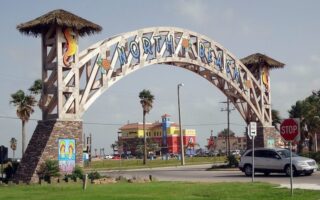
Head across the canal to the village of North Beach to run a ~3 mile out and back along the lively seaside promenade. Highlights include views of the USS Lexington.
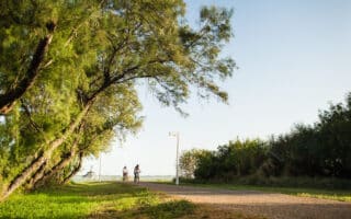
Though it’s technically part of the Corpus Christi Bay Trail, the path at Texas A&M University makes for a pleasant short run on its own. The Hike and Bike Trail is 1.4 miles (one way), but there are more interior university paths and the adjacent Bay Trail.
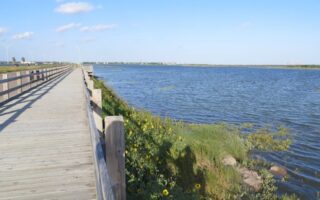
Sunset Lake Park, located across the Nueces Bay in the suburb of Portland, includes a scenic paved multi-use trail which leads to the Indian Point Pier. Nice water views. 2.7 miles out and back with extensions along Sunset Drive.
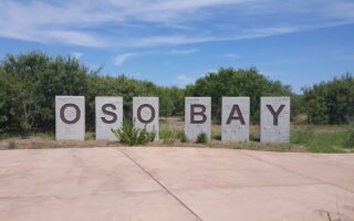
The Oso Bay Wetlands offer plenty of running options, including dirt paths, the Holly Hike and Bike Trail, and other multi-use trails. We’ve mapped a ~6 mile route that explores the whole area.
Oso Creek is known for its mountain bike trails, but runners are welcome to utilize the dirt singletrack and multi use trails in this area surrounding Bill Witt City Park. Add more mileage along the Oso Parkway.
This short 2 mile path along the creek following the Shea Parkway is a convenient running option in the South Side of Corpus Christi. Schanen Park and Breckenridge Park are both good starting points.
Calallen Neighborhood
Corpus Christi/Padre Island, TX
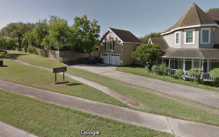
Fancy a run with interesting architecture and tree-lined streets? The go-to residential neighborhood for running in Corpus Christi is the Calallen suburbs, especially the area surrounding the River Hills Country Club.
User Ratings
Leave A Review or Comment
Review or Comment on This Route/Share a Photo!
Share your feedback on this route and see that of other Great Runs users. Click on the image icon to upload a photo. And please let us know if there are notes or changes we should incorporate!