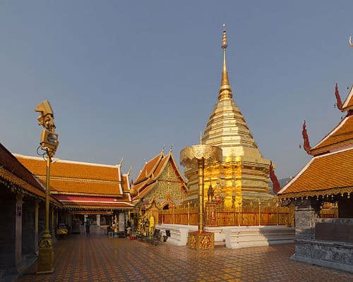
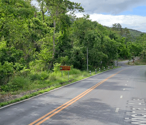
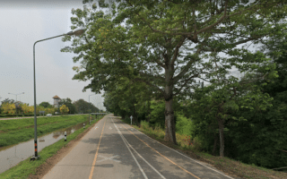
Runners looking for a scenic but serious hill challenge in Chiang Mai head to Doi Suthep–Pui National Park. At the summit of the park is Doi Suthep, a large Buddhist temple that can be seen from the city. From the entrance of the park, it’s 11 km one-way, climbing 650m, with grades of 6-8%. Add the heat factor, and this run is not for the squeamish. Start the run at the park entrance near the Chiang Mai Zoo. The route is along the main park road, Route 1004, which has a decent shoulder. Of course you could also take a can to the Temple and run down. A few options here:
Route 1004. Google Street View
Shorter Route: Run 5 km to Pha Lat Temple and turn around. 300m climb, less steep.
Long Option to Doi Suthep: 10.7 km one-way, 650m gain. Continue along the road from Pha Lat for another 6 km to Doi Suthep , continuing to climb. There are numerous viewpoints along the way.
Short Option to Doi Suthep: 6.5 km one-way, 600m gain. Get off the Route 1004 at Pha Lat and take the forest trail (Wat Sakithaka To Wat Phra That Doi Suthep Off Road Hiking Way). This saves ~4.5 km but has more challenging footing and is steeper.
At the summit, you’ll be rewarded by the site of the magnificent temple (runners should wear appropriate clothing). You can run the return (perhaps using the shorter option) or take a red car back down. Those who are particularly ambitious can continue along the road. It’s another 5.5 km to Bhubing Palace.
Scroll Down For Route Maps
Essentials
Up to 11 km (6.7 miles) one-way using the longer route. Shorter but more challenging option is 6.5 km one-way. Another option is to run 5 km to Pha Lat
600-650m (1190-2150 feet) gain, grades 6-8%. A serious challenge
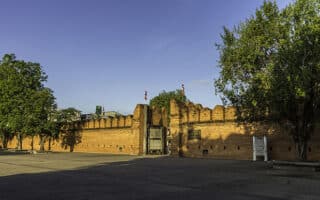
Not be the most bucolic run ever, but running the perimeter of Chiang Mai Old City is popular with runners. A road follows the old moat built to guard the city. A highlight is a loop around paths and shade trees of Suan Buak Haad Public Park. Go early!
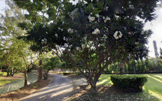
The best area for a run in Chiang Mai. You can put together several off-road, shaded km combining the Huay Kaew Arboretum paths, a running track along the Ang Kaew Reservoir, and paths around Chiang Mai University, which has a jogging track.
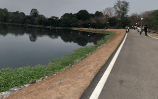
The best spot for a scenic off-road run in the Chiang Mai area. One can do a run of nearly 10 km, combining a scenic loop around the lake and a new, dedicated running running track. A popular place for walkers, runners, and cyclists. Add with new 5 km cycle track.
Paved multi-use path in the Huay Tueng Thao Lake area runs along Canal Road for 5 km between a 'bike bridge' and the International Conference Center. Combine with 700-year Stadium & Sports Complex & Huay Tueng Thao Lake area route.
A tranquil spot for a run, with several small lakes, exercise paths, and shaded areas. Runners can also do a loop around the adjacent Highland People Discovery Museum on a pleasantly canopied road. It's 3 km combined.
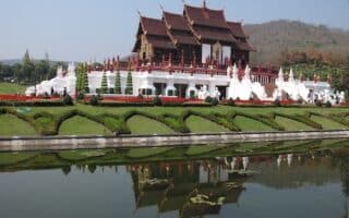
It's worth the small fee to enjoy a run on the paths around the beautifully landscaped grounds of this park that's a popular visitor destination in Chiang Mai. Note that the park has set hours and a fee is required.
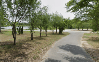
This facility is owned by Chiang Mai University and is located 9 km west of the central city. There are traffic-free roads and paths that are open to the public and popular with walkers and runners. Pleasantly green, with some several small ponds.
A popular spot for those who want a good running track. The grounds of the complex also have some long, flat sections that are good for interval training, and a road that goes around part of the stadium. Well lit and popular with runners at night.
Share your feedback on this route and see that of other Great Runs users. Click on the image icon to upload a photo. And please let us know if there are notes or changes we should incorporate!
Subscribe
2 Comments
Oldest
Newest
Inline Feedbacks
View all comments
Essentials
Up to 11 km (6.7 miles) one-way using the longer route. Shorter but more challenging option is 6.5 km one-way. Another option is to run 5 km to Pha Lat
600-650m (1190-2150 feet) gain, grades 6-8%. A serious challenge


Review or Comment on This Route/Share a Photo!
Share your feedback on this route and see that of other Great Runs users. Click on the image icon to upload a photo. And please let us know if there are notes or changes we should incorporate!