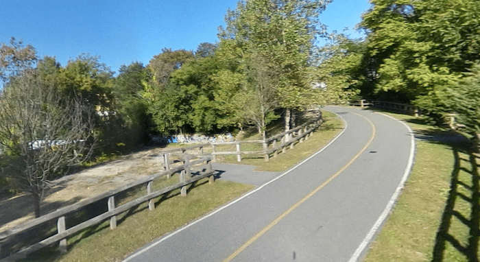
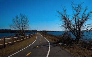
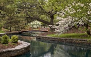
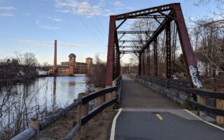
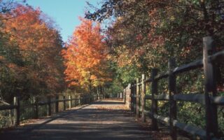
The Fred Lippitt Woonasquatucket River Greenway runs along the west bank of the Woonasquatucket River from Allepp Street in Providence to Lyman Ave in Johnson. It’s a great option near Rhode Island College, and up to 4.4 miles one-way. The first mile is on-road, starting near Providence at the I-95/Highway 6 highway tangle. Overall, about half the route is on an off-road trail and half is on road. There are some nice water views in sections.
Google Street View
Features:
Categories:
Scroll Down For Route Maps
Essentials
- Up to 4.4 miles (7 km) one-way
- 101 feet (30m) east to west one-way
- Providence End: Providence Pl./Kinsley Ave., just west of Waterplace Park; West End: Lyman Ave.
- See trail map for access points and parking
Current Weather & Forecast

Providence, US
9:51 am,
Jun 22, 2026
L: 22°
H: 26°
Daily ForecastHourly Forecast
Today
5:00 pm
22° / 26°°C
1 mm
100%
11 mph
91 %
1015 mb
0 mm/h
Tomorrow
5:00 pm
20° / 24°°C
1 mm
100%
6 mph
99 %
1013 mb
0 mm/h
Wednesday
5:00 pm
15° / 29°°C
0 mm
0%
6 mph
89 %
1016 mb
0 mm/h
Thursday
5:00 pm
17° / 31°°C
0 mm
0%
8 mph
68 %
1019 mb
0 mm/h
Friday
5:00 pm
18° / 30°°C
1 mm
100%
7 mph
97 %
1017 mb
0 mm/h
Today
11:00 am
23° / 24°°C
0 mm
0%
11 mph
75 %
1015 mb
0 mm/h
Today
2:00 pm
23° / 24°°C
1 mm
100%
7 mph
76 %
1014 mb
0 mm/h
Today
5:00 pm
23° / 23°°C
1 mm
100%
5 mph
91 %
1013 mb
0 mm/h
Today
8:00 pm
23° / 23°°C
1 mm
100%
3 mph
97 %
1013 mb
0 mm/h
Today
11:00 pm
20° / 20°°C
1 mm
100%
1 mph
99 %
1013 mb
0 mm/h
Tomorrow
2:00 am
21° / 21°°C
1 mm
100%
0 mph
99 %
1012 mb
0 mm/h
Tomorrow
5:00 am
21° / 21°°C
1 mm
100%
3 mph
99 %
1012 mb
0 mm/h
Other Routes in Providence, RI
The signature run in Providence, popular with pedestrians and cyclists alike. Starting at India Point Park in Providence, the paved trail follows the Providence River for 14.5 miles to Bristol. Great water views much of the way.
A quite pleasant run along the Providence River in downtown Providence, mostly off-road. The 5 mile loop includes Memorial Park, Fox Point, India Point, George Redman Linear Park, and Waybaussett Neck.
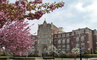
A running tour of the College Hill Historic District, which includes the attractive campus of Brown University. Hilly, tree-lined streets attractive 18th and 19th century homes.
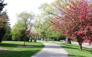
Elaborately landscaped 427-acre park and historic district is one of the loveliest urban parks in the United States. Our 3.1 mile loop runs past the Temple to Music, and The Roger Williams Botanical Gardens. Good 2-mile add-on as well.
With a dedicated bicycle lane, the Boulevard is a Providence landmark. Visitors enjoy the Boulevard’s beautiful trees, shrubs, and grass.
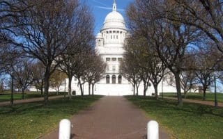
A route through the Pleasant Valley neighborhood, starting at the Rhode Island State Capitol. Nice parkways, 18th Century homes.
Create your own route on the pleasant paths around the campus of Providence College and the adjacent Oakland Ave. Historic District neighborhood. Can combine with Pleasant Valley route for a longer run.
This lovely, 3-mile paved route follows the Ten Mile River from the Kimberly Ann Rock Athletic Fields north through Slater Memorial Park and then Ten Mile River Park in Darlington. Some sections wooded, other sections with attractive water views.
Choose a section of this 19-mile paved commuter route through the Cranston and Warwick areas south of Providence. The path mostly runs through commercial areas, but it does hit some lovely spots, especially on the south end. Hilly along western half.
Pleasant park on Brush Neck Cove & Buttonwoods Cove in Warwick, 10 miles south of Providence. Paved perimeter path is 2.8 miles trough woods and with some water views. Add on with Buttonwoods Ave.
Great option for a scenic off-road run through Cumberland, Lincoln, and Woonsocket. The 10-mile paved multi-use path that follows the Blackstone River, with some nice water views. Combination of woods, waterfront, and a couple of industrial sections.


Excellent running options in this historic seaport town located 15 miles south of Providence include a section of the East Bay Bike Path, scenic trails in Colt State Park, the town's historic streets, and the pedestrian paths of the waterfront Roger Williams University.
User Ratings
Leave A Review or Comment
Review or Comment on This Route/Share a Photo!
Share your feedback on this route and see that of other Great Runs users. Click on the image icon to upload a photo. And please let us know if there are notes or changes we should incorporate!