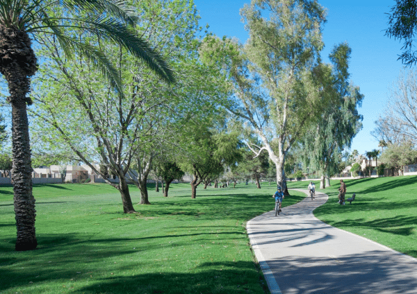
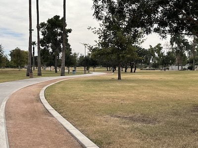
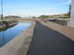
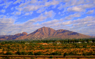
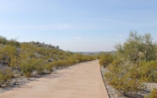
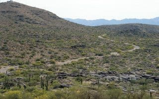
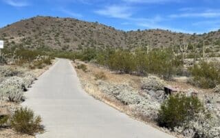
The Indian Bend Wash Greenbelt is a paved multi-use path passing through an oasis of parks, lakes, paths and golf courses traversing for 13.5 miles through the heart of Scottsdale. It’s the best option for a green, long-distance, off-road run in Scottsdale. The path passes through numerous park and alongside golf courses. The greenbelt features more than 24 grade-separated crossings, meaning runners can avoid major cross traffic. Bonus: most of it is lit at night
We’ve divided the Greenbelt into two sections, using Indian Bend Rd. as the dividing point. There’s also a separate, 4.5-mile section of the Greenbelt in Phoenix, from Shea Blvd. & N 54th. northwest to Venturoso Park (N 32nd & Thunderbird), which we’ve put into a separate route.
South Section: E Indian Bend Rd. South to Tempe Town Lake
South Section: Mark Lowenstein
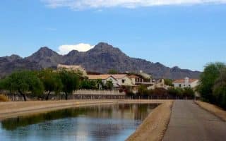
The south section of the Greenbelt runs for 8 miles from East Indian Bend Rd. to Tempe Town Lake. Most of the trail is through parks. with the level of ‘green’ depending on the season, rainfall, & irrrigation. Headed south, the trail passes through Chaparral Park, Camelback Park, El Dorado Fields, & McKellips Lake. The nicest sections are the 2.5 miles between Indian Bend Rd. & Camelback Rd., and the 2.5 miles between Thomas Rd. & E McKellips Rd.
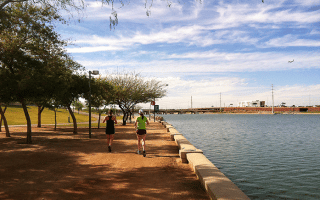
Add-Ons: At the south end, the trail ends near Tempe Town Lake, where there’s excellent waterfront running! Also nearby is the Tempe section of Papago Park.
North Section: E Indian Bend Rd. North to E Cactus Blvd.
This section of the Greenbelt in Scottsdale runs for 5.4 miles from E Indian Bend Rd. northeast to E Cactus Blvd. Some maps also show this as the ‘Camelback Walk’ and or the ‘Scottsdale Bike Path’. Follow the path north along Hayden Rd. The most scenic section of the northern route is the ~2.2 miles north of E McCormick Pkwy., along the McCormick Ranch Golf Club and Marguerite Lake, and through a park-like section to Mountain View Park. [Optional Spur: A greenbelt trail runs through Mountain View Park, for ~1 mile though a mainly residential area.] The northern ~1.5 miles from E Shea Blvd. to E Cactus Rd. is not as scenic.
The Indian Bend Wash Greenbelt is a paved multi-use path passing through an oasis of parks, lakes, paths and golf courses traversing for 13.5 miles through the heart of Scottsdale. It’s the best option for a green, long-distance, off-road run in Scottsdale. The path passes through numerous park and alongside golf courses. The greenbelt features more than 24 grade-separated crossings, meaning runners can avoid major cross traffic. Bonus: most of it is lit at night
We’ve divided the Greenbelt into two sections, using Indian Bend Rd. as the dividing point. There’s also a separate, 4.5-mile section of the Greenbelt in Phoenix, from Shea Blvd. & N 54th. northwest to Venturoso Park (N 32nd & Thunderbird), which we’ve put into a separate route.
South Section: E Indian Bend Rd. South to Tempe Town Lake
South Section: Mark Lowenstein
The south section of the Greenbelt runs for 8 miles from East Indian Bend Rd. to Tempe Town Lake. Most of the trail is through parks. with the level of ‘green’ depending on the season, rainfall, & irrrigation. Headed south, the trail passes through Chaparral Park, Camelback Park, El Dorado Fields, & McKellips Lake. The nicest sections are the 2.5 miles between Indian Bend Rd. & Camelback Rd., and the 2.5 miles between Thomas Rd. & E McKellips Rd.
Add-Ons: At the south end, the trail ends near Tempe Town Lake, where there’s excellent waterfront running! Also nearby is the Tempe section of Papago Park.
North Section: E Indian Bend Rd. North to E Cactus Blvd.
This section of the Greenbelt in Scottsdale runs for 5.4 miles from E Indian Bend Rd. northeast to E Cactus Blvd. Some maps also show this as the ‘Camelback Walk’ and or the ‘Scottsdale Bike Path’. Follow the path north along Hayden Rd. The most scenic section of the northern route is the ~2.2 miles north of E McCormick Pkwy., along the McCormick Ranch Golf Club and Marguerite Lake, and through a park-like section to Mountain View Park. [Optional Spur: A greenbelt trail runs through Mountain View Park, for ~1 mile though a mainly residential area.] The northern ~1.5 miles from E Shea Blvd. to E Cactus Rd. is not as scenic.
Scroll Down For Route Maps
Essentials
Overall, 13.5 miles. We've divided the route into two sections: 8.1 miles from E Indian Bend Rd. south to Tempe, and 5.4 miles north to E Cactus Blvd.
Fairly flat. Overall it's a slight downhill headed south
A hilly desert park covering 1500 acres in Phoenix and Tempe. Numerous trail and loop options include several interesting sights: Hole in the Rock, the Desert Botanical Garden, several small lakes, and the Phoenix Zoo.
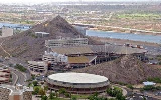
Tempe Town Lake, in the heart of downtown Tempe and adjacent to the Arizona State University campus, has a wonderful running trail along the north and south banks of the water. A full loop is 7.5 miles, with good add-on options.
A section of the Indian Bend Wash trail in Phoenix. Paved multi-use trail runs through a linear park from E Shea Blvd. northwest to Venturoso Park. The Scottsdale section of Indian Bend Wash is ~5 miles southeast.
A great run through the huge campus of Arizona State University in Tempe. A highlight of the run is the short but very steep ascent of “A Mountain”. Also near Phoenix downtown and Lake Trails.
This 25-mile multi-use runs along the oldest remaining pioneer canal on the north side of the Salt River, through from Glendale to Tempe, mainly north of the I-10. The 14 'improved' miles are known as the 'Canalscape'. Some lovely residential neighborhoods, parks, & connections to additional trails.
One of the longer multi-use trails in Maricopa County, running ~36 miles between Mesa and Peoria along both sides of the Arizona Canal. It's ~9 miles north of downtown Phoenix, passes through Scottsdale, Tempe, Glendale.
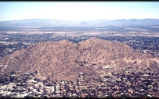
Camelback Mountain is iconic throughout the Phoenix area. Extreme heat, no shade, elevation gain… and crowds can make this a challenging run, but the view of the Phoenix metro area is spectacular.
Vast network of mountain & desert hiking trails, centrally located. This is mainly trail running, with moderate to strenuous options. The Dreamy Draw section has a paved bike path that's nice for running.
This recreation area near the Phoenix Mountains Preserve includes extensive trail running options for all abilities. There's also the paved, Dreamy Draw Bikeway (4 miles out and back). Runners can also connect to the Arizona Canal Trail.
Not far from Camelback Mountain, Mummy Mountain has great views and very little traffic to interrupt your run. With wide streets, large houses and a view of the whole valley, this a great place to run.
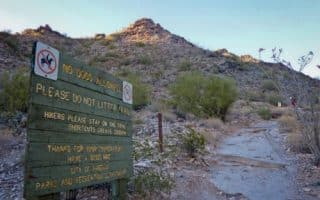
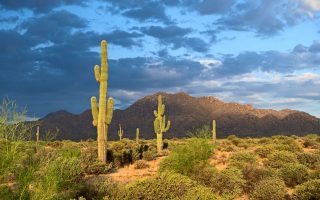
Get a taste of desert running! This preserve in far north Scottsdale features an extensive network of trails, ranging from easy to moderately hilly and technical. Our favorite for running is the 5.6-mile Apache Wash Loop, for its unrestricted desert views.
Large, popular desert park 30 miles from Scottsdale. 40 miles of trails used for hiking, mountain biking, and running. There are trail runs of varying length and difficulty level. Gorgeous skies and views. Video excerpts!
The Reach 11 Sport Complex, on the north side of Phoenix, is quickly gaining traction as a favorite local running spot. West side trail is up to 9 miles out and back, and the east side Barrier Free Nature Trail is up to a 7.5 mile loop.
Share your feedback on this route and see that of other Great Runs users. Click on the image icon to upload a photo. And please let us know if there are notes or changes we should incorporate!
Subscribe
0 Comments
Oldest
Newest
Inline Feedbacks
View all comments
Essentials
Overall, 13.5 miles. We've divided the route into two sections: 8.1 miles from E Indian Bend Rd. south to Tempe, and 5.4 miles north to E Cactus Blvd.
Fairly flat. Overall it's a slight downhill headed south


Review or Comment on This Route/Share a Photo!
Share your feedback on this route and see that of other Great Runs users. Click on the image icon to upload a photo. And please let us know if there are notes or changes we should incorporate!