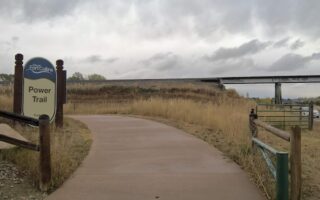
The Poudre River Trail is one of the signature running options in Fort Collins, and is easily accessible trail from downtown. The paved multi-use trail is an ambitious project that has been 40 years in the making. The most recent sections of the now 40+ mile trail that stretches from Bellvue to Greeley were completed in [NEW] 2024, with a final ‘gap’ section in Timnath scheduled for completion in 2026.
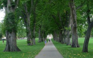
There’s a wonderful variety of terrain and landscape along this trail. In Fort Collins, the trail runs through Lee Martinez Park & Old Fort Collins Heritage Park along the Cache la Poudre River. The trail then runs northwest for ~6 miles to Bellvue and southeast for 37+ miles to Greeley. It’s worth it to explore the trail’s different sections. Some comments below:
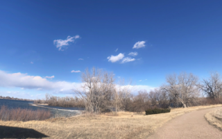
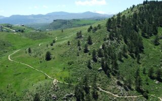
Northwest Section: Fort Collins to Bellvue: From downtown, good access is off N College Ave./Lee Martinez Community Park. There’s a nice 4 mile section headed NORTHWEST along the river, and then to Lions Open Space. There are some particularly nice views of the foothills headed northwest. The northern terminus is in Bellvue @ Rist Canyon Rd.
- Additional trail connections near Fort Collins: Headed west from downtown, there are additional trails in Lee Martinez Community Park and a scenic loop around the North Shields Ponds. Headed south, connect to the Spring Creek Trail in the Cattail Chorus Natural Area just off Prospect Rd.
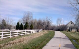
Headed SOUTHEAST from downtown, the trail mainly follows the river, passing through several small parks and open spaces. The terrain is flat and quite open, with views of the fairly narrow river and the surrounding foothills.
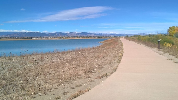
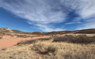
Miles 8-15: South of Fort Collins, the ~7 miles between E Mulberry Rd. and E Harmony Rd. in Timnath is quite scenic. The trail passes through several open spaces, mostly along the river, and also along some other lakes and ponds, in Prospect Ponds Natural Area. Just south of there, a nice section in Arapaho Bend Natural Area, with some additional trails.
Miles 15-19: This is a more residential/commercial section in Timnath. As of early 2026, the trail ends just south of Timnath Community Park, where work is ongoing to fill the gap.
Tinmath to Greeley: This is a 21 mile section (separately mapped). After the gap, the trail picks up at E County Rd. in Windsor. The trail follows the river through several open spaces. Some nicer sections are Miles 3-7 (Rain Dance National Golf Course, Eastman Park, Pelican Lakes); Miles 12.5-16.5, through Signature Bluffs, Sheep Draw, & Cottonwood Blend Natural Areas. The southeastern end is at Island Grove Park in Greeley.
The Poudre River Trail is one of the signature running options in Fort Collins, and is easily accessible trail from downtown. The paved multi-use trail is an ambitious project that has been 40 years in the making. The most recent sections of the now 40+ mile trail that stretches from Bellvue to Greeley were completed in [NEW] 2024, with a final ‘gap’ section in Timnath scheduled for completion in 2026.
There’s a wonderful variety of terrain and landscape along this trail. In Fort Collins, the trail runs through Lee Martinez Park & Old Fort Collins Heritage Park along the Cache la Poudre River. The trail then runs northwest for ~6 miles to Bellvue and southeast for 37+ miles to Greeley. It’s worth it to explore the trail’s different sections. Some comments below:
Northwest Section: Fort Collins to Bellvue: From downtown, good access is off N College Ave./Lee Martinez Community Park. There’s a nice 4 mile section headed NORTHWEST along the river, and then to Lions Open Space. There are some particularly nice views of the foothills headed northwest. The northern terminus is in Bellvue @ Rist Canyon Rd.
- Additional trail connections near Fort Collins: Headed west from downtown, there are additional trails in Lee Martinez Community Park and a scenic loop around the North Shields Ponds. Headed south, connect to the Spring Creek Trail in the Cattail Chorus Natural Area just off Prospect Rd.
Headed SOUTHEAST from downtown, the trail mainly follows the river, passing through several small parks and open spaces. The terrain is flat and quite open, with views of the fairly narrow river and the surrounding foothills.
Miles 8-15: South of Fort Collins, the ~7 miles between E Mulberry Rd. and E Harmony Rd. in Timnath is quite scenic. The trail passes through several open spaces, mostly along the river, and also along some other lakes and ponds, in Prospect Ponds Natural Area. Just south of there, a nice section in Arapaho Bend Natural Area, with some additional trails.
Miles 15-19: This is a more residential/commercial section in Timnath. As of early 2026, the trail ends just south of Timnath Community Park, where work is ongoing to fill the gap.
Tinmath to Greeley: This is a 21 mile section (separately mapped). After the gap, the trail picks up at E County Rd. in Windsor. The trail follows the river through several open spaces. Some nicer sections are Miles 3-7 (Rain Dance National Golf Course, Eastman Park, Pelican Lakes); Miles 12.5-16.5, through Signature Bluffs, Sheep Draw, & Cottonwood Blend Natural Areas. The southeastern end is at Island Grove Park in Greeley.

Review or Comment on This Route/Share a Photo!
Share your feedback on this route and see that of other Great Runs users. Click on the image icon to upload a photo. And please let us know if there are notes or changes we should incorporate!