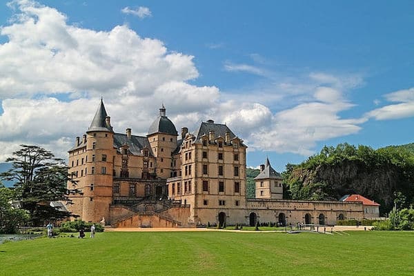
Located 20 km south of Grenoble, the Castle Park of Vizille is a worth it destination run. Anchored by the Château de Vizille that’s now a Museum focused on the French Revolution, there are 100 acres of gorgeous grounds, from grand lawns and gardens to a lake and canal-side paths, and some forested sections. A loop of the canal paths is ~4 km, but this can be a longer run if some of the additional grounds are included. NOTE: Closed Tuesdays.
Longer Run: For those who would like a long run on quiet with pretty views, the cycle route between the Château de Vizille and the Le Chateau d’Uriage is a great option. It’s ~20 km out and back, and fairly flat. More info, which includes a GPX route that can be downloaded.
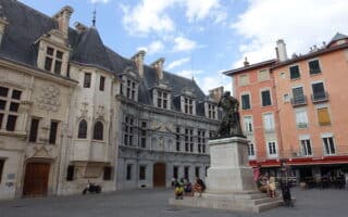
This is an easy-to-follow 7.5 km 'runseeing' tour of the central, historic part of Grenoble, featuring Paul Mistral Park, several other small parks, and some of the city's key sights. We've also mapped a 2.5 km one-way route through the main parks.
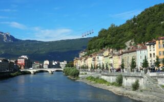
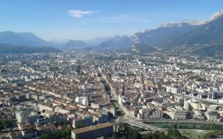
Nearly 18 km of paths along the Isère river, with lovely water and mountain views. We've mapped an eastern section and a western section, starting at the centrally located Jardin de Ville. Can be combined with Drac River paths.
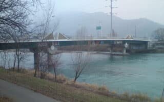
The signature river path in Grenoble is the Isère, but there's also some nice running along the Drac River. This route covers 10 km of the Chemin de la Digue from Seyssins north to Sassenage, where you can join the Isère path to Veurey-Voroize.
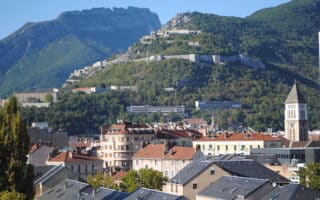
If you'd like to get the thighs burning while 'storming' a hill-top fort with great views, the run/hike to the Fort de la Bastille is for you! It's a 300m climb over 2.5 km. One option is to take the Téléphérique up and then run down...
This run might not win awards for best scenery, but it's unique: Cours Jean Jaurès is the longest sraight avenue in Europe! It runs for 7.8 km from just below the Bastille south to Le Pont de Claix. It's 50m wide and mostly tree-lined, with ample room for running.
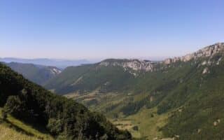
Grenoble lies at the foot of the French Alps, and is a mecca for trail running. The Grenoble Tourism Office lists 15 marked routes in the area, for runners of all abilities. We've listed three of the 'easier' ones. They have good footing, but are hilly!
Share your feedback on this route and see that of other Great Runs users. Click on the image icon to upload a photo. And please let us know if there are notes or changes we should incorporate!
 Located 20 km south of Grenoble, the Castle Park of Vizille is a worth it destination run. Anchored by the Château de Vizille that’s now a Museum focused on the French Revolution, there are 100 acres of gorgeous grounds, from grand lawns and gardens to a lake and canal-side paths, and some forested sections. A loop of the canal paths is ~4 km, but this can be a longer run if some of the additional grounds are included. NOTE: Closed Tuesdays.

Review or Comment on This Route/Share a Photo!
Share your feedback on this route and see that of other Great Runs users. Click on the image icon to upload a photo. And please let us know if there are notes or changes we should incorporate!