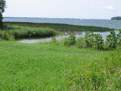
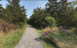
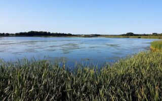
Lemoine Point Conservation area features scenic, easy trail running in the western part of Kingston, overlooking Collins Bay. The area features 11 km of trails over 136 hectares, with a nice variety of terrain: forest, field, marsh, and shoreline. The Kingston Airport is just to the east.
Creative Commons: SoftwareSimian
We’ve put together a 5.5 km perimeter loop, which includes 2.5 km along the shoreline. Add more with interior trails, consisting of deciduous woods.
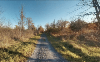
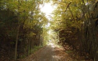
Scroll Down For Route Maps
Essentials
11 km of trails. We've mapped a 5.5 km (3.5 mile) perimeter loop
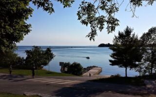
The signature run in Kingston, with some 11 km of scenic pathway along the St. Lawrence River. Great views, several parks and visitor sites, such as the former Kingston Penitentiary. Good add-on and route variation options.
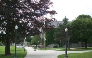
One of our favorite runs in Kingston is to stitch together a route combining the paths around the campus of Queen's University with City Park and the area's and residential neighborhoods. Centrally located. Combine with the Waterfront Trail for more.
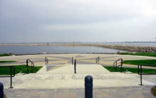
A pleasant run along a section of the Rideau Trail in Kingston, combining Lake Ontario Park, a scenic 2 km through the Marshlands Conservation Area, and Grenville Park, where there's an additional 1 km loop.
This 9 km route combining Nicholsons Point and Parrott's Bay conservation areas makes for some fairly easy trail running in the west part of Kingston. Mainly wooded trails, and one of the better options to get in some hills!
This multi-use path follows an old railroad bed for 22 km between Kingston and Orser Rd. at the City of Kingston boundary. Terrain includes 2 km waterfront section in Kingston, natural open landscapes, rock cuts, woodland, and wetlands.
Just north of downtown, this is a popular recreation area and a good spot for some trail running. There are 14 km of trails through a combination of marsh, field, and forest habitat. Note: used for XC skiing in winter.
Choose a section of this long-distance path that runs between Smiths Falls and Strathcona. Combination of woods and farmland, with a few more remote, rugged sections. Closest access to Kingston is 27 km north in the Sydenham/Harrowsmith area.
Share your feedback on this route and see that of other Great Runs users. Click on the image icon to upload a photo. And please let us know if there are notes or changes we should incorporate!
Subscribe
0 Comments
Oldest
Newest
Inline Feedbacks
View all comments
Essentials
11 km of trails. We've mapped a 5.5 km (3.5 mile) perimeter loop


Review or Comment on This Route/Share a Photo!
Share your feedback on this route and see that of other Great Runs users. Click on the image icon to upload a photo. And please let us know if there are notes or changes we should incorporate!