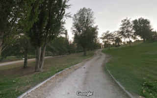
The Green Cyclist Belt of Madrid is a 40 mile multi-use path around the municipality of Madrid. This red asphalt path is well maintained, with divided lanes for bikes and pedestrians. The closest part of the path to Madrid’s center skirts the eastern section of Casa de Campo. Depending on where you are staying, pick up the path from any of the metro stations along the way (there is a station every 3 miles or so). If you need a rest, there are areas equipped with benches, fountains, path maps, and trees to provide shade. Run for as long as you desire and take the metro back to the start.
Features:
Scroll Down For Route Maps
Essentials
- 40 miles - Pick it up anywhere!
- Closest section to central Madrid skirts the eastern edge of Casa de Campo
- Trail is along metro stations most of the way
Current Weather & Forecast

Madrid, ES
8:01 am,
Jul 14, 2026
L: 21°
H: 22°
Daily ForecastHourly Forecast
Today
11:00 pm
21° / 22°°C
0 mm
0%
16 mph
19 %
1008 mb
0 mm/h
Tomorrow
11:00 pm
28° / 41°°C
0 mm
0%
14 mph
30 %
1008 mb
0 mm/h
Thursday
11:00 pm
28° / 40°°C
0 mm
0%
17 mph
24 %
1008 mb
0 mm/h
Friday
11:00 pm
29° / 41°°C
0 mm
0%
17 mph
24 %
1006 mb
0 mm/h
Saturday
11:00 pm
29° / 43°°C
0 mm
0%
13 mph
26 %
1006 mb
0 mm/h
Today
8:00 am
32° / 32°°C
0 mm
0%
10 mph
19 %
1008 mb
0 mm/h
Today
11:00 am
34° / 37°°C
0 mm
0%
13 mph
17 %
1008 mb
0 mm/h
Today
2:00 pm
38° / 40°°C
0 mm
0%
14 mph
13 %
1006 mb
0 mm/h
Today
5:00 pm
40° / 40°°C
0 mm
0%
16 mph
9 %
1004 mb
0 mm/h
Today
8:00 pm
34° / 34°°C
0 mm
0%
12 mph
10 %
1006 mb
0 mm/h
Today
11:00 pm
31° / 31°°C
0 mm
0%
8 mph
14 %
1007 mb
0 mm/h
Tomorrow
2:00 am
29° / 29°°C
0 mm
0%
5 mph
19 %
1006 mb
0 mm/h
Other Routes in Madrid, Spain
Located a few km west of Madrid’s historic center, Casa de Campo is 5 times the size of New York's Central Park. Our route begins at the Royal Palace and loops through a small section of the park. Another great route begins at the Batán Metro Station.

Our Madrid 'runseeing tour' follows some of the city's historic and major avenues, passing several of Madrid’s most important sites. The P. del Prado was the first tree-lined avenue in a European capital! Video Excerpts!
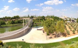
There are nearly 10 km of running paths along the Mazanares River in central Madrid. This recently renovated esplanade provides beautiful views of the Royal Palace, Almudena Cathedral, and other famous landmarks. VIDEO EXCERPT!
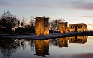
This route provides a varied 5K route with streams, lakes, rolling hills, and the famous Templo de Debod, an ancient Egyptian temple which was dismantled and rebuilt in Madrid.
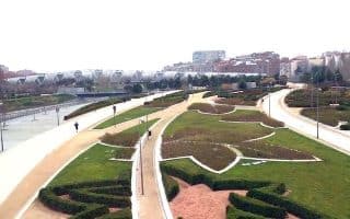
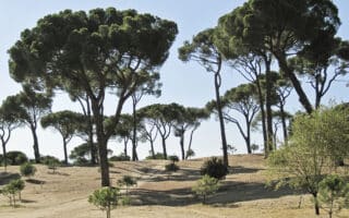
If you are interested in modern art, Juan Carlos I Park is the route for you. Located in northeast of Madrid, this 148 acre park features a large lake, olive groves, Tres Culturas garden, and 19 open-air sculptures! Good option near the airport.


Located in the district of Hortaleza in northeast Madrid, this 840-acre park has 32 km of trails that are great for running. The terrain is fairly open & exposed, with some hills! A perimeter loop is ~5 km. Great option near the airport.

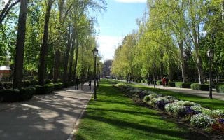
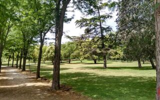
One of the largest parks in Madrid. Beautiful sculptures, a peaceful lake, and graceful paths that are wonderful for running. Loop around the edge of the park and then explore the interior paths. Video Excerpts!
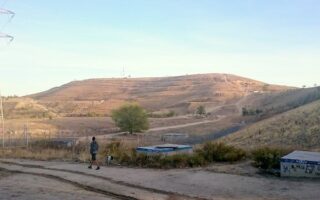
This big park to the north of Madrid University has miles of sprawling dirt paths that offer one of the best workouts in the city with great hill work and stationary exercise equipment. A loop is ~ 5 km. Can combine with University paths, Parque del Oeste.

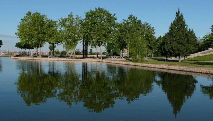
Parque Enrique Tierno Galván & Manzanares Lineal Park in southeastern Madrid's Legazpi neighborhood are great for running. Can combine with our Madrid Río route or parks in the Usera neighborhood just to the west.

The Usera neighborhood in southern Madrid features numerous adjacent parks with pleasant paths for running. Highlights include Parque de la Pradolongo & Parque Emparatriz Maria de Austria. Can combine with Parque Lineal del Manzanares.
A series of trails and cycle paths through forest parks and sports complexes in the Entrevías, Pavones, Palomeras, and Vicálvaro districts of south/eastern Madrid. Numerous options for shorter or longer distances, all off-road.
Fortuna is a district in southwest Madrid. The highlight of running here a series of groomed gravel paths lining the banks of the narrow Arroyo de la Canaleja (canal). A loop of up to 15 km is possible!
User Ratings
Leave A Review or Comment
Review or Comment on This Route/Share a Photo!
Share your feedback on this route and see that of other Great Runs users. Click on the image icon to upload a photo. And please let us know if there are notes or changes we should incorporate!