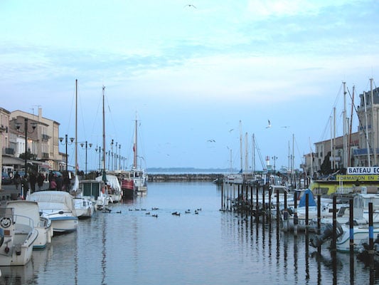
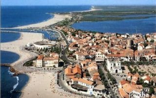
Marseillan is across the Étang de Thau (lake) from Sète and its port is a protected heritage site. The best places to run in Marseillan are along the beach, a pier out to the Onglus Lighthouse, and a waterfront promenade along the lake and around the marina.
Waterfront Path. Google Street View
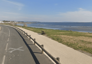
Waterfront Run. One can put together is a nice run along the lake, combining the Prom. de la Belle Scribote, the marina, and Chem. de l’Étang. There are nice views of the lake. The path is a combination dedicated promenade and roadside path/sidewalk. It’s 2.3 km from the Les Glénans sailing school north to the Chez Titin restaurant. ROUTE MAP
Longer Option: At the Les Glénans sailing school, you can run along the Chem. Boudas/Chem. de la Belle Bouche for 1.8 km. There’s a cycle path featuring nice water views. ROUTE MAP
Beach Run: There are two sections of beach in Marseillan. The better one for running is the beach that runs south from Sète. It has several names along its 7 km length, but look for Plage Castellas on the map. The beach is wide and often has sections of firm sand that are good for running. South of there is the shorter Plage Marseillan, which features softer sand.
Path to lighthouse. Google Street View
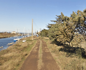
Run to Onglus Lighthouse (phare). In the Les Onglus area inland from the beach, there’s a quay/pier path that runs out to the Onglus Lighthouse. It’s 2.2 km one-way. There are nice views of the canal & water the whole way. The surface is dirt and can get wet/muddy. The start is right near the Gare de Marseillan-Plage train station. ROUTE MAP
Marseillan is across the Étang de Thau (lake) from Sète and its port is a protected heritage site. The best places to run in Marseillan are along the beach, a pier out to the Onglus Lighthouse, and a waterfront promenade along the lake and around the marina.
Waterfront Path. Google Street View
Waterfront Run. One can put together is a nice run along the lake, combining the Prom. de la Belle Scribote, the marina, and Chem. de l’Étang. There are nice views of the lake. The path is a combination dedicated promenade and roadside path/sidewalk. It’s 2.3 km from the Les Glénans sailing school north to the Chez Titin restaurant. ROUTE MAP
Longer Option: At the Les Glénans sailing school, you can run along the Chem. Boudas/Chem. de la Belle Bouche for 1.8 km. There’s a cycle path featuring nice water views. ROUTE MAP
Beach Run: There are two sections of beach in Marseillan. The better one for running is the beach that runs south from Sète. It has several names along its 7 km length, but look for Plage Castellas on the map. The beach is wide and often has sections of firm sand that are good for running. South of there is the shorter Plage Marseillan, which features softer sand.
Path to lighthouse. Google Street View
Run to Onglus Lighthouse (phare). In the Les Onglus area inland from the beach, there’s a quay/pier path that runs out to the Onglus Lighthouse. It’s 2.2 km one-way. There are nice views of the canal & water the whole way. The surface is dirt and can get wet/muddy. The start is right near the Gare de Marseillan-Plage train station. ROUTE MAP
Scroll Down For Route Maps
Essentials
Beach: Up to 7 km; Waterfront Promneade: 2.3 km one-way; Onglus Lighthouse: 2.2 km one-way
Running along the Lez River in Montpellier is a classic European river run. There are paths on both sides of the river from the Espl. de l'Europe in central Montpellier, south for 5+ km to Lattes. Options to extend south of Lattes.
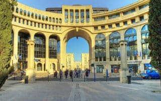
A 7 km 'runseeing' tour of the older, historic sections of Montpellier, highlighting the Place Europe, Antigone, Arch, Botanic Gardens, and the Charles de Gaulle Esplanade. Very pedestrian-friendly route.
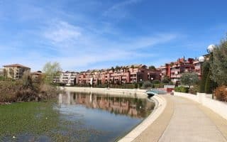
A run anchored by the southern part of the Lez River in Lattes is a nice loop, incorporating a marina, riverfront paths, marshlands, and bucolic farming fields. Nearly all off-road or on lightly trafficked secondary roads.
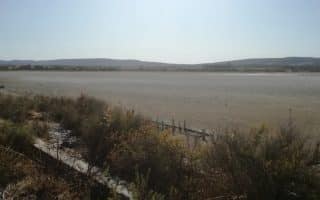
Extensive running options south of Montpellier around marhlands, former salt mines, and a series of canals and waterways. Routes in Réserve l'Estagnol, Salines de Villeneuve, & Canal du Rhône à Sète. Scenic, open, and flat!
A unique 10k run highlighting the area's unique geographic setting, with fantastic variety: beachside promenade, quaiside river paths, a tour of the marina, pier to an oceanside point, and road out to an old fort and Parc du levant.
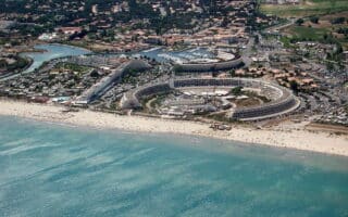
Excellent running opportunities in a series of beach resorts located 15 km south of Montpellier, anchored by Palavas-les-Flots. Lovely beaches, quiet roads, and off-road runs in parks, preserves, and around marshlands.
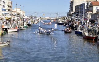
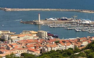
Sète is a major port city, located 33 km south of Montpellier. There's a scenic run along the marina/port for up to 5.6 km, and many km of running on the wide, sandy runnable beach.
The best places to run in this Mediterranean port of the Canal du Midi, located 50 km south of Montpellier, are the paths along the Hérault River, quai paths around the Port du Cap d'Agde Marina, and along Rochelongue Beach.
Share your feedback on this route and see that of other Great Runs users. Click on the image icon to upload a photo. And please let us know if there are notes or changes we should incorporate!
Subscribe
0 Comments
Oldest
Newest
Inline Feedbacks
View all comments
Essentials
Beach: Up to 7 km; Waterfront Promneade: 2.3 km one-way; Onglus Lighthouse: 2.2 km one-way


Review or Comment on This Route/Share a Photo!
Share your feedback on this route and see that of other Great Runs users. Click on the image icon to upload a photo. And please let us know if there are notes or changes we should incorporate!