Penticton is a small city at the southern end of the Okanagan Valley, situated between Okanagan and Skaha lakes. There are some nice opportunities for running in Penticton, which can be mixed & matched.
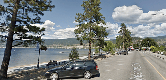
Waterfront Run. A scenic path runs along Lakeshore Drive, with wonderful views of Okanagan Lake, a pretty beach, and marina. It’s ~5 km out and back from SS Sicamous Heritage Park east to the marina and Esplanade Park.
Penticton Channel Path. Google Street View
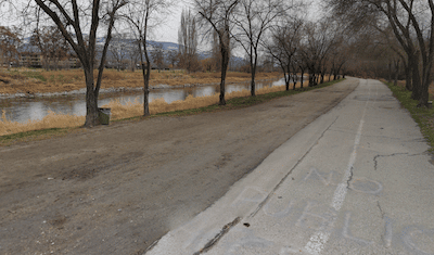
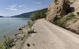
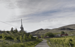
Penticton Channel Path. A paved multi-use path runs along the western side of the Penticton Channel, which connects Okanagan and Skaha lakes. Good opportunity for an easy, flat, off-road run. It’s up to 6.5 km one-way. The Penticton Airport is at the Skaha Lake end. Combine with the waterfront route for a 17.5 km run!
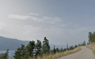
KVR Trail. This lengthy, multi-use trail runs through Penticton. On the east side, it’s 3.5 km from the McCulloch Trestle to Main St. After a 1 km road connection, the KVR Trail continues on the west side of the Penticton Channel for many km. We’ve mapped 18 km from McCulloch Trestle to Summerland. The western section is a bit hillier.
Penticton is a small city at the southern end of the Okanagan Valley, situated between Okanagan and Skaha lakes. There are some nice opportunities for running in Penticton, which can be mixed & matched.
Waterfront Run. A scenic path runs along Lakeshore Drive, with wonderful views of Okanagan Lake, a pretty beach, and marina. It’s ~5 km out and back from SS Sicamous Heritage Park east to the marina and Esplanade Park.
Penticton Channel Path. Google Street View
Penticton Channel Path. A paved multi-use path runs along the western side of the Penticton Channel, which connects Okanagan and Skaha lakes. Good opportunity for an easy, flat, off-road run. It’s up to 6.5 km one-way. The Penticton Airport is at the Skaha Lake end. Combine with the waterfront route for a 17.5 km run!
KVR Trail. This lengthy, multi-use trail runs through Penticton. On the east side, it’s 3.5 km from the McCulloch Trestle to Main St. After a 1 km road connection, the KVR Trail continues on the west side of the Penticton Channel for many km. We’ve mapped 18 km from McCulloch Trestle to Summerland. The western section is a bit hillier.
Scroll Down For Route Maps
Essentials
Waterfront Path: 5 km out and back; Channel Trail: Up to 6.5 km one-way
Waterfront & Channel trails are fairly flat; KVR Trail is hillier in western section
SS Sicamous Heritage Park is a good starting point for Lake Okanagan path or Penticton Channel Path
One of our favorite routes in the Okanagan. Attractive path along the waterfront, with great views of Okanagan Lake and the surrounding mountains. Festive, fun, and flat. A perfect 10k from City Park to Poplar Point and back.
A great spot for an off-road run in the Kelowna area. The mainly gravel multi-use trail travels along Mission Creek from Okanagan Lake in South Kelowna east to KLO Creek, much of it through parkland -- a combination of wooded and open terrain.
Run along lakes and past colourful cliffs, forests, vineyards, and orchards on this scenic multi-use path connecting Kelowna and Vernon. Some 42.5 km of a planned 53 km are complete. Some of the most scenic sections are along Wood Lake and Kalamalka Lake.
Get the heart rate going with some hill/trail running in Kelowna's largest park. You can run to the summit on the road or the Apex trail. St. Paul's Tomb Trail, at the base of the mountain is a 2.5 km flatter multi-use trail.
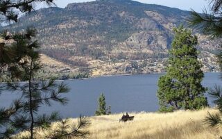
Running in the McKinley Beach area is a good opportunity to get some hill training in on quiet roads with great views. We've mapped a 10k loop, starting at the Marina, around area's roads, and out to the McKinley Reservoir.
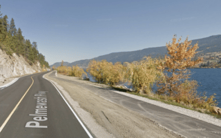
The best long waterfront run in the Okanagan. A bike path runs alongside Pelmewash Parkway on the west side Wood Lake for 7.5 km. Wonderful lake and hillside views. For full 15 km lake loop, use the Okanagan Rail Trail on the lake's eastern side.
Some scenic roads and paths passing by orchards in the Vernon area. Combine the 4 km out and back Grey Canal Trail with some of the area's side roads, which pass by orchards and feature nice lake views as they climb into the hillside. HILLY!
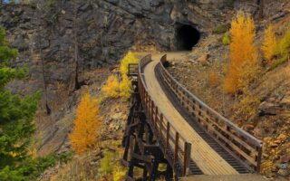
A unique and scenic run. This multi-use path on a former rail bed features spectacular mountainside sections over wooden trestles and steel bridges, and through tunnels. Gravel surface, not overly hilly, and great views.
A scenic off-road run in the southern part of the Okanagan Valley, passing farms, vineyards and orchards. This flat, wide, gravel path runs for 13.5 km, from the north end of Osoyoos Lake noth to Inkaneep Provincial Park, passing through Oliver.
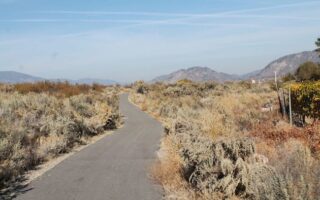
One doesn't often use 'desert' and 'Canada' in the same sentence, so this is your opportunity to enjoy a paved path through desert-like terrain in Osoyoos. Our 7 km route includes a 2 km loop on a wooden boardwalk through desert ecology.
Share your feedback on this route and see that of other Great Runs users. Click on the image icon to upload a photo. And please let us know if there are notes or changes we should incorporate!
Subscribe
0 Comments
Oldest
Newest
Inline Feedbacks
View all comments
Essentials
Waterfront Path: 5 km out and back; Channel Trail: Up to 6.5 km one-way
Waterfront & Channel trails are fairly flat; KVR Trail is hillier in western section
SS Sicamous Heritage Park is a good starting point for Lake Okanagan path or Penticton Channel Path
Review or Comment on This Route/Share a Photo!
Share your feedback on this route and see that of other Great Runs users. Click on the image icon to upload a photo. And please let us know if there are notes or changes we should incorporate!