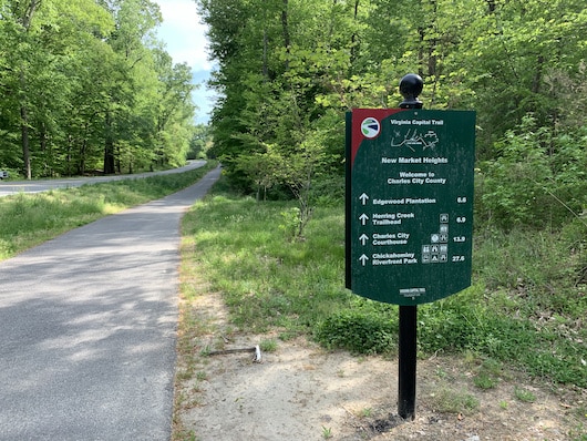
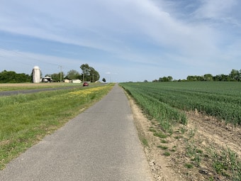
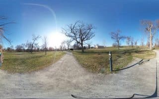
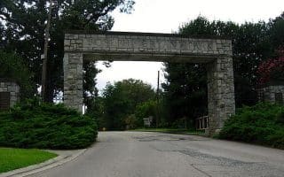
At over 50 miles long, the Virginia Capital Trail is the best bet for runners who want to train long distance. This paved multi-use path reaches southeast (roughly along the river/Route 5 corridor) from Richmond to Jamestown (officially part of Williamsburg). It features some rolling hills, which adds interest whether you’re going for a quick jog, a tempo run, or a marathon-training sesh. The full trail one-way would be a cool ultra! The terrain is a mix of woods and open farm fields, and a few miles along the river. There numerous historic sites and signposts along the way. There are mile markers every mile.
Author Photo
On the Richmond end, the path is accessible from 1-95 near Great Shiplock Park. Simply continue running southeast and turn around when you like. Or, drive to one of the parking areas and start there, for variety. It’s about 2 miles to Rockett’s Landing Marina, 4 miles to New Market Road, 6 miles to Battlefield Park Road, and 10 miles to 4 Mile Creek Park. This trail map has excellent information on trail segments, distances, and other features. A lovely open section is between miles 22 and 27. PRO TIP: Amtrak runs two trains per day between Richmond and Williamsburg. Unfortunately, no stops in-between.
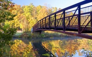
The most popular running spot in Richmond, with waterside trails and multiple pedestrian bridges. Well-groomed 2-10 mile options along the Buttermilk and North Bank trails, Forest Hill Park, and Pony Pasture. Trails are mainly wooded, gravel surface.
Pleasant ~1.25 mile (one way) path along the Richmond Canal system with murals, history lessons, and tips on things to do. Run out to the T. Tyler Potterfield Memorial Bridge for views — especially great at sunrise or sunset.
An attractive road for running on the south side of the James River, with views to the river and historic bridges, and attractive residential roads coming off it. It rides above the James River trail system, providing numerous access points to those trails as well.
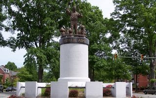
Fun sidewalked street run with monuments commemorating historic Richmond figures. An out and back through the Historic District is about 5 km, but it’s possible to continue further on the sidewalk.
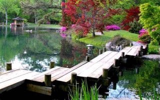
Run the grounds of this gorgeous Victorian estate with mansion, Japanese botanical gardens, and a ~3 mile paved perimeter path with some challenging hills. Options to connect with Byrd Park or the North Bank Trail.
The 1 mile packed gravel VITA course at Byrd Park is a favorite for time-strapped runners in need of a quick workout or people who love to do circuit-style runs (complete with strength training equipment). For a longer run, connect with Maymont Park.
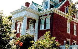
Richmond has some lovely residential areas featuring pretty, lengthy streets lined with trees and historic homes. Favorite neighborhoods for running include the Museum & Fan Districts, Windsor Farms/Near West End, and some streets off Riverside Dr. or around Maymont/Byrd Park.
Historic green space with a 3.4 mile paved path around ponds, forest, azealia gardens, and playing fields. Add-ons include dirt singletrack paths like the one along Jordan’s Branch.
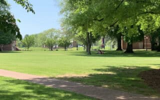
Great running on this classic open air campus, with beautiful brick buildings, manicured courtyards, and the lovely Westhampton Lake at its heart. Can be combined with other paths and streets in the area.
The 64 miles of paved bike paths, double track fire roads, and dirt trails of scenic Pocahontas State Park are definitely worth the 30 minute drive from Richmond. Popular trails are the Old Mill bike path and the Beaver Lake loop.
Share your feedback on this route and see that of other Great Runs users. Click on the image icon to upload a photo. And please let us know if there are notes or changes we should incorporate!


Review or Comment on This Route/Share a Photo!
Share your feedback on this route and see that of other Great Runs users. Click on the image icon to upload a photo. And please let us know if there are notes or changes we should incorporate!