This is a nice route in the Pocket & Greenhaven parts of San Diego, combining a trail along the Pocket Canal with a linear park path through Seymour Park. It’s a nice combination of canal-side route and a pleasant park. Overall, it’s 3.5 miles one-way, with a longer route adding 2.5 mile section of the Sacramento River Trail.
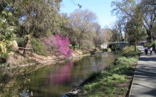
Seymour Park. Google Street View
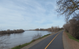
We start the route at Garcia Bend Park, because that’s where you can connect to the Sacramento River Trail. Run for 0.5 miles through the park and then north on Pocket Blvd., picking up the Pocket Canal Parkway trail, which runs along both banks of the narrow canal for `1 mile. There are views of the water all the way. At Portugese Community Park, continue west along the canal, turning north onto a path that leads through Seymour Park. This is a narrow, green linear park with a trail that runs north through its 1.8 mile length to Riverside Blvd.
Optional Spur: Running track at John F Kennedy High School. Just south of Northlite Cir. (2.5 mile mark), take the Coachlite Way path briefly west to the school.
Add-On: Connect to a section of the Sacramento River Trail at Garcia Bend Park. Scenic path along the river runs south for 2.5 miles, where you can connect to the Del Rio Trail.
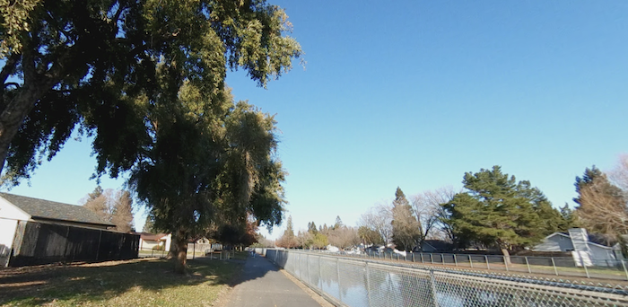
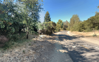
This is a nice route in the Pocket & Greenhaven parts of San Diego, combining a trail along the Pocket Canal with a linear park path through Seymour Park. It’s a nice combination of canal-side route and a pleasant park. Overall, it’s 3.5 miles one-way, with a longer route adding 2.5 mile section of the Sacramento River Trail.
Seymour Park. Google Street View
We start the route at Garcia Bend Park, because that’s where you can connect to the Sacramento River Trail. Run for 0.5 miles through the park and then north on Pocket Blvd., picking up the Pocket Canal Parkway trail, which runs along both banks of the narrow canal for `1 mile. There are views of the water all the way. At Portugese Community Park, continue west along the canal, turning north onto a path that leads through Seymour Park. This is a narrow, green linear park with a trail that runs north through its 1.8 mile length to Riverside Blvd.
Optional Spur: Running track at John F Kennedy High School. Just south of Northlite Cir. (2.5 mile mark), take the Coachlite Way path briefly west to the school.
Add-On: Connect to a section of the Sacramento River Trail at Garcia Bend Park. Scenic path along the river runs south for 2.5 miles, where you can connect to the Del Rio Trail.
Scroll Down For Route Maps
Essentials
Up to 3.5 miles (5.5 km) one-way, with good add-on options
Flat
South End: Garcia Bend Park; North End: Riverside Blvd.
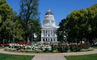
A 'runseeing' tour of downtown Sacramento. The highlight is the run along Capitol Mall, with nice views of the Capitol. Other streets in the downtown area are pleasant for running -- tree-lined with nice homes. Also includes Sutter’s Fort State Historic Park.
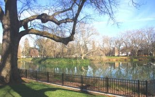
Lovely park and neighborhood for running. We've mapped a 3.6 mile loop around the park, which features nice gardens, ball fields, a golf course, and the Zoo. Add on with the attractive neighborhood roads and Sacramento River Bike Trail.
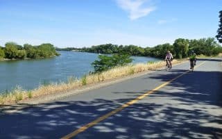
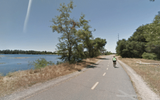
Paved multi-use path along the east bank of the Sacramento River. It's 5 miles from Discovery Park south to the Pocket neighborhood along the levee, with some nice water views. There's also a trail on the west bank of the river. Good add-on options.
Newly opened in 2024, this rail-trail runs for 5 miles from near the Sacramento Zoo south toward Freeport. Some residential & business sections, and several parks. At the southern end is a nice 2.5 mile section of the Sacramento River Bike Trail.
Paved multi-use path that connects Downtown, Del Paso Heights, and Rio Linda over 10.6 miles. Combination of residential at the southern end, some historic neighborhoods, and more rural scenery alongside Dry Creek at the northern end.
The paved Jedediah Smith Memorial Trail follows the American River for 32 miles between Sacramento and Folsom Lake, featuring several riverfront parks. It's the anchor of running in the area. We've mapped the full trail and some good loop oprtions.
Nice running on the eastern section of the Jedediah Smith Memorial Trail in Folsom. Full lake loop is 11.3 miles, passing through several parks & preserves. Lake views along about half of the route.
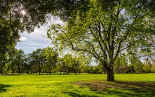
Davis is a suburb of Sacramento, home to the large UC Davis and known for its bikeability. There's lovely running in Davis, highlighted by the UC Davis Arboretum, nice paths around campus, a running track, and the East Davis Greenways.
Share your feedback on this route and see that of other Great Runs users. Click on the image icon to upload a photo. And please let us know if there are notes or changes we should incorporate!
Subscribe
0 Comments
Oldest
Newest
Inline Feedbacks
View all comments
Essentials
Up to 3.5 miles (5.5 km) one-way, with good add-on options
Flat
South End: Garcia Bend Park; North End: Riverside Blvd.


Review or Comment on This Route/Share a Photo!
Share your feedback on this route and see that of other Great Runs users. Click on the image icon to upload a photo. And please let us know if there are notes or changes we should incorporate!