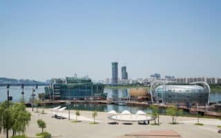
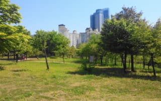
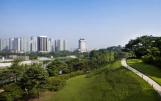
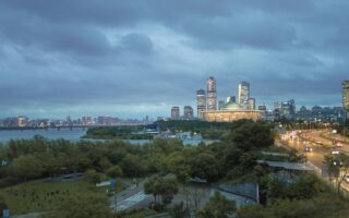
Hangang Park, located on Yeouido Island, is a large, popular park on the river featuring scenic views, plus running paths and a swimming pool. It’s a little over 3k (2 miles) from one end of the park to the other, and one could do about 5 miles around the perimeter of the park. The park adjoins the National Assembly, built in the 1970s, and several other important buildings, such as the Korea Development Bank. There’s a “mall-like” park, which runs just across Yeouiseo-ro, for a little over 1km in each direction, with the the Korea Development Bank just to the west.
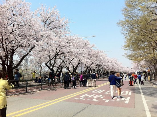
Yunjunro Street, behind the National Assembly Building, is famous for its cherry blossom trees, which line up for nearly 6km.
Hangang Park, located on Yeouido Island, is a large, popular park on the river featuring scenic views, plus running paths and a swimming pool. It’s a little over 3k (2 miles) from one end of the park to the other, and one could do about 5 miles around the perimeter of the park. The park adjoins the National Assembly, built in the 1970s, and several other important buildings, such as the Korea Development Bank. There’s a “mall-like” park, which runs just across Yeouiseo-ro, for a little over 1km in each direction, with the the Korea Development Bank just to the west.
Yunjunro Street, behind the National Assembly Building, is famous for its cherry blossom trees, which line up for nearly 6km.
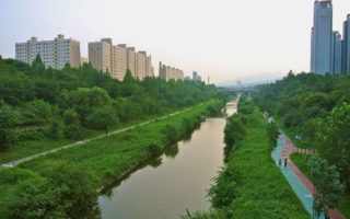
The 100+ km of paved multi-use paths along both sides of the Han River (Han-Gang) are among most popular running spots in Seoul. A wonderful greenbelt, with various loop options involving the bridges and great river views. The paths run below the bridges.
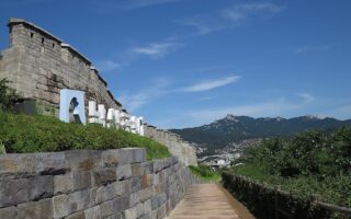
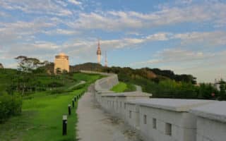
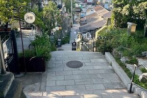
A route following a popular urban walk around the Old City Wall encircling a part of Seoul, incorporating the slopes of four mountains. Hilly and challenging, with lots of stairs. Up to 19 km, but can be done in sections, with good transport options.
900-foot high South Mountain is an oasis of green, right in the center of Seoul. About 10 km of paved paths, including 2k climb to the summit, quite steep. Great views from the top. More of a challenging trail run.
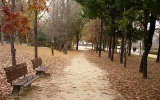
This urban island park opened in 2005 is a nice spot for running, with 3-4 km of scenic, tree-lined paths through the park's four 'sections'. 'Bike Road' along western perimeter is good longer option.
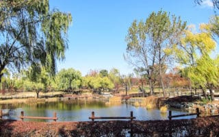
Pleasant, centrally located park with several km of paved paths, a large field, and a pond. It's 4.5k runner's loop around the perimeter. Great to combine with Han River path, just to the south. National Museum of Korea is in the park.
Five interconnected parks, with miles of trails - in forests, along the river, fields, and more. A highlight is Haneul/Sunset Park, with 291 stairs, and great views.
Site of 1988 Summer Games and now a major sports and recreation complex. There are five different walking/jogging trails, of varied terrain, ranging from 1.3k to 4.3k, featuring gates, gardens, a lake, & sports facilities.
Lovely park for running on the southern banks of the Han River, with 5.7 km of pedestrian paths passing through a scenic landscape of naturally sandy plains and silver grass. The park has numerous other sports facilities & an observation deck.
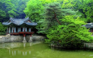
The second largest palace in Seoul, located east of Gyeongbokgung Palace and the famous Bukchon Hanok Village. The "Secret Garden" has nearly 80 acres of trails and is open to the public. The place is heavily visited, so best to go early.
A nice run in the Jongno District in northern Seoul, combining the small, hilly Naksan Park with a path along the city walls, and a road passing by several murals. This can be run standalone or combined with our Changdeokgung route.
A hilly run with rewarding views of the city from the summit. It’s one of the better options near the city to get some trail running in. The route to the summit, "Beacon Mound", is about 3 km from the Great West Gate.
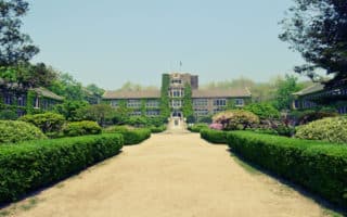
Very pretty university campus with older buildings and pleasant running paths, at base of Ansan Mountain. There are also wooded trails and a forest park on campus. Can combine with Ansan trails.
Good running on waterside bike path from Gwacheon to Gangnam. It's about 7 km one way. Much of the trail is below or away from the road, making for a pleasant canopy. Follows Budong line.
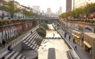
Nearly 11 km path, part of a major urban renewal project opened in 2005. Great spot to walk or run through the heart of the city. Much of the path is below the roadway, passing under 22 bridges, starting at the large Cheonggye Plaza.
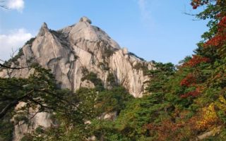
A large national park that is unusually close to a major city. Great for hiking, with wooded trails. Some are excellent for trail running. A run/hike to the top of Bukhansan Mountain is a great challenge.
Share your feedback on this route and see that of other Great Runs users. Click on the image icon to upload a photo. And please let us know if there are notes or changes we should incorporate!
Subscribe
0 Comments
Oldest
Newest
Inline Feedbacks
View all comments
Essentials
It's about 3 km from one end of the park to the other. One can put together a 9k (5 mile) loop around the park


Review or Comment on This Route/Share a Photo!
Share your feedback on this route and see that of other Great Runs users. Click on the image icon to upload a photo. And please let us know if there are notes or changes we should incorporate!