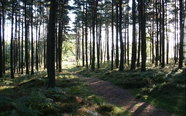
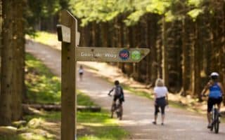
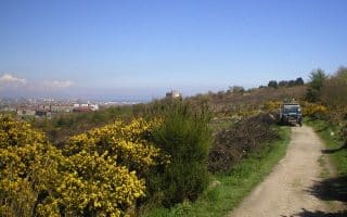
Kirkhill Forest is one of the finer trail running options around Aberdeen, and a great place to get in some hill training. The forest is located northwest of the city, near the airport. Whether runners choose the smooth gravel roads throughout the park or the tucked away dirt and grass side paths, there is a running route for all skill sets in the Kirkhill Forest. Most paths are well marked with green trail markers at every intersection. We’ve mapped an 11 km tour of the forest on its gravel roads, which follows a “lollipop” pattern from the main forest entrance off A96. More trails can be found across the highway in the Tyrebagger Hill/Elrick County Park. The trails on this side of the highway are a bit more technical and steep, but they’re a fun challenge for more experienced trail runners.
Keith Grinsted
Features:
Scroll Down For Route Maps
Essentials
- 11.2 km (7 miles) lollipop loop. Numerous other options available
- 220m (71 feet)
- A96
- Chapel of Stoneywood Road Bus Stop
Current Weather & Forecast

Aberdeen, GB
11:18 am,
Jun 18, 2026
L: 17°
H: 18°
Daily ForecastHourly Forecast
Today
10:00 pm
17° / 18°°C
1 mm
100%
21 mph
87 %
1010 mb
0 mm/h
Tomorrow
10:00 pm
17° / 26°°C
1 mm
100%
12 mph
95 %
1015 mb
0 mm/h
Saturday
10:00 pm
14° / 25°°C
0 mm
0%
8 mph
83 %
1018 mb
0 mm/h
Sunday
10:00 pm
16° / 28°°C
0 mm
0%
7 mph
90 %
1016 mb
0 mm/h
Monday
10:00 pm
17° / 23°°C
1 mm
100%
16 mph
97 %
1015 mb
0 mm/h
Today
1:00 pm
23° / 24°°C
1 mm
100%
21 mph
79 %
1005 mb
0 mm/h
Today
4:00 pm
23° / 23°°C
1 mm
100%
13 mph
87 %
1007 mb
0 mm/h
Today
7:00 pm
26° / 26°°C
1 mm
100%
12 mph
72 %
1010 mb
0 mm/h
Today
10:00 pm
26° / 26°°C
1 mm
100%
7 mph
83 %
1009 mb
0 mm/h
Tomorrow
1:00 am
24° / 24°°C
1 mm
100%
8 mph
92 %
1009 mb
0 mm/h
Tomorrow
4:00 am
23° / 23°°C
1 mm
100%
8 mph
95 %
1011 mb
0 mm/h
Tomorrow
7:00 am
21° / 21°°C
1 mm
100%
5 mph
89 %
1011 mb
0 mm/h
Other Routes in Aberdeen, Scotland
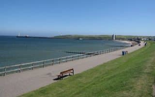
The signature running option in Aberdeen is the Esplanade, a 3.7 km asphalt pathway stretching from the North Pier at the mouth of the River Dee to the Donmouth Local Nature Reserve.
Enjoy the paved pathways along the River Don, starting from Seaton Park. We’ve mapped a 13 km loop using the Bridge of Don and the Persley Bridge. Pro Tip: Nice daffodils in Seaton Park in spring.
Aberdeenshire Coastal Path
Aberdeen, Scotland
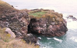
The Aberdeenshire Coastal Path is a gorgeous seaside trail run winding atop the bluffs between Nigg Bay and Cove Bay. Run an out and back up to 11.5 km or take the bus for a one-way.
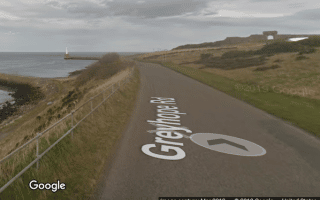
The 3.4 km loop around the Nigg Bay Golf Club has wonderful views of the bay, lighthouse, and classic links golf course. It's nearly 10k if accessed from central Aberdeen. Can also be combined with the Aberdeenshire Coastal Path.
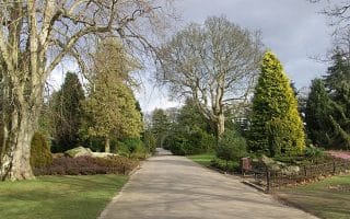
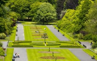
Historic 180 ha park known of its manicured English gardens, and famous for daffodils & snow drops in spring. Our 6.3 km loop uses Hazlehead Ave and Groats Road, and some additional pathways & woodland trails.
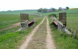
In the corridor of a former railway, the Formartine and Buchan Way is a mostly gravel path stretching more than 88 km north from Dyce. It’s 13 km between Dyce and Udny Station.
The Deeside Way is a paved long distance path along the “Old Deeside Way” rail line from Aberdeen all the way out to Ballater. Our guide includes a 17 km straightaway and a 6.6 km loop. Famous for daffodils and snowdrops in spring.
It’s not a long route, but the wide gravel path around Kincorth Hill is worthwhile for its great views of the Aberdeen skyline. Run some gentle hill repeats on the 2 km route.
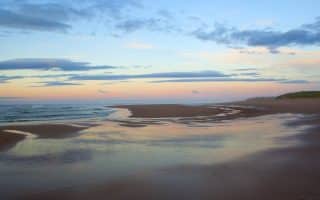
Some of Scotland’s most desireable beach running is just north of Aberdeen, starting from Donmouth. Run up to 16 km in one direction and return on the bus, or do an out and back of almost any length.

Run the spectacular grounds of the royal family's summer home! Options include the grounds and paths of the Balmoral Estate, Ballochbuie Forest, a loop around Loch Muick, and numerous other area trails. Balmoral is famous for daffodils in spring.
User Ratings
Leave A Review or Comment
Review or Comment on This Route/Share a Photo!
Share your feedback on this route and see that of other Great Runs users. Click on the image icon to upload a photo. And please let us know if there are notes or changes we should incorporate!