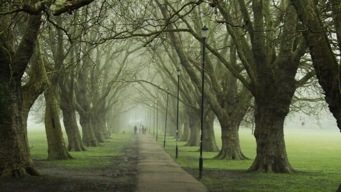
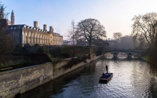
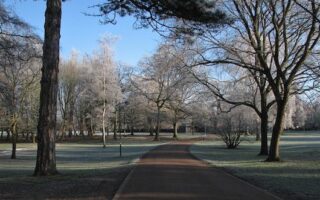
Here’s a run that has it all: history, water views, ancient riverside meadows and commons. This 5.6 mile loop features paths along the Cam River, and paths through four distinct green spaces: Jesus Green, Midsummer Common, Stourbridge Common, and Ditton Meadows. There’s also a marked 2.5 km route around Jesus Green.
Our approach to the route is to go one way along the river path and then back through the meadow/common paths. Start near St. John’s College/Bridge of Sighs and head north on the south side of the Cam River path. Stay on the river path, passing through the west side of Jesus Green and Midsummer Common (ancient riverside meadows) for 1 mile. After another 0.5 miles, you’ll hit Stourbridge Common, and then Ditton Meadows, arriving at Ditton Hall on High St. at the 2.7 mile mark. Turn around here, and wind your way back along the paths of Ditton Meadows and Stourbridge Common for ~1 mile, then along the river for a 1/2 mile, and then along the paths of Midsummer Common and Jesus Green (we recommend the diagonal avenue of london plane trees tree-lined coming off Victoria Ave).
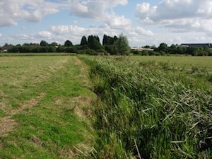
Midsummer Common. Geograph.co.uk
Add-Ons: Additional paths in and around the various greens. Or, head further north on the Cam River paths, for example the extra 1.3 miles to Baits Bite Lock (see our route there) and Milton Country Park near there.
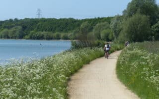
Here’s a run that has it all: history, water views, ancient riverside meadows and commons. This 5.6 mile loop features paths along the Cam River, and paths through four distinct green spaces: Jesus Green, Midsummer Common, Stourbridge Common, and Ditton Meadows. There’s also a marked 2.5 km route around Jesus Green.
Our approach to the route is to go one way along the river path and then back through the meadow/common paths. Start near St. John’s College/Bridge of Sighs and head north on the south side of the Cam River path. Stay on the river path, passing through the west side of Jesus Green and Midsummer Common (ancient riverside meadows) for 1 mile. After another 0.5 miles, you’ll hit Stourbridge Common, and then Ditton Meadows, arriving at Ditton Hall on High St. at the 2.7 mile mark. Turn around here, and wind your way back along the paths of Ditton Meadows and Stourbridge Common for ~1 mile, then along the river for a 1/2 mile, and then along the paths of Midsummer Common and Jesus Green (we recommend the diagonal avenue of london plane trees tree-lined coming off Victoria Ave).
Midsummer Common. Geograph.co.uk
Add-Ons: Additional paths in and around the various greens. Or, head further north on the Cam River paths, for example the extra 1.3 miles to Baits Bite Lock (see our route there) and Milton Country Park near there.
Scroll Down For Route Maps
Essentials
5.6 mile (9 km) loop
Flat
Bridge St., just north of Bridge of Signs. Start on south side river path.
A pleasant gravel path lines the Cam River for several km, with opportunities for detours to some of Cambridge's gorgeous meadows and commons. We've a 9.3 km one-way route to Clayhithe, including a table w/segment distances.
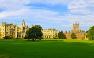
One of our top 10 university running tours. This prestigious medieval university features jaw-dropping gothic architecture, riverside paths, open meadows and greens, and impressive athletic fields.
A tour of three pleasant green spaces in the southeastern part of Cambridge: Coldham's Common, the Barnwell Preserve, and Cherry Hinton Hall Park. 2/3 of it is within the greens and off-road paths, 1/3 connectors.
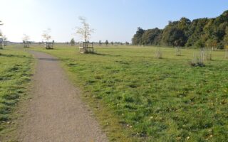
Trumpington Meadows is a 58-hectare park in the southeast part of Cambridge that's a lovely spot for a run. The 3-4 miles of trails are a nice mix of fields, meadows, woodland, and paths along the Cam river.
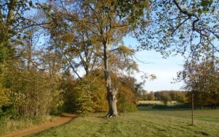
The Gog Magog Hills offer some gorgeous countryside running just a couple of miles south of Cambridge. Wandlebury Country Park has 8 km of paths through woodland, meadows and farm fields. Additional trails in Magog Down.
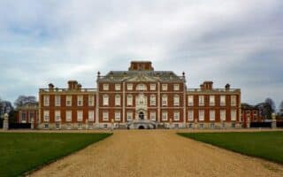
Run the grounds of this classic English country estate, which includes a 2.5-mile Grand Avenue, belts of woodland, fields & meadows, formal gardens, a chain of lakes, and farmland. Includes marked walk and cycle paths.
More than 2,400 acres of pretty countryside, featuring a popular 9-mile multi-use path around the perimeter of Gratham Water (lake). There are water views some of the way, and sections of fields, farms, and woodland.
Run the trails of the second largest woodland in Cambridgeshire! The 900-year-old forest has 2-3 miles of trails, known as 'rides', through aspen, oak, ash, field maple and birch. A 45 minute drive from Cambridge.
Share your feedback on this route and see that of other Great Runs users. Click on the image icon to upload a photo. And please let us know if there are notes or changes we should incorporate!
Subscribe
0 Comments
Oldest
Newest
Inline Feedbacks
View all comments
Essentials
5.6 mile (9 km) loop
Flat
Bridge St., just north of Bridge of Signs. Start on south side river path.
 Here’s a run that has it all: history, water views, ancient riverside meadows and commons. This 5.6 mile loop features paths along the Cam River, and paths through four distinct green spaces: Jesus Green, Midsummer Common, Stourbridge Common, and Ditton Meadows. There’s also a marked 2.5 km route around Jesus Green.


Review or Comment on This Route/Share a Photo!
Share your feedback on this route and see that of other Great Runs users. Click on the image icon to upload a photo. And please let us know if there are notes or changes we should incorporate!