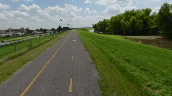
The Levee Bike Path is the signature running spot in Baton Rouge. Starting downtown, the paved path runs south along the Mississippi River for 27+ miles as far as St. Gabriel. For much of the way, the path is on a levee above the river, paralleling River Rd. Some sections have clear views of the water. with good views of the water. The heart of the path is the ~4.5 miles between downtown and Farr Park, where it’s wide, paved, lit, and has good water views. The bike path links to the existing one mile riverfront promenade downtown, where there are some fun loop options – see MAP.
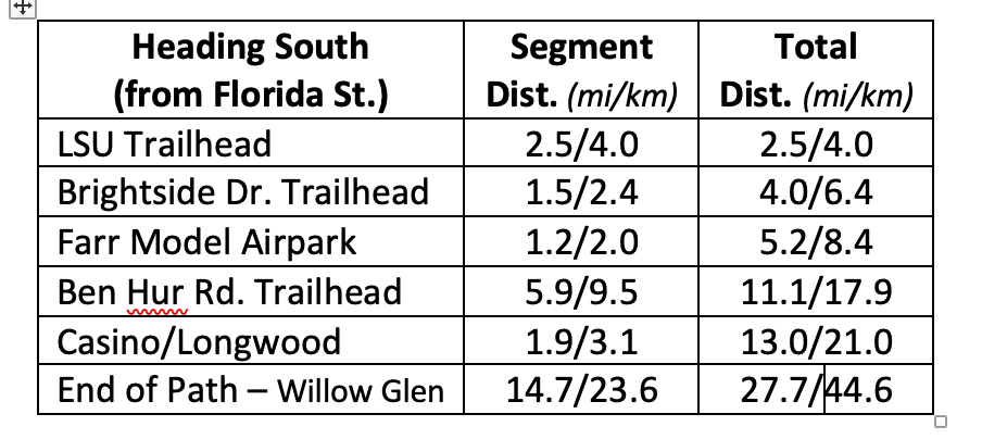
It’s 13 miles from downtown to the L’Auberge Casino and Longwood area. South of there, the path becomes more remote and rural. Distances and major landmarks are in the table below.
The Levee Bike Path is the signature running spot in Baton Rouge. Starting downtown, the paved path runs south along the Mississippi River for 27+ miles as far as St. Gabriel. For much of the way, the path is on a levee above the river, paralleling River Rd. Some sections have clear views of the water. with good views of the water. The heart of the path is the ~4.5 miles between downtown and Farr Park, where it’s wide, paved, lit, and has good water views. The bike path links to the existing one mile riverfront promenade downtown, where there are some fun loop options – see MAP.
It’s 13 miles from downtown to the L’Auberge Casino and Longwood area. South of there, the path becomes more remote and rural. Distances and major landmarks are in the table below.
Scroll Down For Route Maps
Essentials
Up to 27.7 miles (44.6 km) one-way. See distancre table
Fairly flat - 332 feet (101m) over full 27.7 miles
Downtown: off Florida St. or Riverfront Plaza
Access points downtown: Sing the River Sculpture, off Florida St.; and at Riverfront Plaza. Several access points/trailheads further south
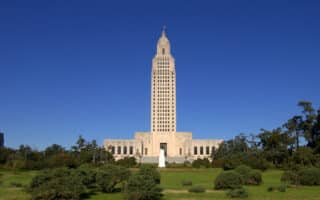
An enjoyable, 4.5 mile 'runseeing' tour of downtown Baton Rouge and some key sites. Includes the State Capitol, Old Capitol, Downtown Greenway, Spanish Town Historic District, and a section of the Riverfront/Levee Path.
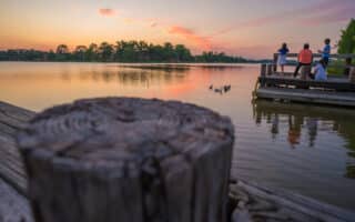
The LSU Lakes, located just east of the LSU campus, are a scenic and popular running spot in Baton Rouge. It's ~4 miles around University Lake and ~1.5 miles around City Park Lake. Nice water views and other facilities.
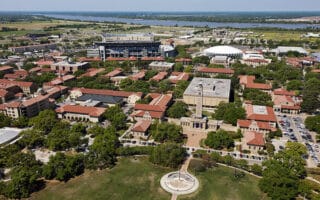
Pleasant campus for running, with its Parade Ground, pedestrian paths, and athletic fields running track, and live oaks. Can be combined with LSU Lakes loop and the Levee Bike Path.
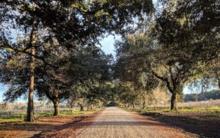
Gorgeous gardens and paths lined with live oaks. 5 miles of trails that are scenic and pleasant for running. See details for info, hours, regulations. In the western part of Baton Rouge between Perkins Rd. & I-10.
Highland Road Community Park is a large neighborhood park with a popular cross-country running course. Can be combined with the pleasant residential streets in the adjacent Villa St. George and Oak Hills neighborhoods.
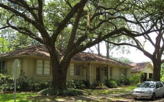
Some nice Baton Rouge neighborhoods for running include Spanish Town Historic District, the Settlements area off Perkins Rd., and Oak Hills/Villa St. George, anchored by Highland Rd.
Share your feedback on this route and see that of other Great Runs users. Click on the image icon to upload a photo. And please let us know if there are notes or changes we should incorporate!
Subscribe
0 Comments
Oldest
Newest
Inline Feedbacks
View all comments
Essentials
Up to 27.7 miles (44.6 km) one-way. See distancre table
Fairly flat - 332 feet (101m) over full 27.7 miles
Downtown: off Florida St. or Riverfront Plaza
Access points downtown: Sing the River Sculpture, off Florida St.; and at Riverfront Plaza. Several access points/trailheads further south

Review or Comment on This Route/Share a Photo!
Share your feedback on this route and see that of other Great Runs users. Click on the image icon to upload a photo. And please let us know if there are notes or changes we should incorporate!