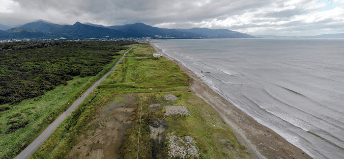
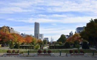
Otaru is a port city that lies northwest of Sapporo on Ishikari Bay. The waterfront section stretches in a narrow strip for 30 km from Otaru Dream Beach west to the Otaru Aquarium on the tip of the bay. The two best best places to run in Otaru are the Otaru Dream Beach Area/Hoshioki River Path, and further north along the Otaru Canal and some lovely city parks.
Otaru Dream Beach Area. A nearly 10 km beach extends east and west of where the Shin River pours into the bay. The sand is fairly firm for running, so this makes for a decent beach run. There’s also a sort of road on the west side of the Shin River that runs along the beach for 3 km. Runnable, some beach views, and can be sandy. ROUTE MAP
Hoshioki River Path. Google Street View
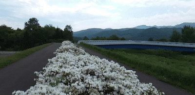
Hoshioki River Path and Hoshimi Ryokuchi Park. Toward the western end of the beach, at Zenibako Star Light Beach, there are paths along the narrow Hoshioki River. It’s 2.5 km one-way between the beach and the train tracks, just south of Hoshimi Ryokuchi Park. A pedestrian bridge leads from the path on the east side of the river path to the park, which features 1-2 km of pleasant paths for walking. ROUTE MAP
Otaru is a port city that lies northwest of Sapporo on Ishikari Bay. The waterfront section stretches in a narrow strip for 30 km from Otaru Dream Beach west to the Otaru Aquarium on the tip of the bay. The two best best places to run in Otaru are the Otaru Dream Beach Area/Hoshioki River Path, and further north along the Otaru Canal and some lovely city parks.
Otaru Dream Beach Area. A nearly 10 km beach extends east and west of where the Shin River pours into the bay. The sand is fairly firm for running, so this makes for a decent beach run. There’s also a sort of road on the west side of the Shin River that runs along the beach for 3 km. Runnable, some beach views, and can be sandy. ROUTE MAP
Hoshioki River Path. Google Street View
Hoshioki River Path and Hoshimi Ryokuchi Park. Toward the western end of the beach, at Zenibako Star Light Beach, there are paths along the narrow Hoshioki River. It’s 2.5 km one-way between the beach and the train tracks, just south of Hoshimi Ryokuchi Park. A pedestrian bridge leads from the path on the east side of the river path to the park, which features 1-2 km of pleasant paths for walking. ROUTE MAP
Scroll Down For Route Maps
Essentials
Numerous distance options: Beach is up to 10 km; Beachside road is ~3 km one-way; Hoshioki River Path is 2.5 km one-way; Hoshimi Ryokuchi Park has 1-2 km of paths
Flat
Otaru Dream Beach. Can also park at Hoshimi Ryokuchi Park to run the park paths & Hoshioki River paths
Parking in the beach area or Hoshimi Ryokuchi Park
The top running route in Sapporo, this paved multi use path stretches over 25 km along the Toyohira River. Start from out from or run to Nakajima Park or Makominai Park for the best sections.
The airy public campus of Hokkaido University has a very park-like feel with plenty of runnable paths and sidewalks. We’ve mapped a 7.5 km tour of the highlights, including Gingko Ave. Good winter option!
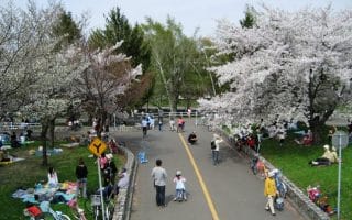
A long linear park in central Sapporo, this prized green space has a 3 km loop (intersected by several streets), but it makes a nice addition to the Hokkaido University or Toyohira River routes.
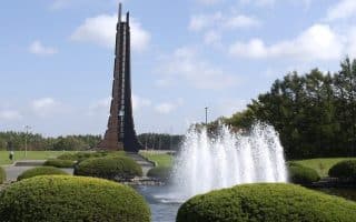
Located along the Shinoroshin River in the north of the city, this park is acclaimed for its landscape architecture and sculptures. A full loop around the park is about 10 km.
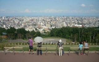
The paved, well lit paths of Asahiyama Memorial Park lead to a great vista of the city, but there are also miles of trail running around the hills of Mt Moiwa.
More of Sapporo’s best trail running can be found at the sprawling Nopporo Forest Park. There are lots of options, but a circuit around the park perimeter is about 20 km. A trail map shows loop options of various lengths.
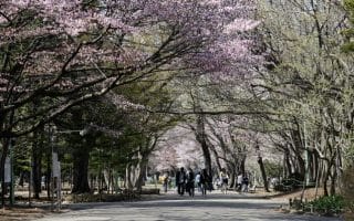
This park in west Sapporo is famous for its gravel paths lined with cherry blossoms. There are also connections to dirt singletrack trails leading to some great viewpoints.
The Shin River, and its branches (the Kotonihassamu River & Kotoni River) have paved and dirt pathways along the banks. They are not always the most scenic options, but good for distance. Another route, along the Nakano River in the Teine Ward.
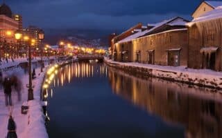
The heart of Otaru is 20 km northwest of Sapporo. Pleasant running along the canal -- especially pretty in winter! -- and in Temiya Park & Otaru Park. For a challenge & great views, run to the Asahi Observation Deck.
Share your feedback on this route and see that of other Great Runs users. Click on the image icon to upload a photo. And please let us know if there are notes or changes we should incorporate!
Subscribe
0 Comments
Oldest
Newest
Inline Feedbacks
View all comments
Essentials
Numerous distance options: Beach is up to 10 km; Beachside road is ~3 km one-way; Hoshioki River Path is 2.5 km one-way; Hoshimi Ryokuchi Park has 1-2 km of paths
Flat
Otaru Dream Beach. Can also park at Hoshimi Ryokuchi Park to run the park paths & Hoshioki River paths
Parking in the beach area or Hoshimi Ryokuchi Park


Review or Comment on This Route/Share a Photo!
Share your feedback on this route and see that of other Great Runs users. Click on the image icon to upload a photo. And please let us know if there are notes or changes we should incorporate!