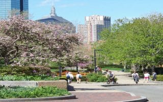
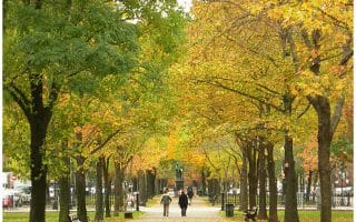
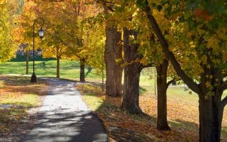
The Emerald Necklace is a greenway originally conceived by Frederick Law Olmsted. It runs nearly 8 miles from the State House to Franklin Park. This is a spectacular urban run, with a nice variety and many sights to see. There are gorgeous old trees and lovely parks and gardens. Just about the entire Necklace is a dedicated, off-road path, with a couple of on-road ‘connector sections’. Typical of Boston, it is not very well signed. Below are comments on some of the specific sections and some fun loops. This MAP is a helpful guide., There are many terrific sections to run standalone, some fun loops. This TABLE has segment distances & transport options for a one-way run! Pro Tip: Gorgeous in autumn.
Best Loops: Jamaica Pond (1.5 miles); Franklin Park Circuit (2.5 miles); Fens to Jamaica Pond (using both sides) is a 7,7 mile loop including the loop of Jamaica Pond; MFA to Jamaica Pond 5 miler.
Sections
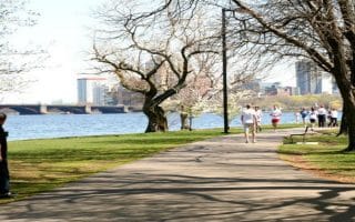
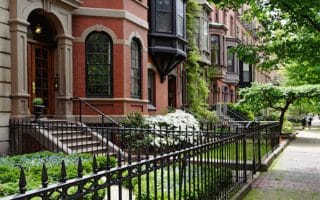
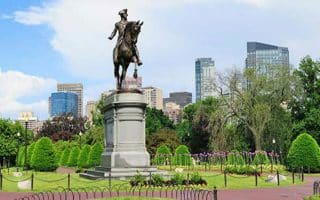
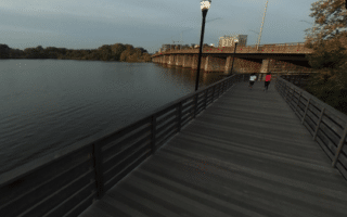
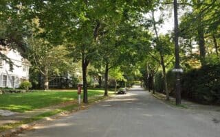
State House to End of Comm. Ave. Mall (1.5 miles). Starting at the State House, the initial section, headed southwest, takes you by the famous Boston Common, Public Garden, and the Comm. Ave. Mall, in Back Bay, with gorgeous brownstones on either side. It is a couple of blocks inland from the Charles River. Use Boyltson St. to connect to the Fens section (0.4 miles, not well waymarked). Fun loop: Neckalace one-way, Charles River paths for the return (use Massachusetts Ave. to get to the river).
Fens to Jamaica Pond (2.3 miles). This section is more of a linear park trail, really pretty, with paths on both sides of the Muddy River. On the south side is the MFA and the Shattuck Visitor Center (info & restroom!). From Boylston St. to the (awful rotary) at Park Dr., it’s 1 mile. There’s a running track at Roberto Clemente Field. Then, cross Park Ave. and continue along the Riverway Section It’s 1.3 miles to Washington St. Then, cross Washington St. (no sign!) and continue for 1 mile to Jamaica Pond. Just before Jamaica Pond, there’s a great running track at Downes Field (just across Pond Ave.)
A highlight is the 1.5 mile loop around Jamaica Pond.
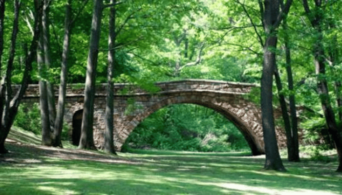
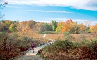
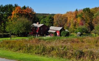
Jamaica Pond to Franklin Park. Use the Arborway for 0.6 miles to connect to the Arnold Arboretum (see map, not the best connection, and poorly signed). The Arboretum is a fantastic place for running, with miles of easy, gorgeous trails. And some good hills, with great views from Peters Hill and Bussey Hill. ARBORETUM MAP.
From the Arboretum, use the Forest Hill Gate to exit onto the Arborway, where there’s a good bike path for 0.5 miles to connect to Franklin Park. At Franklin Park, there are many wonderful paths for running — some easier, others more rugged, and some hills! Easiest and most popular is the 2.5 mile ‘Circuit Loop’ paralleling Circuit Dr. (note: the back half is car-free and especially scenic).
The Emerald Necklace is a greenway originally conceived by Frederick Law Olmsted. It runs nearly 8 miles from the State House to Franklin Park. This is a spectacular urban run, with a nice variety and many sights to see. There are gorgeous old trees and lovely parks and gardens. Just about the entire Necklace is a dedicated, off-road path, with a couple of on-road ‘connector sections’. Typical of Boston, it is not very well signed. Below are comments on some of the specific sections and some fun loops. This MAP is a helpful guide., There are many terrific sections to run standalone, some fun loops. This TABLE has segment distances & transport options for a one-way run! Pro Tip: Gorgeous in autumn.
Best Loops: Jamaica Pond (1.5 miles); Franklin Park Circuit (2.5 miles); Fens to Jamaica Pond (using both sides) is a 7,7 mile loop including the loop of Jamaica Pond; MFA to Jamaica Pond 5 miler.
Sections
State House to End of Comm. Ave. Mall (1.5 miles). Starting at the State House, the initial section, headed southwest, takes you by the famous Boston Common, Public Garden, and the Comm. Ave. Mall, in Back Bay, with gorgeous brownstones on either side. It is a couple of blocks inland from the Charles River. Use Boyltson St. to connect to the Fens section (0.4 miles, not well waymarked). Fun loop: Neckalace one-way, Charles River paths for the return (use Massachusetts Ave. to get to the river).
Fens to Jamaica Pond (2.3 miles). This section is more of a linear park trail, really pretty, with paths on both sides of the Muddy River. On the south side is the MFA and the Shattuck Visitor Center (info & restroom!). From Boylston St. to the (awful rotary) at Park Dr., it’s 1 mile. There’s a running track at Roberto Clemente Field. Then, cross Park Ave. and continue along the Riverway Section It’s 1.3 miles to Washington St. Then, cross Washington St. (no sign!) and continue for 1 mile to Jamaica Pond. Just before Jamaica Pond, there’s a great running track at Downes Field (just across Pond Ave.)
A highlight is the 1.5 mile loop around Jamaica Pond.
Jamaica Pond to Franklin Park. Use the Arborway for 0.6 miles to connect to the Arnold Arboretum (see map, not the best connection, and poorly signed). The Arboretum is a fantastic place for running, with miles of easy, gorgeous trails. And some good hills, with great views from Peters Hill and Bussey Hill. ARBORETUM MAP.
From the Arboretum, use the Forest Hill Gate to exit onto the Arborway, where there’s a good bike path for 0.5 miles to connect to Franklin Park. At Franklin Park, there are many wonderful paths for running — some easier, others more rugged, and some hills! Easiest and most popular is the 2.5 mile ‘Circuit Loop’ paralleling Circuit Dr. (note: the back half is car-free and especially scenic).


Review or Comment on This Route/Share a Photo!
Share your feedback on this route and see that of other Great Runs users. Click on the image icon to upload a photo. And please let us know if there are notes or changes we should incorporate!