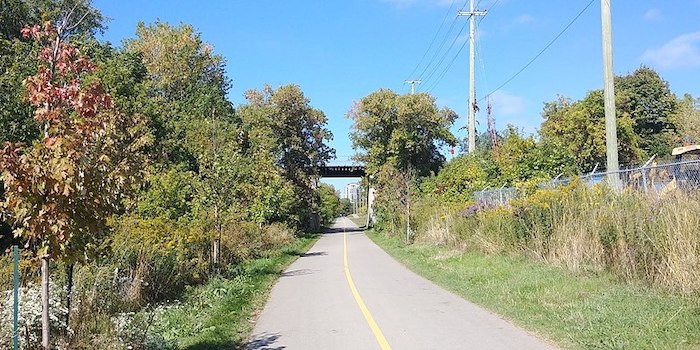
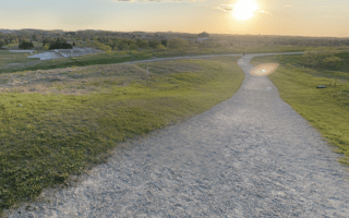
The Iron Horse/Trans-Canada and Laurel trails are two centrally located multi-use trails connecting Kitchener and Waterloo, as well as key sites and numerous parks. These flat, paved trails are also connectors to other area trails and can be combined for a longer run. Note:these trails are maintained in winter.
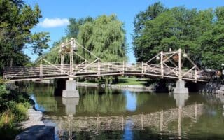
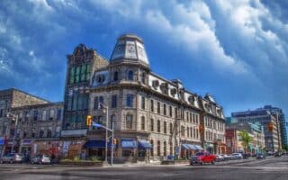
Iron Horse Trail. Paved multi-use path that overlaps with the area’s section of the Trans Canada runs for 5 km between Park Street in Waterloo (close to King St. & downtown), and Ottawa Street in Kitchener. Combination of woods, open spaces, residential areas. Key sights along the way, starting in Waterloo: Kaufman Park, Woodside Park, Highland Courts Park, Victoria Park, Raddatz Park, and the Transit Hub Trail through Cherry Park. Can combine with our Victoria Park route. BONUS: Lit at night!
Add-On: The Laurel Trail (below) runs just north of the Iron Horse Trail.
Spur Line Trail. CC: Julius177
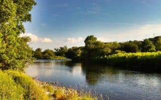
Laurel Trail. Paved 5 km multi-use path connecting key points in Waterloo. From downtown, the trail runs northwest for 3 km, through Waterloo Park, skirting the eastern side of the University of Waterloo, to the Research & Technology light rail station. Or, run for 2 km northeast along Lautel Creek to Marshall St.
Add-On: The Spur Line Trail connects to the Laurel Trail in uptown Waterloo and runs for 2.4 km to just north of downtown Kitchener, near the train station.
The Iron Horse/Trans-Canada and Laurel trails are two centrally located multi-use trails connecting Kitchener and Waterloo, as well as key sites and numerous parks. These flat, paved trails are also connectors to other area trails and can be combined for a longer run. Note:these trails are maintained in winter.
Iron Horse Trail. Paved multi-use path that overlaps with the area’s section of the Trans Canada runs for 5 km between Park Street in Waterloo (close to King St. & downtown), and Ottawa Street in Kitchener. Combination of woods, open spaces, residential areas. Key sights along the way, starting in Waterloo: Kaufman Park, Woodside Park, Highland Courts Park, Victoria Park, Raddatz Park, and the Transit Hub Trail through Cherry Park. Can combine with our Victoria Park route. BONUS: Lit at night!
Add-On: The Laurel Trail (below) runs just north of the Iron Horse Trail.
Spur Line Trail. CC: Julius177
Laurel Trail. Paved 5 km multi-use path connecting key points in Waterloo. From downtown, the trail runs northwest for 3 km, through Waterloo Park, skirting the eastern side of the University of Waterloo, to the Research & Technology light rail station. Or, run for 2 km northeast along Lautel Creek to Marshall St.
Add-On: The Spur Line Trail connects to the Laurel Trail in uptown Waterloo and runs for 2.4 km to just north of downtown Kitchener, near the train station.
Scroll Down For Route Maps
Essentials
Laurel Trail: 5 km (3.1 miles) one-way; Spur Line Trail: 2.4 km one-way; Iron Horse Trail: 5 km (3.1 miles) one-way
Create your own route combining the paths around the University of Waterloo campus and the sizable Waterloo Park. This pleasant run is 6-7 km. For more, continue to the University of Waterloo Environmental Reserve & Laurel Creek Conservation Area.
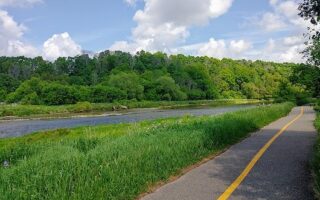
Combine the fields and green space of RIM Park with a 4 km jaunt along the Walter Bean multi-use trail along the Grand River. A pleasant 7.5 loop. For a longer run, connect to the Health Valley Trail off University Ave. adds up to 9 km out and back.
Some terrific trail running options just west of the University. Westside Trails feature 12 km of hilly terrain, and the adjacent GeoTime Trail is a unique 4 km interpretive trail loop illustrating major geological events.
Another pleasant multi-park route in Kitchener, anchored by the historic Victoria Park. A greenway links Victoria Park with several natural open spaces. The full route is 13 km, but can easily be shorter or longer.
A series of paths connect several adjacent parks in the Westmount & Laurentian Hills neighborhoods in South Kitchener, making for a pleasant 'linear park' run. Includes Lakeside Park, Concordia Park, Laurentian Park, and McLennan Park.
A terrific network of multi-use paths for running along the Grand River and Speed River in Cambridge, located 25 km southwest of Kitchener-Waterloo. Includes 5 km along the Grand in central Cambridge, and up to 18 km on the Cambridge to Paris Rail Trail.
A popular visitor destination, known for its Theater Festival. The signature running route is along the Avon River and around Queen's Park. There's also decent running on the area's residential streets and extensive farm roads just outside town.
Great running options in "The Royal City", including paths along the Speed & Eramosa Rivers, wonderful parks, the campus of the University of Guelph and adjacent 400-acre Arboretum with its 12.5 km of trails.
Share your feedback on this route and see that of other Great Runs users. Click on the image icon to upload a photo. And please let us know if there are notes or changes we should incorporate!
Subscribe
0 Comments
Oldest
Newest
Inline Feedbacks
View all comments
Essentials
Laurel Trail: 5 km (3.1 miles) one-way; Spur Line Trail: 2.4 km one-way; Iron Horse Trail: 5 km (3.1 miles) one-way


Review or Comment on This Route/Share a Photo!
Share your feedback on this route and see that of other Great Runs users. Click on the image icon to upload a photo. And please let us know if there are notes or changes we should incorporate!