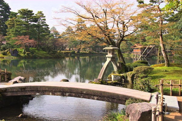
This run hits some of the scenic & historic highlights of Kanazawa, including the famous Kanazawa Castle and adjacent Kenroku-en garden. We’ve mapped a 5 km route, to be used as a guideline, as there are numerous paths in these areas. This is particularly gorgeous in cherry blossom season and in fall colors.
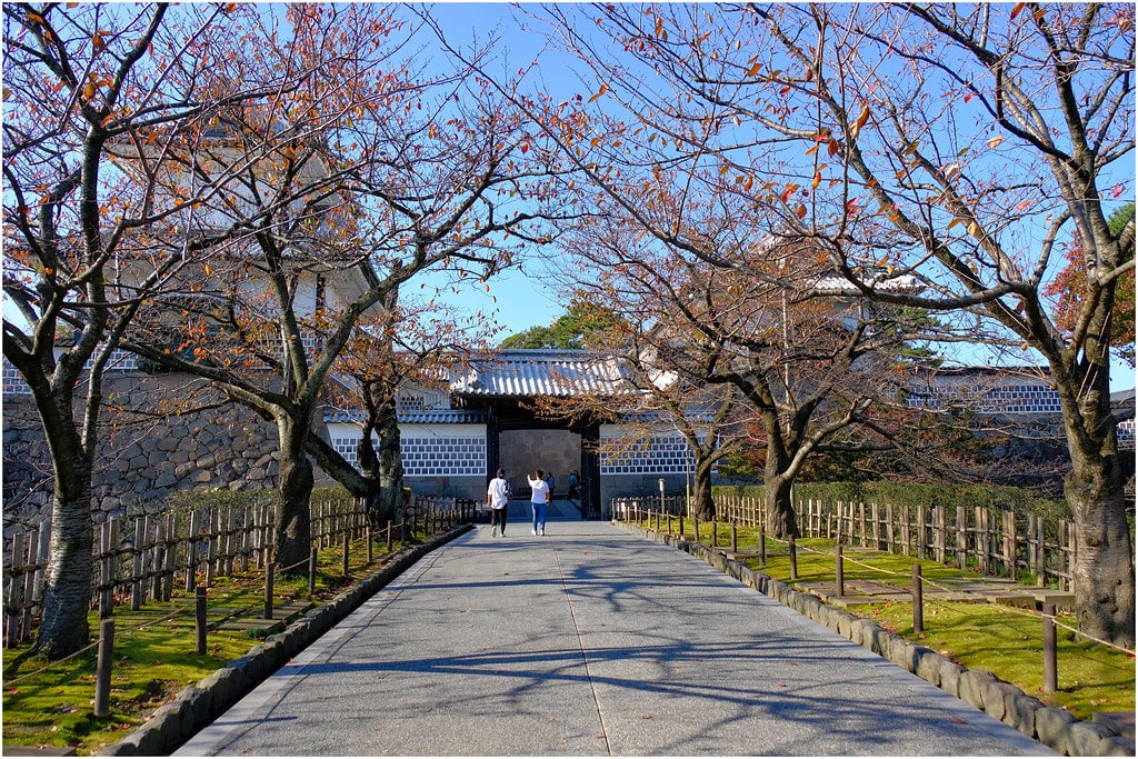
Castle grounds. Flickr: Geoff Whalan
Start 1 km through the paths of Hirosaka Park, near the modern art museum. Exit the south end, crossing the moat into the Kanazawa Castle Park grounds. There are numerous paths around the grounds of this restored 16th-century castle, and some good hills! A loop is ~2 km. Exit the southeast end into Kenroku-en garden, considered one of only three ‘perfect gardens’ in Japan. It’s beautifully landscaped, enjoyable in any season. We’ve mapped a ~1.3 km loop around the perimeter, but you can also use this 1.3 k interpretive walking tour map. Exit the northwest end of the gardens, loop around the 21st Century Museum of Contemporary Art, and back through Hirosaka Park to complete the route.
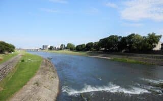
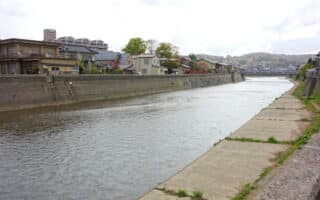
Longer Run: It’s 0.5 km to our Sai River route, with 9 km of paved paths on both sides of the river.
Notes & Tips: See information for hours and fees. Castle grounds are free. Admission is free during ‘early hours’ to Kenroku-en, where it might be OK for running. Use respect and discretion. Castle Information. Garden Information.
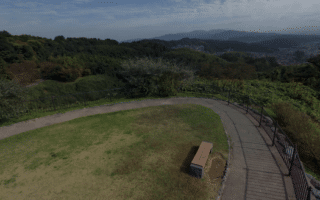
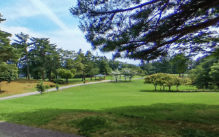
This run hits some of the scenic & historic highlights of Kanazawa, including the famous Kanazawa Castle and adjacent Kenroku-en garden. We’ve mapped a 5 km route, to be used as a guideline, as there are numerous paths in these areas. This is particularly gorgeous in cherry blossom season and in fall colors.
Castle grounds. Flickr: Geoff Whalan
Start 1 km through the paths of Hirosaka Park, near the modern art museum. Exit the south end, crossing the moat into the Kanazawa Castle Park grounds. There are numerous paths around the grounds of this restored 16th-century castle, and some good hills! A loop is ~2 km. Exit the southeast end into Kenroku-en garden, considered one of only three ‘perfect gardens’ in Japan. It’s beautifully landscaped, enjoyable in any season. We’ve mapped a ~1.3 km loop around the perimeter, but you can also use this 1.3 k interpretive walking tour map. Exit the northwest end of the gardens, loop around the 21st Century Museum of Contemporary Art, and back through Hirosaka Park to complete the route.
Longer Run: It’s 0.5 km to our Sai River route, with 9 km of paved paths on both sides of the river.
Notes & Tips: See information for hours and fees. Castle grounds are free. Admission is free during ‘early hours’ to Kenroku-en, where it might be OK for running. Use respect and discretion. Castle Information. Garden Information.
A seaside path in Hakusan, which neighbors Kanazawa. The concrete path runs for up to 10 km, from Matto Seaside Park south to Mikawa, paralleling the E8. Some nice views of the Sea of Japan. Additional paths in Matto Seaside Park.
A nice run in the waterfront section of Kanazawa. A concrete seaside path runs from Kenmin Seaside Park south for 5 km, which can be combined with interior park paths for a nice loop. Extend our Hakusan route, with 10+ km of seaside path & Matto Seaside Park.
9 km of paved multi-use paths along the Sai River are among the best places for a longer, easier off-road run in central Kanazawa. Water views, parks, numerous bridges allowing for loops, and a running track at Seibu Ryokuchi Park.
Concrete paths along the Asano River, in the Kazuemachi Chaya & Higashi Chaya districts, known for their teahouses and restored 18th-century wooden houses. Up to 5.6 km between the Asanogawa Bridge & Tagamihonmachi Asagiri Park.
For a hill challenge, run/hike to the 141m Utatsuyama Mountain summit, which is surrounded by a lovely wooded park. Use the road for a longer route, or the shorter, more rugged paths, which include lots of stairs. Hydrangea & iris garden half way up.
Park in the Wakamatsumachi area, built on the site of a former golf course. Nice spot for a run, with 3-4 km of paths, some more open & others more wooded.
Share your feedback on this route and see that of other Great Runs users. Click on the image icon to upload a photo. And please let us know if there are notes or changes we should incorporate!


Review or Comment on This Route/Share a Photo!
Share your feedback on this route and see that of other Great Runs users. Click on the image icon to upload a photo. And please let us know if there are notes or changes we should incorporate!