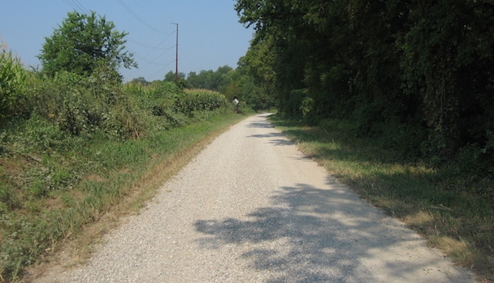
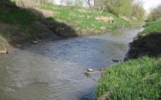
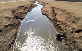
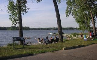
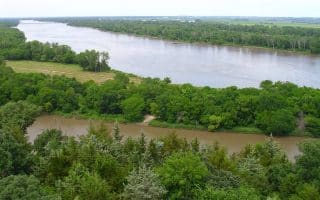
Just across the river in Council Bluffs, Iowa, the Wabash Trace Trail is a flat limestone trail that runs over 60 miles all the way to the Missouri border. For runners coming from the Omaha/Council Bluffs side of the trail, the best starting point is the Iowa West Foundation Trailhead Park, at the intersection of Wabash Ave and South Omaha Bridge in southeast Council Bluffs. (The easiest way to arrive here from Omaha is Route 80). From the trailhead to Mineola is about 9.6 miles, but feel free to turn around sooner if that’s too long for an out and back. The Wabash is a good option for running on a softer surface, since many of the long bike paths around Omaha are cement.
Features:
Scroll Down For Route Maps
Essentials
- 9.6 miles one-way (with shorter and longer options)
- 449 feet
- Iowa West Foundation Trailhead Park
- South Omaha Bridge Road
Current Weather & Forecast

Omaha, US
8:44 am,
Jul 8, 2026
L: 24°
H: 26°
Daily ForecastHourly Forecast
Today
4:00 pm
24° / 26°°C
0 mm
0%
12 mph
63 %
1019 mb
0 mm/h
Tomorrow
4:00 pm
16° / 32°°C
0 mm
0%
11 mph
79 %
1019 mb
0 mm/h
Friday
4:00 pm
19° / 32°°C
0 mm
0%
13 mph
72 %
1017 mb
0 mm/h
Saturday
4:00 pm
19° / 34°°C
0 mm
0%
16 mph
68 %
1019 mb
0 mm/h
Sunday
4:00 pm
18° / 32°°C
0 mm
0%
17 mph
76 %
1022 mb
0 mm/h
Today
10:00 am
27° / 30°°C
0 mm
0%
12 mph
59 %
1018 mb
0 mm/h
Today
1:00 pm
21° / 27°°C
0 mm
0%
11 mph
55 %
1018 mb
0 mm/h
Today
4:00 pm
19° / 23°°C
0 mm
0%
7 mph
63 %
1019 mb
0 mm/h
Today
7:00 pm
17° / 17°°C
0 mm
0%
5 mph
74 %
1019 mb
0 mm/h
Today
10:00 pm
16° / 16°°C
0 mm
0%
4 mph
79 %
1018 mb
0 mm/h
Tomorrow
1:00 am
18° / 18°°C
0 mm
0%
6 mph
67 %
1019 mb
0 mm/h
Tomorrow
4:00 am
26° / 26°°C
0 mm
0%
6 mph
44 %
1018 mb
0 mm/h
Other Routes in Omaha, NE

At 25 miles, the cement paved Keystone Trail is one of the longest and most popular paths in the Omaha area. It runs along Papillion Creek until joining with the Bellevue Loop Trail near the Missouri River.

One of the most scenic and enjoyable runs in Omaha, featuring the fountains of Heartland of America Park, views of the Missouri River, and the Bob Kerrey Pedestrian Bridge -- the longest footbridge connecting two states!
Zorinsky Lake, in the west of Omaha, has a 7.4 mile paved route circling the lake. This route can also be shortened to 4.5 miles by crossing over the 168th Street Bridge.
Standing Bear Lake, 10 miles northwest of the city center, is home to a 5 mile concrete path wrapping around the reservoir.
Chalco Hills Recreation Area is one of the top spots in Omaha for athletics and wildlife viewing. There are 7 miles of trails, including a 5.7 mile dirt and paved path around Wehrspann Lake. One of the better spots in the area for hill work.
Bordering the Big Papillion Creek for nearly 10 miles, the Big Papio Trail starts in Hefflinger Park and runs south to Seymour Smith Park where it connects with the Keystone Trail.
The 13.25 mile West Papio Trail, which runs from Huntington Park to Papillion, is considered one of the most scenic running routes in Omaha.
This large reservoir in north central Omaha has numerous dirt and asphalt paths. Our route covers the 6.7 mile trajectory of the Feast and Feathers Thanksgiving race.
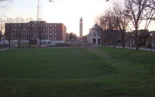
A great 5 mile run, meandering through Memorial park and the Omaha Rose Garden, Elmwood Park, and the University of Nebraska campus (north and south). Enjoy this trail on its own or as an add-on to the Keystone Trail.
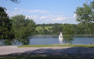
Another gem of nearby Council Bluffs, Iowa, Lake Manawa is a large property of the Iowa Department of Natural Resources with several miles of asphalt trail for biking and running. The Lake Manawa bike path is 6 miles one way.
South Bend, a town bordering the Platte River just south of Omaha, has numerous great running spots: the 15-mile MoPac Trail, and trail running in Platte River State Park, & Schramm Park State Recreation Area.
User Ratings
Leave A Review or Comment
Review or Comment on This Route/Share a Photo!
Share your feedback on this route and see that of other Great Runs users. Click on the image icon to upload a photo. And please let us know if there are notes or changes we should incorporate!