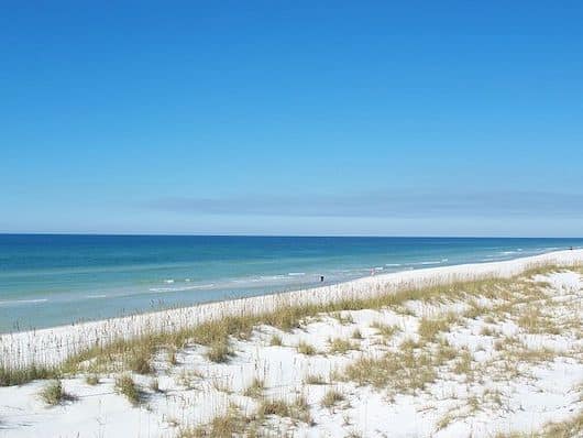
This area is 35 miles west of Panama City, offering some wonderful beach running around St. Joe Beach and miles of undeveloped beaches and dunes around the St. Joseph Peninsula.
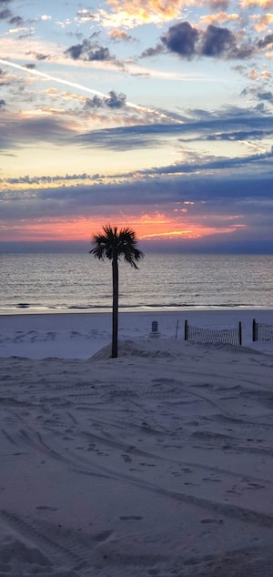
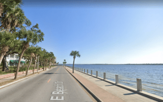
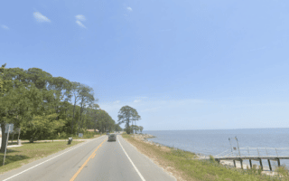
St. Joe Beach. A nice 5-mile stretch of beach is from St. Joe Beach west to Mexico Beach. This section of SR 98 has a decent shoulder and views to the beach/water a good part of the way. Headed east from St. Joe Beach, there’s a paved pedestrian path that runs for 2.5 miles along Windmark Public Beach between the public access point and Bella Beach House.
Aurélie Vilmer
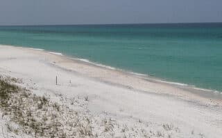
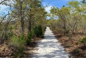
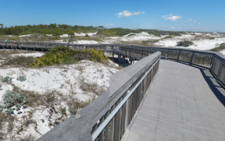
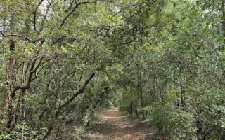
Cap San Blas. Probably the most beautiful section of beach in the area. Heading west from Cap San Blas, one can run for nearly 15 miles along a wide, undeveloped beach with beautiful dunes to the end of the peninsula. T.H. Stone Memorial St. Joseph Peninsula State Park also features a 1/2 mile maritime forest nature trail. As an alternative to the beach, the 30E road, while a bit inland, has a nice pedestrian path for 9 miles to the end, and then a sand path continues for 6 miles to the end of the peninsula. NOTE: Hurricane Michael in 2018 caused significant damage and there are still some breaches. See the park web site for more info.
You can also head east of Cap San Blas for 8 miles to the break.
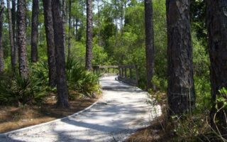
St. George Island. More miles of beach running on this barrier island. Access from Eastpoint using the Bryant Patton Bridge. No high-rises, uncrowded. At the eastern end is St. George Island State Park, which has several miles of low trafficked roads to run on, 2.5 miles of nature trails, and nine miles of excellent beach running. Information & Map
This area is 35 miles west of Panama City, offering some wonderful beach running around St. Joe Beach and miles of undeveloped beaches and dunes around the St. Joseph Peninsula.
St. Joe Beach. A nice 5-mile stretch of beach is from St. Joe Beach west to Mexico Beach. This section of SR 98 has a decent shoulder and views to the beach/water a good part of the way. Headed east from St. Joe Beach, there’s a paved pedestrian path that runs for 2.5 miles along Windmark Public Beach between the public access point and Bella Beach House.
Aurélie Vilmer
Cap San Blas. Probably the most beautiful section of beach in the area. Heading west from Cap San Blas, one can run for nearly 15 miles along a wide, undeveloped beach with beautiful dunes to the end of the peninsula. T.H. Stone Memorial St. Joseph Peninsula State Park also features a 1/2 mile maritime forest nature trail. As an alternative to the beach, the 30E road, while a bit inland, has a nice pedestrian path for 9 miles to the end, and then a sand path continues for 6 miles to the end of the peninsula. NOTE: Hurricane Michael in 2018 caused significant damage and there are still some breaches. See the park web site for more info.
You can also head east of Cap San Blas for 8 miles to the break.
St. George Island. More miles of beach running on this barrier island. Access from Eastpoint using the Bryant Patton Bridge. No high-rises, uncrowded. At the eastern end is St. George Island State Park, which has several miles of low trafficked roads to run on, 2.5 miles of nature trails, and nine miles of excellent beach running. Information & Map
Scroll Down For Route Maps
Essentials
St. Joe Beach to Mexico Beach is 5 miles; Cap San Blas west to the end of the peninsula is 15 miles, or east to the break is 8 miles
Some 40+ miles of wide, nearly continuous beach featuring firm, compact sand near the water that's good for running. Easternmost point is St. Andrews State Park, westernmost is Destin East Jetty, passing numerous beaches and parks.
Near downtown Panama City, it's possible to stitch together a pleasant run on waterside roads with sidewalks, with views to Saint Andrew Bay and East Bay. Full loop is up to 10 miles, including Bunkers Cove. Some pretty residential streets as well.
The best opportunity for off-road running near Panama City. Conservation Park has 24 miles of trails and 1 mile of boardwalks through wetlands and pine forest. Can connect to Gayle's Trails, a continually developing network of multi-use paths.
One of the longest, seamless waterfront running opportunities in northwest Florida. Located in Eastpoint, just across the causeway from Apalachicola, Highway 96/30 goes east along the water for 8 miles. Good shoulder and great views of Saint George Sound.
A 15,000-acre preserve In the Santa Rosa Beach/Grayton Beach area, with 27 miles of trails through a pine forest. There are marked loops of several distances, with mile markets. Flat, compact sand surface. Good shade option.
One of our favorite spots in the area for running. The 1,640-acre park features a variety of habitats and terrain: pristine beaches, freshwater coastal dune lakes, old-growth long-leaf pine forests, and wetlands. Numerous trail and route options.
Located near Elgin Air Force Base, this area features several miles of mainly forested, shaded trails. It's easy to moderate trail running, and popular with mountain bikers too. We've mapped 5k and 11k loops.
For a longer off-road run in the area, the Timpoochee Trail is a good option. The paved multi-use path runs for 19 miles along Highway 30A between Santa Rosa and Rosemary Beach. Not all that scenic.
Share your feedback on this route and see that of other Great Runs users. Click on the image icon to upload a photo. And please let us know if there are notes or changes we should incorporate!
Subscribe
0 Comments
Oldest
Newest
Inline Feedbacks
View all comments
Essentials
St. Joe Beach to Mexico Beach is 5 miles; Cap San Blas west to the end of the peninsula is 15 miles, or east to the break is 8 miles
 St. Joe Beach. A nice 5-mile stretch of beach is from St. Joe Beach west to Mexico Beach. This section of SR 98 has a decent shoulder and views to the beach/water a good part of the way. Headed east from St. Joe Beach, there’s a paved pedestrian path that runs for 2.5 miles along Windmark Public Beach between the public access point and Bella Beach House.
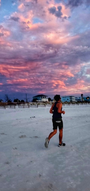

Review or Comment on This Route/Share a Photo!
Share your feedback on this route and see that of other Great Runs users. Click on the image icon to upload a photo. And please let us know if there are notes or changes we should incorporate!