In addition to the Ravine Trail and the Don Valley trails, there are some nice parks and multi-use trails for running in North York. Here are some recommendations for running in the area between Highways 401 & 407.
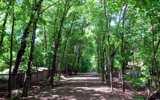
Upper Don Trail. Also called the Betty Sutherland Trail, this path runs for 5.4 km between Betty Sutherland Park and just north of Finch Ave E. The paved, flat, mainly wooded path follows the Don River. At the northern end, you can connect to the North York Bike Trail/Finch Hydro Corridor Trail (see below). Accessible from the Old Cummer Go Station. ROUTE MAP
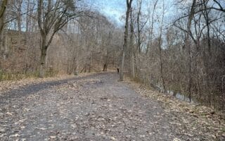
North York Bike Trail/Finch Hydro Corridor Trail. This paved multi-use path runs east-west across North York for 15 km, connecting several parks, additional trails, and the campus of York University. The eastern end starts as the North York Bike Trail, at the intersection with the Upper Don Trail (see above). Being a ‘hydro corridor’, there are large hydro towers a good part of the way. Distance options, east-west (cumulative): ROUTE MAP
2 km. Maxone Mark. These first 2 km are a gradual uphill, headed east
4 km. Hendon Park. Trail turns into the Finch Hydro Corridor Recreational Trail
7 km. G Ross Lord Park (nice running here on additional trails, see below)
11 km. Just south of York University campus (TTC: Finch Station). Head just north to run paths at York and a running track at Steeles Ave.
12.9 km. Connect to trail heading north to Black Creek Parkland
15 km. West end of trail at Norfinch Dr.
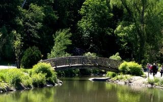
G Ross Lord Park. This is a pleasant park, with numerous trails and a reservoir. There’s a popular perimeter trail that loops for ~5 km around the park. For more, connect to: some of the additional trails; the Finch Hydro Corridor Recreational Trail headed east or west; and the trail headed north through the West Don Valley Open Space for ~ 3 km to Marita Payne Park. ROUTE MAP: PARK PERIMETER
York campus. Flickr: Jose San Juan
Area Around York University. There’s some nice running in the area of this large public research university. There are decent pedestrian paths around the campus, the heart of which is between Keele St. & Highway 400 east-west and Steeles Ave. to Finch Ave. north-south. There’s a running track at the north end off Steeles Ave. Additional options in this area:
York University Busway/Finch Hydro Corridor Recreational Trail. This paved multi-use trail runs east-west across for 15 km across North York. Catch it south of campus, just north of Finch. It’s 2 km east to G Ross Lord Park, where there are additional trails.
Parkland Trails. Just west of Sentinel Rd., there are some pleasant wooded trails running north through the Black Creek Parkland or south to Derrydowns Park/Northwood Park (note: not 100% seamless)
In addition to the Ravine Trail and the Don Valley trails, there are some nice parks and multi-use trails for running in North York. Here are some recommendations for running in the area between Highways 401 & 407.
Upper Don Trail. Also called the Betty Sutherland Trail, this path runs for 5.4 km between Betty Sutherland Park and just north of Finch Ave E. The paved, flat, mainly wooded path follows the Don River. At the northern end, you can connect to the North York Bike Trail/Finch Hydro Corridor Trail (see below). Accessible from the Old Cummer Go Station. ROUTE MAP
North York Bike Trail/Finch Hydro Corridor Trail. This paved multi-use path runs east-west across North York for 15 km, connecting several parks, additional trails, and the campus of York University. The eastern end starts as the North York Bike Trail, at the intersection with the Upper Don Trail (see above). Being a ‘hydro corridor’, there are large hydro towers a good part of the way. Distance options, east-west (cumulative): ROUTE MAP
2 km. Maxone Mark. These first 2 km are a gradual uphill, headed east
4 km. Hendon Park. Trail turns into the Finch Hydro Corridor Recreational Trail
7 km. G Ross Lord Park (nice running here on additional trails, see below)
11 km. Just south of York University campus (TTC: Finch Station). Head just north to run paths at York and a running track at Steeles Ave.
12.9 km. Connect to trail heading north to Black Creek Parkland
15 km. West end of trail at Norfinch Dr.
G Ross Lord Park. This is a pleasant park, with numerous trails and a reservoir. There’s a popular perimeter trail that loops for ~5 km around the park. For more, connect to: some of the additional trails; the Finch Hydro Corridor Recreational Trail headed east or west; and the trail headed north through the West Don Valley Open Space for ~ 3 km to Marita Payne Park. ROUTE MAP: PARK PERIMETER
York campus. Flickr: Jose San Juan
Area Around York University. There’s some nice running in the area of this large public research university. There are decent pedestrian paths around the campus, the heart of which is between Keele St. & Highway 400 east-west and Steeles Ave. to Finch Ave. north-south. There’s a running track at the north end off Steeles Ave. Additional options in this area:
York University Busway/Finch Hydro Corridor Recreational Trail. This paved multi-use trail runs east-west across for 15 km across North York. Catch it south of campus, just north of Finch. It’s 2 km east to G Ross Lord Park, where there are additional trails.
Parkland Trails. Just west of Sentinel Rd., there are some pleasant wooded trails running north through the Black Creek Parkland or south to Derrydowns Park/Northwood Park (note: not 100% seamless)
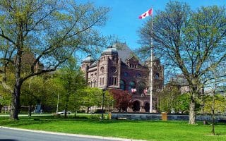
A 5-mile tour of downtown Toronto landmarks. Start at City Hall, and run by The Royal Ontario Museum, Queen’s Park, the Art Gallery of Ontario, and the University of Toronto.
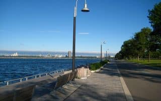
The signature running trail along the Lake Ontario waterfront in Toronto. A great run from downtown is from Queen’s Quay to the Humber River Bridge, about 5 miles.
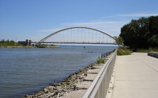
Some great waterfront running 4.5 miles west of Queen’s Quay, bordering Etobicoke. Includes Humber Bay Shores Park, Humber Bay Park East and West, and Mimico Waterfront Park, then looping back to the bridge.
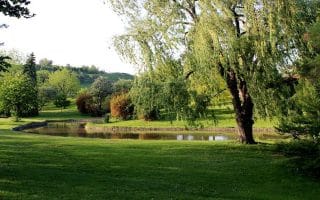
A wonderful 400 acre park just north of the lakeshore and Sunnyside Beach. There are lovely gardens, little bridges, ponds, and waterfalls, and some more secluded trails.
A linear park running about 8 miles through the northeast part of the city, connecting the neighborhoods of Rosedale, Moore Park, Forest Hill, Chaplin Estates, and Fairbank. The trail consists of three sections.
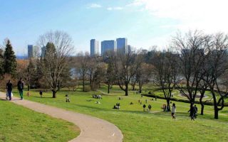
A popular area to visit in Toronto. A series of parks and trails provide a nearly 15 km run from the Botanical Gardens in the north to the Lakeshore in the south. Numerous connections to other parks and trails.
A series of trails running through a ravine in North Toronto, connecting Sunnybrook Park with the Alexander Muir Memorial Gardens in the west. Mainly wooded, and even some hill opportunities! Can connect to our Edwards Gardens/Lower Don route.
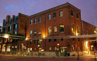
This is a good option slightly east of downtown. Enjoy a quick jaunt through the Distillery Historic District (fun shops, restaurants), and join the Lower Don River Trail in the aptly named Corktown Commons.
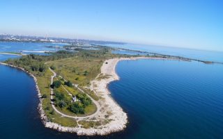
A fun residential community near the water about 3 miles east of downtown. There are some good running options here, including the Woodbine Beach Boardwalk, and the “Spit” out to the lighthouse.
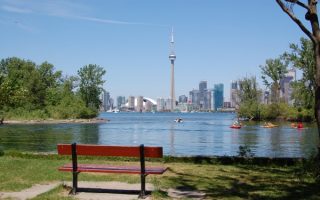
A 15 minute ferry ride from downtown, the ‘Island’ is a great destination for runners, with numerous trail options. There are beaches, picnic grounds, a lighthouse, a disc golf course, gardens, and great views of the Toronto skyline.
This western suburb near Pearson Airport has some excellent running options, including several longer, linear park trails. Highlights include the Etobicoke Creek Trail, West Deane Park Path, trails along the Humber River, Centennial Park, and Humber Bay Park.
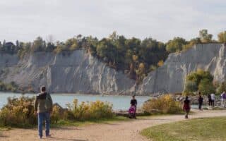
The iconic run in Scarborough is the waterfront path at Scarborough Bluffs, with great views of the cliffs and the waterfront. There's also a 10 km waterfront path between East Point Park and Frenchman's Bay. Trail runners will love Rouge River Park.
Enjoy a trail run in the largest urban park in North America! There are many km of trails, with options for all abilities. Combination of meadows, forests, wetlands and farmland, with some views of the Rouge and Little Rouge rivers.
Share your feedback on this route and see that of other Great Runs users. Click on the image icon to upload a photo. And please let us know if there are notes or changes we should incorporate!


Review or Comment on This Route/Share a Photo!
Share your feedback on this route and see that of other Great Runs users. Click on the image icon to upload a photo. And please let us know if there are notes or changes we should incorporate!