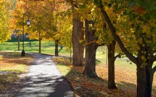
The town of Concord, located 20 miles west of Boston is an important historic spot and popular visitor destination — known for its American Revolutionary War sites, Emerson’s Old Manse, Alcott’s Orchard House, and more. There are some wonderful opportunities for scenic runs while enjoying this history — plus some terrific additional trails.
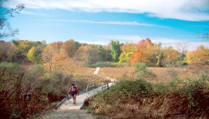
Battle Road Trail. 4.6 miles one-way, 290 foot gain. This is the iconic run in Concord. This 5 mile crushed stone trail connects historic sites from Meriam’s Corner in Concord to Fiske Hill in Lexington. The main theme of the trail is the Battle of April 19, 1775 that launched the American Revolution. Much of the trail follows original remnants of the Battle Road; other sections leave the historic road to follow the route of the Minute Men, traversing farming fields, wetlands, and forests. This park map shows the major sites along the way. Note: Not Maintained in Winter.
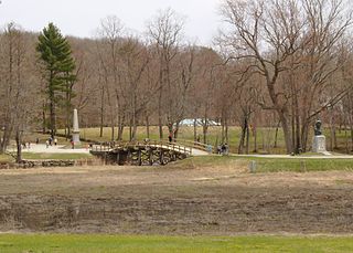
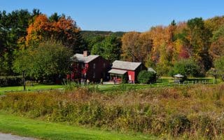
Old North Bridge. Public Domain.
Old North Bridge and Historic Concord Center. 5.1 miles, 241 foot gain. This is a fantastic 5-mile run combining the Old North Bridge, site of the ‘Shot Heard Round the World’, and the historic sites of Concord’s famous authors. Start at the rotary in Concord Center, and run east along Lexington Rd. for 0.7 miles to Wayside, passing Emerson’s home. At Wayside, take in Alcott House and two short, hilly loops off Lexington Rd. to Revolutionary Ridge and Author’s Ridge. Retrace your steps to Concord Center and turn RIGHT on Monument St. Run for 0.7 miles to the Old Manse, location of the Old North Bridge. Run the historic bridge and hill — it’s very scenic — to the North Bridge Visitor Center (there are some additional trails here), then LEFT on Liberty St., and LEFT on Lowell Rd., crossing the Concord River, returning to Concord Center. ROUTE MAP
Note: Can be combined with Battle Road Trail. It’s 1.4 miles from Concord Center to Merriam’s Corner.
Reformatory Branch Trail & Great Meadows National Wildlife Refuge. Loop is 5.2 miles, 158 foot gain. A scenic off-road run. The Reformatory Branch Trail is a wide, gravel-surfaced wooded path that starts 0.4 km from Concord Center off Monument St. and runs for 4.2 miles east to Bedford, where there are connections to the Minuteman Bikeway (paved multi-use trail that runs for 10 miles to Alewife MBTA Station. Another great option is to run a loop incorporating Great Meadows National Wildlife Refuge. Run for 1.4 miles east on the Reformatory Branch Trail, and getting off the trail to run a 1.8 mile loop around the refuge on the Dike Trail, with scenic views out to the wetlands. Return by taking the Dike Trail along the Concord River and then Great Meadows Rd. (ignore the ‘private’ signs). ROUTE MAP: Loop Including NWR.
The town of Concord, located 20 miles west of Boston is an important historic spot and popular visitor destination — known for its American Revolutionary War sites, Emerson’s Old Manse, Alcott’s Orchard House, and more. There are some wonderful opportunities for scenic runs while enjoying this history — plus some terrific additional trails.
Battle Road Trail. 4.6 miles one-way, 290 foot gain. This is the iconic run in Concord. This 5 mile crushed stone trail connects historic sites from Meriam’s Corner in Concord to Fiske Hill in Lexington. The main theme of the trail is the Battle of April 19, 1775 that launched the American Revolution. Much of the trail follows original remnants of the Battle Road; other sections leave the historic road to follow the route of the Minute Men, traversing farming fields, wetlands, and forests. This park map shows the major sites along the way. Note: Not Maintained in Winter.
Old North Bridge. Public Domain.
Old North Bridge and Historic Concord Center. 5.1 miles, 241 foot gain. This is a fantastic 5-mile run combining the Old North Bridge, site of the ‘Shot Heard Round the World’, and the historic sites of Concord’s famous authors. Start at the rotary in Concord Center, and run east along Lexington Rd. for 0.7 miles to Wayside, passing Emerson’s home. At Wayside, take in Alcott House and two short, hilly loops off Lexington Rd. to Revolutionary Ridge and Author’s Ridge. Retrace your steps to Concord Center and turn RIGHT on Monument St. Run for 0.7 miles to the Old Manse, location of the Old North Bridge. Run the historic bridge and hill — it’s very scenic — to the North Bridge Visitor Center (there are some additional trails here), then LEFT on Liberty St., and LEFT on Lowell Rd., crossing the Concord River, returning to Concord Center. ROUTE MAP
Note: Can be combined with Battle Road Trail. It’s 1.4 miles from Concord Center to Merriam’s Corner.
Reformatory Branch Trail & Great Meadows National Wildlife Refuge. Loop is 5.2 miles, 158 foot gain. A scenic off-road run. The Reformatory Branch Trail is a wide, gravel-surfaced wooded path that starts 0.4 km from Concord Center off Monument St. and runs for 4.2 miles east to Bedford, where there are connections to the Minuteman Bikeway (paved multi-use trail that runs for 10 miles to Alewife MBTA Station. Another great option is to run a loop incorporating Great Meadows National Wildlife Refuge. Run for 1.4 miles east on the Reformatory Branch Trail, and getting off the trail to run a 1.8 mile loop around the refuge on the Dike Trail, with scenic views out to the wetlands. Return by taking the Dike Trail along the Concord River and then Great Meadows Rd. (ignore the ‘private’ signs). ROUTE MAP: Loop Including NWR.
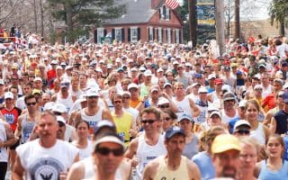
One of the most famous runs in the country. Run all the way from downtown to Newton! Sections on the Boston side and Cambridge side, with numerous bridges along the way, allowing for great loops.
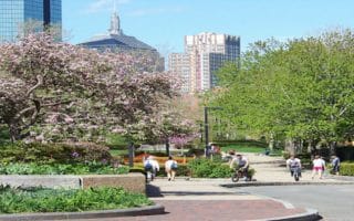
An Olmsted-designed linear park running 8 miles from the State House to Franklin Park. Highlights: Boston Common, Public Garden, Comm Ave. Mall, Fens, Riverway, Jamaica Pond, Arnold Arboretum, Franklin Park.
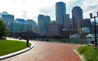
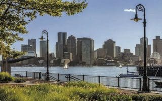
There are 43 miles of path known as the 'Harborwalk'. We've mapped the most scenic 14-mile continuous segment, from Charlestown to UMASSS. Water views, important sites, and a festive scene! Table with segment distances.
The 6-mile segment from Pleasure Bay to UMASS in South Boston is our favorite section of the Boston waterfront for running, with expansive water views. Includes Castle Island, Carson Beach, JFK Library, and UMASS Boston, with its dramatic waterfront setting!
In the 1980s, the old orange line trolley was put underground. The result is a beautiful running path that starts in the heart of Back Bay and continues all the way to Forest Hills, 4 miles one-way.
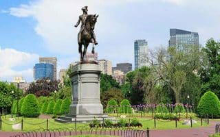
A great tour of Boston's Back Bay. Includes the Commonwealth Ave. Mall, Public Garden, State House, and a jaunt along the river. Captures so much of Boston in one run!
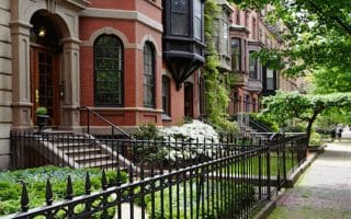
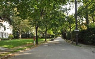
A tour of Boston's lovely South End, which is easily accessible from Back Bay or downtown hotels. Brownstone lined streets, pleasant, historic squares and parks, and main streets lined with restaurants and boutiques.
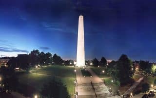
Another classic run that includes Boston's history and the water. Run up to the Bunker Hill Monument, and then enjoy the Harborwalk past the USS Constitution and along the water. Near downtown and river paths.
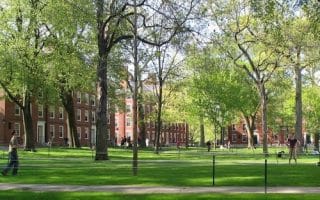
Two of the most famous universities in the world are also popular visitor destinations. We've designed a 'running' tour of both campuses, which are 2 miles apart and are linked by either neighborhood streets or the Charles River Paths.
Fabulous running across the Harbor in East Boston, adjacent to Logan Airport. 2+ miles of gorgeous waterfront paths, then 2+ miles along the East Boston Greenway through Bremen Street Park to Constitution Beach. 10 mins from downtown on the Blue Line.
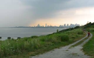
Great waterfront running on Winthrop Shores Drive, and then the best run you'll ever do around a waste treatment plant, using a 2.5 mile perimeter loop around Deer Isle with 360° ocean views. Do in sections or combine for nearly 8 miles.
Some lovely running options just north of Boston: Scenic, paved multi-use paths along the Mystic River; the ~11 mile Northern Strand Community Path from Everett to Lynn; and 100 miles of mixed-use trails in Middlesex Fells Reservation.
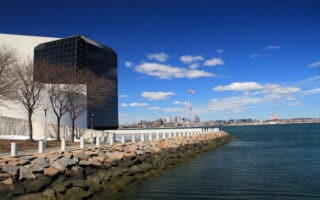
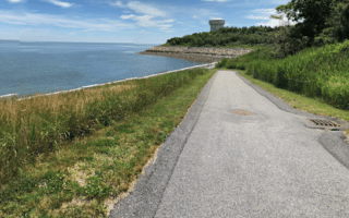
The Boston Harbor Islands National Park features 34 islands and 35 miles of undeveloped shoreline. Spectacle Island is the most run-able, with 5 miles of trails. Deer Island, accessible by land, has a 2.6 mile path with great views.
Wellesley is a fabulous suburb for running. Enjoy a route around the paths of Olmsted-designed Wellesley College and the 2.75 mile path around Lake Waban, plus adjacent residential streets and the Crosstown Path. Two great running tracks too!
A guide to some of Boston's most attractive neighborhoods for running. Downtown, explore the Back Bay and South end. Just west, we've outlined choice neighborhoods in Brookline, Newton, and Wellesley.
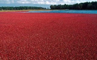
There is nothing quite like the views of cranberries at harvest. The Cranberry Bog has paths along a dike with great views. Enjoy this in combination with 1,000 acre Great Brook Farm State Park, which is 1.5 miles away and has wonderful trails for running.
Three routes in the orchard towns of Harvard, Stow, and Bolton west of Boston around I-495. Lovely roads, with hills and views to orchards and the valley. Enjoy 5 or 10 mile options from the Apple Harvest Ramble, or a route along the Assabet River Rail Trail.
Share your feedback on this route and see that of other Great Runs users. Click on the image icon to upload a photo. And please let us know if there are notes or changes we should incorporate!


Review or Comment on This Route/Share a Photo!
Share your feedback on this route and see that of other Great Runs users. Click on the image icon to upload a photo. And please let us know if there are notes or changes we should incorporate!