There are many km of paths along both the Wiesbaden and Mainz sides of the Rhine River. They’re a mix of paved and gravel, and there are some breaks. We’ve mapped some of the best sections, and also suggest some loop options using the more pedestrian-friendly bridges (Brücke): Theodor-Heuss-Brücke & Südbrücke.
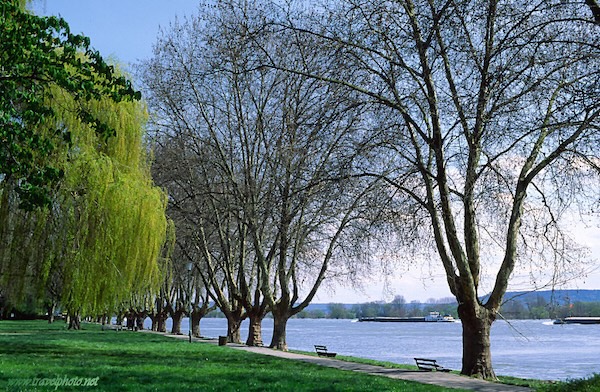
Wiesbaden Side — East Section. There are decent paths along the Rhine for 5.7 km between the Nordbrücke and Kostheimer bridges. It’s a mix of surfaces, and there are water views a good part of the way. A particularly nice section is along the edge of the peninsula reached by the Lachebrücke pedestrian bridge.
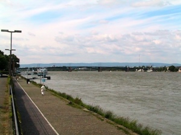
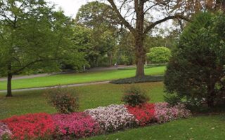
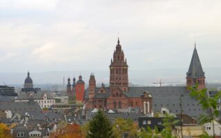
Mainz Side. There are some centrally located paths along the Rhine in Mainz, extending from just west of the Theodor Heuss Bridge east for 6 km to near Highway 60 (Weisenauer Bridge). Headed east, the first 3 km pass near the central historic part of Mainz, on paved multi-use paths with open views to the river. The easternmost 3 km are along more of a towpath. Just east of the Südbrücke, a nice detour/add-on is the lovely paths in Volkspark & Stadtpark.
- Loop Option: Best bet for a loop option is to use the Heuss Bridge & Südbrücke.
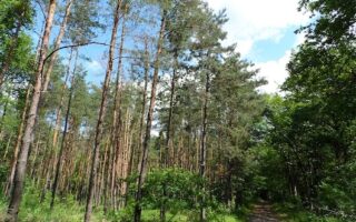
Wiesbaden Side — West Section. Just west of Wiesbaden, there’s 16 km of nearly seamless paths along the Rhine, between Walluf and Geisenheim. This is a popular cycle route, featuring nice views of the river. The first 4 km from Walluf to Eltville are among the more scenic, as the western sections of the path are near the busy #42 road. Ambitious runners can run one-way and take the train back — there are stations in Elrville, Erbacj, Hattenheim, Oestrich-Winkel, & Geisenheim.
There are many km of paths along both the Wiesbaden and Mainz sides of the Rhine River. They’re a mix of paved and gravel, and there are some breaks. We’ve mapped some of the best sections, and also suggest some loop options using the more pedestrian-friendly bridges (Brücke): Theodor-Heuss-Brücke & Südbrücke.
Wiesbaden Side — East Section. There are decent paths along the Rhine for 5.7 km between the Nordbrücke and Kostheimer bridges. It’s a mix of surfaces, and there are water views a good part of the way. A particularly nice section is along the edge of the peninsula reached by the Lachebrücke pedestrian bridge.
Mainz Side. There are some centrally located paths along the Rhine in Mainz, extending from just west of the Theodor Heuss Bridge east for 6 km to near Highway 60 (Weisenauer Bridge). Headed east, the first 3 km pass near the central historic part of Mainz, on paved multi-use paths with open views to the river. The easternmost 3 km are along more of a towpath. Just east of the Südbrücke, a nice detour/add-on is the lovely paths in Volkspark & Stadtpark.
- Loop Option: Best bet for a loop option is to use the Heuss Bridge & Südbrücke.
Wiesbaden Side — West Section. Just west of Wiesbaden, there’s 16 km of nearly seamless paths along the Rhine, between Walluf and Geisenheim. This is a popular cycle route, featuring nice views of the river. The first 4 km from Walluf to Eltville are among the more scenic, as the western sections of the path are near the busy #42 road. Ambitious runners can run one-way and take the train back — there are stations in Elrville, Erbacj, Hattenheim, Oestrich-Winkel, & Geisenheim.


Review or Comment on This Route/Share a Photo!
Share your feedback on this route and see that of other Great Runs users. Click on the image icon to upload a photo. And please let us know if there are notes or changes we should incorporate!