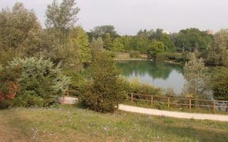
For some hills, views, and trail running, head 8 km southeast of Turin to the Parco della Rimembranza. This large park and gardens features more than 45 km of roads and paths. An arboretum and botanical gardens grace the Maddalena Hill, which climbs to 715m and is the highest point in Turin. At the summit, admire the lighthouse statue of the Winged Victory (Faro Della Vittoria), and great views of Turin and the surrounding alps.
We have not been able to find a good online map. The roads themselves are windy and narrow, with no shoulder. We recommend taking one of the trails to the summit. A path to the summit is a bit over 2 km, climbing 160m, with grades averaging 5% (but 12-13% over the 0.4 km nearest the summit). There are some windier, switchback type paths that make for a gentler ascent or run through the park. It’s mostly wooded. Good shade option for a hot day.
Wikimedia Commons
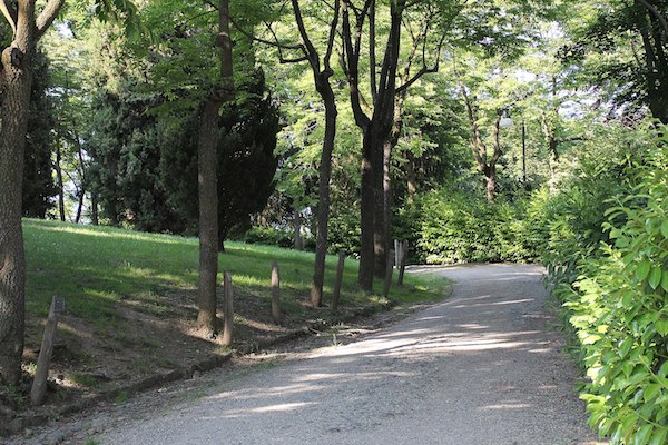
For some hills, views, and trail running, head 8 km southeast of Turin to the Parco della Rimembranza. This large park and gardens features more than 45 km of roads and paths. An arboretum and botanical gardens grace the Maddalena Hill, which climbs to 715m and is the highest point in Turin. At the summit, admire the lighthouse statue of the Winged Victory (Faro Della Vittoria), and great views of Turin and the surrounding alps.
We have not been able to find a good online map. The roads themselves are windy and narrow, with no shoulder. We recommend taking one of the trails to the summit. A path to the summit is a bit over 2 km, climbing 160m, with grades averaging 5% (but 12-13% over the 0.4 km nearest the summit). There are some windier, switchback type paths that make for a gentler ascent or run through the park. It’s mostly wooded. Good shade option for a hot day.
Essentials
45 km of roads and paths. Climb to the summit from the bus stop is 2.2 km, with 160m elevation gain and steep grades
HILLY!
Bus stop or in the park
Car helpful, but the #70 bus runs to near the foot of the park, Str. Maddalena (street). From there, walk/run into the poark
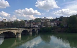
Scenic path along the Po River, with views of important Turin sites and the mountains in the distance. It's up to 9 km one-way from Parco del Valentino to the A4. Pass through numerous parks, including Parco Coletta, Parco della Confluenza.
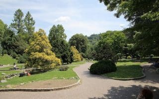
One of the signature running spots in Turin. There are paths along the river, and interior paths passing by Valentino Palace, numerous gardens and fountains, a recreated medieval town, sports fields, and museum. The park is 1.5 km from end-to-end.
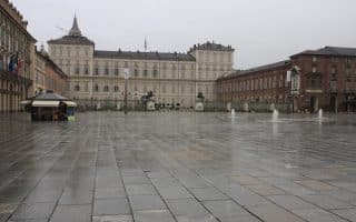
A 'runseeing' tour of some of Turin's highlights, attempting to minimize the twists and turns! Via Roma, passing numerous important sights, the Piazza Castello, Colletta Park, Po River paths, and the University. Options for shorter route & lots of variation.
A run through two parks and along the Dora river, with lots of options for variety. Parco Pellerina has ~4 km of lovely paths for running, with numerous sports facilities and lakes. Adjacent Parco Dora is more modern, with wide paths and an industrial look.
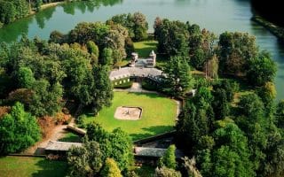
Gorgeous running in the second largest enclosed park in Europe! Create your own run on the beautifully landscaped grounds and paths around the baroque La Venaria Reale and Castello de La Mandria. Options for some wilder, more remote paths and small roads.
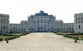
A verdant treat for running on the grounds of this former hunting lodge 10 km southwest of Turin. Anchored by the wide paths and grand gardens of the Palazzina, there straight shot roads/paths running through woodland and agricultural land, 5 km long and 4 km wide.
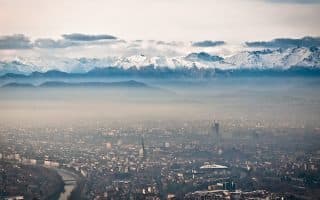
Wonderful views from this domed Basilica atop a 672m hill. Best bet for running is to take the cog railway to the summit, and run along the 'Panoramica' for a fairly flat 3 km to Monte Aman. The other trails are steeper and more challenging trail running.
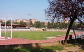
A 5-miler incorporating two 'athletically-oriented' parks. Ruffini Park has tree-lined walking paths and an outdoor running track. Then run 2.5 km to the large Cavalieri di Vittorio Veneto Park, site of 1933 Olympic Stadium, a running track, fields, and paths.
Share your feedback on this route and see that of other Great Runs users. Click on the image icon to upload a photo. And please let us know if there are notes or changes we should incorporate!
Subscribe
0 Comments
Oldest
Newest
Inline Feedbacks
View all comments
Essentials
45 km of roads and paths. Climb to the summit from the bus stop is 2.2 km, with 160m elevation gain and steep grades
HILLY!
Bus stop or in the park
Car helpful, but the #70 bus runs to near the foot of the park, Str. Maddalena (street). From there, walk/run into the poark

Review or Comment on This Route/Share a Photo!
Share your feedback on this route and see that of other Great Runs users. Click on the image icon to upload a photo. And please let us know if there are notes or changes we should incorporate!