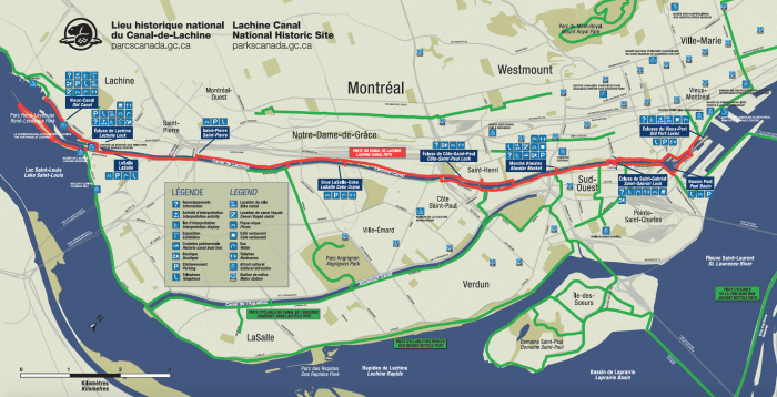
A national historic site, the Lachine Canal is a lovely linear park, following the historic canal and its series of locks. The site has a large network of paths along the Lachine Canal, the Canal Aqueduct, and the Lachine Rapids. We’ve mapped a few options. (Note: Some sections maintained in winter).
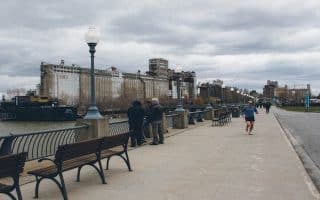
Lachine Canal Paths (red line on this trail map). There are paths headed west toward Parc René-Lévesque in Lachine and east toward downtown and Old Montreal/Old Port, where the canal spills into the St. Lawrence River. Here are options:
‘Downtown Section’: Atwater East to Clock Tower (km/mi)
1.2/0.75: Parc de Seigneurs (join our Old Montreal/Old Port route)
2.5/1.5: Peel Basin (end of red line path on trail map)
5.2/3.2: Extension to Clock Tower/Clock Basin, Old Montreal
Heading West from Atwater
2.0/1.2: Parc Gadbois
4.2/2.6: LaSalle/Coke Crane Station
7.3/4.5: Dollard Ave.
9.1/5.6: Parc des Écluses/Lachine Lock/Musée de Lachine
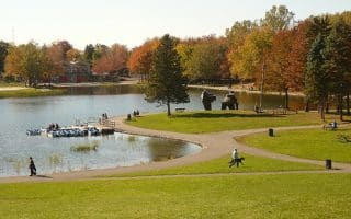
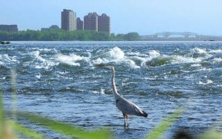
At the Lachine lock, there’s terrific running in area of Parc René-Lévesque, with park & waterfront paths. There are two branches: Extend through the Arboretum du Parc René Lévesque to Pointe du parc René-Levesque (2 km), or take the lovely Promenade Père-Marquette for 1.7 km (See our ROUTE!)
Big Loop Option. Lachine Canal/Lachine Aqueduct
Instead of a there and back from the western end, you can head back east along the Canal de l’Aqueduc, paralleling Boulevard de Champlain. It’s 3.5 km on a cycle path along Blvd. Lasalle to Parc de l’Aqueduc, where the path leads 7.3 km to Rue de l’Eglise, where there’s an 0.7 km road connection to the Lachine Canal Path. To shorten the run, there are Metro connections at Angringon, Monk, Jolicoeur, Verdun, and Eglise.


Review or Comment on This Route/Share a Photo!
Share your feedback on this route and see that of other Great Runs users. Click on the image icon to upload a photo. And please let us know if there are notes or changes we should incorporate!