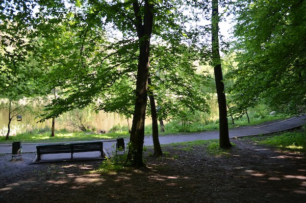
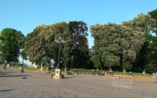
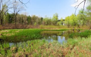
Holosiivskyi National Natural Park is one of the few national parks in the world located within a city. The sprawling area features combination of paved paths and dirt/gravel trails through a forest steppe landscape and passing numerous ponds. It’s located 12 km south of central Kyiv. There are many options for running here, with something for all abilities. There are map kiosks near the park entrances.
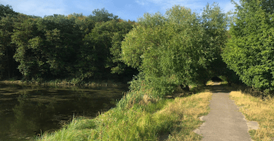
Pond area. Google Street View
Since there are so many trials (not all of them named), it’s challenging to map a specific route. As a guideline, we’ve created a 10k loop that starts near the Expo Center, then uses trails to head southeast to the Observatory in the middle of the park (2 km), then turning north for 3 km to the area of the ponds, which also has a ski slope and a small amusement park. Another popular option is the 2.7 km Eco-Trail in Holosiivskyi Forest, the central part of the Park.
Add-On: Some open, flat km around the Expo Center, which has park-like grounds, including a 1 km track-like loop around a fountain. There’s a popular 5 km route around the Expo Center.
Holosiivskyi National Natural Park is one of the few national parks in the world located within a city. The sprawling area features combination of paved paths and dirt/gravel trails through a forest steppe landscape and passing numerous ponds. It’s located 12 km south of central Kyiv. There are many options for running here, with something for all abilities. There are map kiosks near the park entrances.
Pond area. Google Street View
Since there are so many trials (not all of them named), it’s challenging to map a specific route. As a guideline, we’ve created a 10k loop that starts near the Expo Center, then uses trails to head southeast to the Observatory in the middle of the park (2 km), then turning north for 3 km to the area of the ponds, which also has a ski slope and a small amusement park. Another popular option is the 2.7 km Eco-Trail in Holosiivskyi Forest, the central part of the Park.
Add-On: Some open, flat km around the Expo Center, which has park-like grounds, including a 1 km track-like loop around a fountain. There’s a popular 5 km route around the Expo Center.
Scroll Down For Route Maps
Essentials
Many options. We've put together a ~10k loop to use as a guideline
Rolling hills
Numerous park entrances. Our loop starts neat the Expo Center
Numerous park entrances (Expo Center, or off Polkovnyka Potjekhina St.). Metro: Vystavkovyi tsentr or Ipodrom
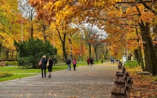
A comprehensive 'runseeing' tour of Kyiv, hitting many of city's main sights and monuments. Much of the route is through large squares and parks. It's quite easy to follow. The full tour is 13.5 km, but can be shortened. Hilly, with some great views.
Pleasant paths along the right bank of Dnieper River that run from the Pedestrian Bridge near the Friendship of Nations Arch for 5 km south to Navodnitsky Park. Good water views. Good options for a loop back through parks and add-ons.
A scenic and interesting 8 km loop combining paths, parks and sights. Nearly seamless off-road route connects the Mariinskyi Park and Palace area out to the Park of the Eternal Glory. Numerous options to vary the paths or add on. Pretty in winter!
This island that sits in the middle of the Dnieper River is a popular urban beach and park. A loop around the island is a pleasant 5 km run, combining paved and wooded paths. Can be combined with our Rusanivska Embankment and Telbin Lake route.
Combining a loop around Telbin Lake and the paths along the Rusanivska Embankment make for an attractive 10k waterside run on the left bank of the river, just across from Hydropark. There are great views of the water and the run is nearly all on paths.
Peremoha Park is lovely urban park with tree-lined, criss-crossing pathways and a lake. One can put together 4-5 km in the park, or combine with Park Kioto, a Japanese-themed park 1.5 km away, with paths lined by cherry trees.
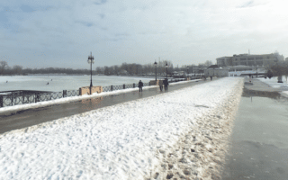
A pleasant run along the Dnieper River in the Obolon area. The 6.5 km route combines paths along the Obolonska Quay with a loop around the adjacent Park Natalka. The entire route is on off-road and multi-use paths. Great views of the water.
One of the more popular places to run in Kyiv, with numerous paved multi-use paths and some easy trail running on forested paths. One can run for many km on the island. We've mapped a popular 12 km loop from Yevropeiska Square.
Large park that sits between the left and right banks of the Dnieper has some good trails for running. A highlight is the round Memorial Garden. We've mapped a 7.7 loop, but many more km are possible. Good for a longer but not challenging trail run.
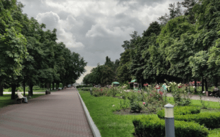
A particularly impressive botanical garden, and popular for running. Wide paved and gravel paths pass by a nice variety of flora and fauna. There's a fortress and a monastery at the eastern end. Can combine with Navodnitsky Park for a longer run.
Several parks in close proximity in the northwestern part of Kyiv, easily reachable by metro. Lots of wide, tree-lined paths. Run the parks standalone of combine Dubky Park, Nyvky Park, & Syretsʹky Park for a ~10k loop. Nyvky Park is the largest of the parks.
Share your feedback on this route and see that of other Great Runs users. Click on the image icon to upload a photo. And please let us know if there are notes or changes we should incorporate!
Subscribe
0 Comments
Oldest
Newest
Inline Feedbacks
View all comments
Essentials
Many options. We've put together a ~10k loop to use as a guideline
Rolling hills
Numerous park entrances. Our loop starts neat the Expo Center
Numerous park entrances (Expo Center, or off Polkovnyka Potjekhina St.). Metro: Vystavkovyi tsentr or Ipodrom


Review or Comment on This Route/Share a Photo!
Share your feedback on this route and see that of other Great Runs users. Click on the image icon to upload a photo. And please let us know if there are notes or changes we should incorporate!