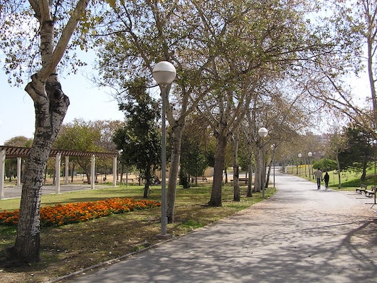
This is a quick & easy 5k run incorporating a few small parks. It’s easily accessible via Tram Line 2. We start in Parco Lo Morant, in the northwestern part of Alicante. Do a ~1.5 km loop of the park’s wide, palm-lined paths. Then, take Calle Diputado José Luis Barceló to Gran Vía, where paths run along a park-like median between two busy streets for ~1 km. Loop up to Plaza de Castalla, and return through another narrow linear park, the POLIDEPORTIVO VIA PARQUE.
Wikimedia Commons
Features:
Scroll Down For Route Maps
Essentials
- 5 km (3.1 mile) loop
- Flat
- Parco Lo Morant
- Tram Line 2: Maestro Alonso
Current Weather & Forecast

Alicante, ES
7:14 am,
Jul 14, 2026
L: 24°
H: 25°
Daily ForecastHourly Forecast
Today
11:00 pm
24° / 25°°C
0.2 mm
20%
8 mph
98 %
1015 mb
0 mm/h
Tomorrow
11:00 pm
15° / 28°°C
1 mm
100%
14 mph
100 %
1005 mb
0 mm/h
Thursday
11:00 pm
15° / 24°°C
0.51 mm
51%
15 mph
80 %
1005 mb
0 mm/h
Friday
11:00 pm
10° / 22°°C
1 mm
100%
13 mph
98 %
1010 mb
0 mm/h
Saturday
11:00 pm
12° / 21°°C
0 mm
0%
10 mph
77 %
1015 mb
0 mm/h
Today
8:00 am
14° / 14°°C
0.2 mm
20%
8 mph
97 %
1015 mb
0 mm/h
Today
11:00 am
14° / 14°°C
0 mm
0%
7 mph
98 %
1014 mb
0 mm/h
Today
2:00 pm
15° / 15°°C
0 mm
0%
8 mph
97 %
1014 mb
0 mm/h
Today
5:00 pm
22° / 22°°C
0 mm
0%
8 mph
82 %
1011 mb
0 mm/h
Today
8:00 pm
21° / 21°°C
0 mm
0%
8 mph
90 %
1009 mb
0 mm/h
Today
11:00 pm
22° / 22°°C
0 mm
0%
8 mph
89 %
1007 mb
0 mm/h
Tomorrow
2:00 am
19° / 19°°C
0.2 mm
20%
6 mph
99 %
1005 mb
0 mm/h
Other Routes in Alicante/Costa Blanca, Spain
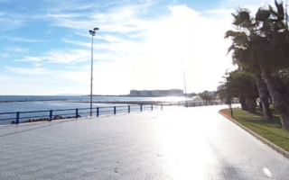
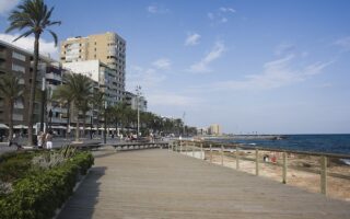
A scenic run along a palm-lined seaside promenade, with great views of the Mediterranean and Santa Barbara. The path stretches for nearly 7 km, from Playa de la Almadraba to the north all the way to the port.

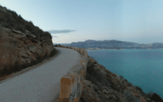
The climb to the Castell de la Santa Bàrbara is an opportunity to see one of Alicante's important sites, take in great views, and also give the lungs a workout. The windy walking path also dips down to a series of observation decks.
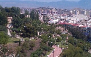
A route combining the tree-lined median of Av. Dr. Gadea to the Plaça dels Estels, and then the paths of Parque El Tossal, one of the more scenic parks in Alicante, which features remains of a castle. Good running track just west of the park.
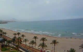
Palm-lined promenade runs for nearly 8 km from San Juan Playa to El Campello, covering three popular beaches. The wide, white sand beaches are also very runnable. Nice views of Montgó (mountain) from the promenade headed north.
Lovely coastal run on a seaside promenade alongside Platja la Vila Joiosa, then around the marina to the port, and then another 1 km promenade along Playa de los Estudiantes. Up to 7 km out and back. Visit the chocolate factory post-run!
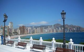
One of our favorite runs on the Costa Blanca is the 6.6 km seafront promenade in the coastal resort of Benidorm. The palm-lined path goes from Poniente Beach north to the end of Levante Beach. Festive, and great views!
Gorgeous, 13,750-acre mountain and marine conservation, with many km of trails that are popular for hiking. There are two trails that are particularly good for running, each about 5 km out and back and featuring great views
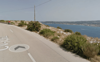
Two attractive routes in the Jávea/Xábia port area: A coastal route for 3.5 km to Platja de l'Arenal, and a run between the Molins De La Plana and Cap Sant Antoni, which features several 'miradors' (viewpoints).
Montgo Mountain is a craggy peak known for rock formations, caves, natural harbors & unusual flora & fauna. The best bet for running is the Carretera de La Colònia, a wide gravel path that after a short steep climb levels off. Good trail running options too.
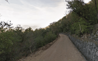
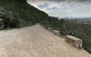
Beautiful nature preserve with wide gravel paths leading through one of the more bucolic Mediterranean forests in Spain. A route to the summit ridge is 7 km with a 300m elevation gain, but you can just choose a section or do a 14.5 km killer loop!

In the 20 km stretch between Torrevieja and San Pedro del Pinatar, there are several scenic coastal paths/waterfront promenades. From north to south, we've mapped routes in Torrevieja, Punta Prima, Oriheula, and Torre De La Horadada.
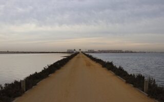
There's fantastic running at this 856 hectare 'wetland of international importance'. There are 15+ km of trails around reed beds, salt ponds, salt pans, pine forests, dunes, and beaches, including 6 km of Mediterranean coastline. Keep an eye out for flamingos!
User Ratings
Leave A Review or Comment
Review or Comment on This Route/Share a Photo!
Share your feedback on this route and see that of other Great Runs users. Click on the image icon to upload a photo. And please let us know if there are notes or changes we should incorporate!