A very popular route among runners in Columbus. The trail runs east-west along the Scioto River, serving as the spine of the famous Scioto Mile, a string of prominent parks, civic landmarks, and promenades.
Author: Emma Lamoreaux
Posts by Emma Lamoreaux
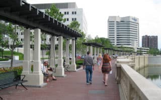
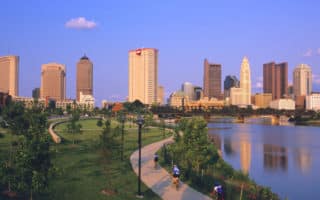
Stretching along the downtown Columbus Riverfront from the Arena District to the Whittier Peninsula, the Scioto Mile is the city’s premier downtown destination.
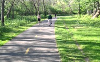
One of the most popular multi-use paths in all of Ohio, the Olentangy Trail runs for 13 miles along the Olentangy River. It's sort of a linear park trail, with parks along much of the way, also passing through the OSU Campus.
A 22-mile trail along one of the city's most scenic river corridors, from Three Creeks Park to Westerville. Most of it is paved, but some sections are unpaved and a little more challenging/technical. Many parks and trail heads along the way.
Large park 18 miles southwest of Columbus featuring 7,000 acres of forest, prairies, and wetlands. Combination of easier multi-use trails and also good for trail running. Connections to Camp Chase Trail.
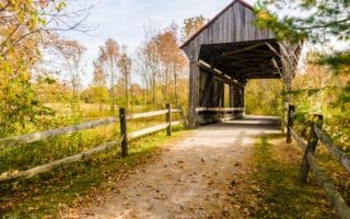
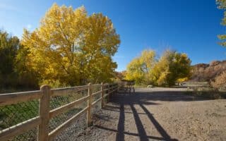
1150 acre park, 17 miles north of downtown, offering great options for trail running with lots of variety. Most trails are in the northern section of the park. There are some gentler, paved options too.
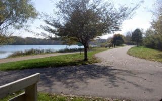
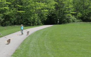
Located 10 miles north of downtown, Antrim Park offers a beautiful 1.2 mile, gravel path around a tranquil lake. A nice option as part of the Olentangy Trail.
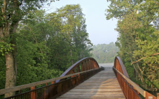
Located on the east edge of downtown, the Bonneville trail is a well-maintained singletrack that follows the Ice Age Bonneville Lake Shoreline. Hilly, with great views.
Attracting lots of bicyclists, walkers, and runners, the route is mostly paved and fairly hilly. Running this route, you’ll pass several of Salt Lake City’s famous landmarks.

Located in the western part of Salt Lake City, this paved trail is great for long distance running. This 8.1 mile route follows the beautiful Jordan River, passing through several lovely parks. Good option near SLC Airport!
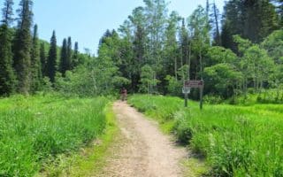
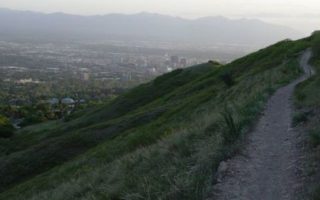
A canyon in the Wasatch Mountains. Great for trail running. Big variety of trails. Hilly and challenging.
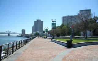
Scenic run through two riverfront parks along the Mississippi River, steps from the French Quarter. Great views of the Mississippi River, a festive scene, & numerous park features owing to recent improvements & connections. Good add-on opportunities!
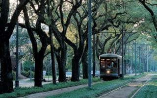
Beautiful, historic neighborhood for running, with elegant homes and a canopy of live oaks. Run with the trolleys along St. Charles Ave., then explore the Garden District neighborhood south of St. Charles.
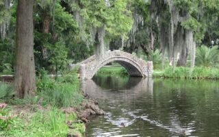
“As magical and unique as the city of New Orleans”, this 1,300-acre park is the 7th-most-visited urban park in the USA. Botanical gardens, lake loops, forest trails, & longer multi-use paths passing under historic live oaks. Can do a 5-6 mile run in the park, with good add-ons.
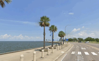
Nearly 20 miles of scenic waterfront running along Lake Ponchartrain -- the USA's second-largest saltwater lake. Great water views! Divided into 5.6-mile waterfront promenade along Lakeshore Dr. toward UNO East Campus, and 12.4-mile Lakefront Trail west to Kenner.
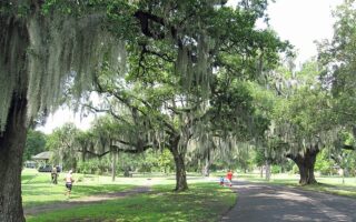
One of the most popular routes for running in New Orleans. Upwards of 3,000 people run under a leafy canopy of live oaks and alongside a little lagoon, each day. Add on with the campus of Tulane University and the area's pretty residential streets.
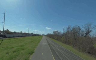
Paved multi-use path atop the Mississippi River levee is a flat & uninterrupted run. There's a 22-mile section from Audubon Park west to St. Charles Parish and a 9-mile section in the Algiers Point area. Can be monotonous. Occasional river views, open & exposed.
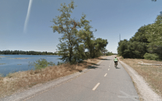
Nice running on the eastern section of the Jedediah Smith Memorial Trail in Folsom. Full lake loop is 11.3 miles, passing through several parks & preserves. Lake views along about half of the route.
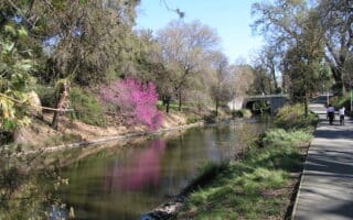
Davis is a suburb of Sacramento, home to the large UC Davis and known for its bikeability. There's lovely running in Davis, highlighted by the UC Davis Arboretum, nice paths around campus, a running track, and the East Davis Greenways.
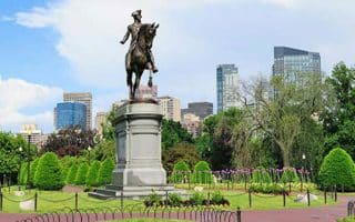
The Freedom Trail is a 3-mile route around the city of Boston and Charlestown, that marks some of Boston’s most famous historic landmarks.
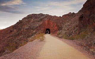
A spectacular 3.5 mile gravel trail between the Lake Mead Visitor Center and Hoover Dam. About a 45 min. drive from Las Vegas. Great views and several tunnels.
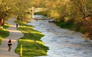
This paved path is the centerpiece of running in downtown Denver. Up to 42 miles, but the best downtown area section starts at Confluence Park, heading 4 miles southeast toward the Cherry Creek Mall.
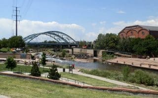
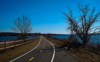
This is a 17.8 mile paved greenway following the Platte River, south toward Englewood and north toward Thornton. We’ve mapped a 4.5 mile loop of the nicest sections.

Here is the course map for the Rock ‘N Roll Denver half-marathon, held in October. Start at the Denver Art Museum. Great tour of downtown, major parks and sites.
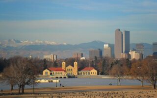
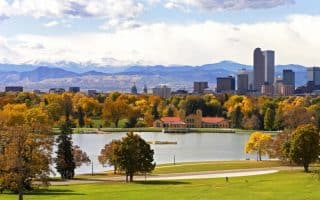
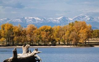
The largest and most notable park in Denver. The 330-acre park contains a zoo, Science Museum, & two lakes. A highlight for runners is the Mile High Loop -- exactly 5k, following the 5,280 feet contour line! Add with other trails.
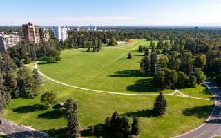
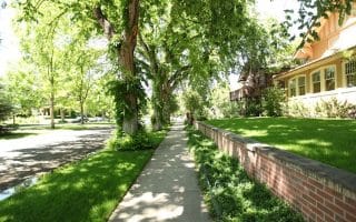
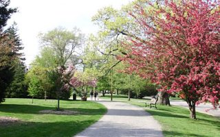
A pleasant urban park in Denver's Capitol Hill neighborhood. Starting from downtown, run by lovely homes, Denver Art Museum, Colorado History Center, St. John’s Cathedral. The 1.6 mile park loop includes the Denver Botanical Gardens at the western edge.
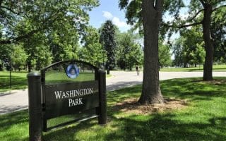
Washington Park includes 150 acres of pleasant grounds including two lakes, two flower gardens, one of which is a replica of George Washington’s gardens at Mount Vernon.
This is a great option for a long run or even a half marathon! We’ve put together a 13.5 mile run incorporating City Park, Cheesman Park, and Washington Park.
Located in the Highlands region of Denver just west of downtown, Sloan Lake is a great spot for a run, featuring a 2.5 mile loop around the perimeter. Nice combo run our Platte River Trail Loop
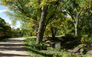
The 66-mile trail connects many of Denver’s parks and has some lovely sections shaded by cottonwood trees. The most scenic stretch is the 6 miles between Three Pond Park and Orchard Road. Detailed trail map included.
Englewood is one of Denver’s major southern suburbs and home to lots of businesses. A great option for running here is Cherry Creek State Park, which is the southeastern terminus of the Cherry Creek Trail that starts in Denver.
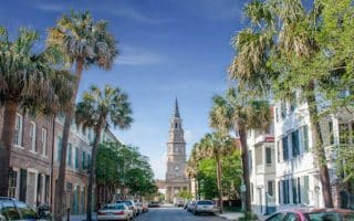
Lots of ways to explore Charleston's spectacular historic district. Get up early and create your own route before the crowds hit. We've mapped an outline route and also a lovely 2.6-miler 'straight shot' on pretty streets to Colonial Lake. Many options to vary.
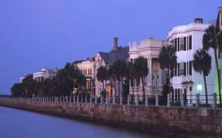
A great 4.3 miler along the water, highlighting Waterfront Park, The Battery, waterfront paths along Murray Blvd., and a loop around Colonial Lake.
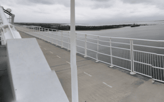
A must-do running experience on Charleston is the run from downtown over the Arthur Ravenel Bridge. It looks daunting, but there's a wide, well-protected multi-use path that's popular with pedestrians and cyclists. Additional options to explore Patriots Point.
A worth-it destination run, located east of Charleston. Enjoy 2.5 miles from the mainland to Sullivan's island with wetland and water views. On the island, there are nice waterfront roads, attractive homes, and great beach running.
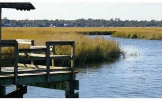
A nice running destination only a few miles from downtown. There are 4-5 miles of trails through woods and along tidal creeks. Some nice views.

A beautiful run along the waterfront to the historic Citadel, and the perimeter of the lovely Hampton Park. Shorter and longer options.