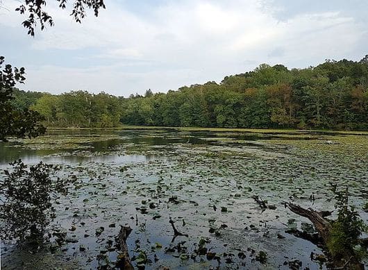
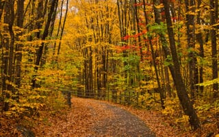
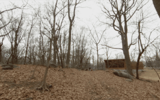
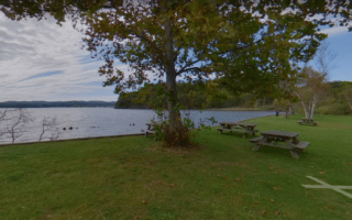
There are extensive running opportunities in the Teatown Lake area. The 1,000 Teatown Lakes Reservation has 15 miles of trails of easy to moderate difficulty, including several lake loops. For a longer, continuous off-road run, the Briarcliff-Peekskill Trailway is a ~9 mile gravel path between Ossining and Cortlandt.
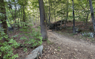
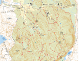
Teatown Lakes Reservation. This trail map shows several marked loops, of varying length and difficulty. Easiest for running is the 1.5 mile lake loop. There are some more challenging, hillier trails with trickier footing. TRAIL MAP
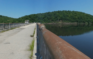
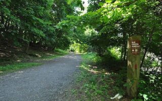
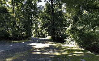
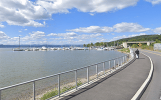
Croton Gorge Park. Google Street View
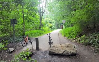
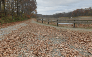
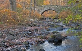
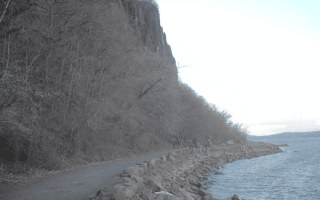
Briarcliff-Peekskill Trailway. This 8.7-mile gravel trail follows a never-built parkway. From Teatown Lakes Reservation, the trail extends south for 2.5 miles to Rt. 9A in Ossining. But the nicer section goes for 6+ miles, skirting the west side of Teatown Lake to Croton Gorge Park, passing Colbaugh Pond, through Briarcliff-Peekskill Trailway Park, and ending at Blue Mountain (many miles of more rugged trails there. ROUTE MAP
Add-Ons: At Croton Gorge Park, connect to the Old Croton Trailway State Park trail, a wide gravel trail that extends for 2.5 miles south (and picks up again after some on-road sections). ROUTE MAP
There are extensive running opportunities in the Teatown Lake area. The 1,000 Teatown Lakes Reservation has 15 miles of trails of easy to moderate difficulty, including several lake loops. For a longer, continuous off-road run, the Briarcliff-Peekskill Trailway is a ~9 mile gravel path between Ossining and Cortlandt.
Teatown Lakes Reservation. This trail map shows several marked loops, of varying length and difficulty. Easiest for running is the 1.5 mile lake loop. There are some more challenging, hillier trails with trickier footing. TRAIL MAP
Croton Gorge Park. Google Street View
Briarcliff-Peekskill Trailway. This 8.7-mile gravel trail follows a never-built parkway. From Teatown Lakes Reservation, the trail extends south for 2.5 miles to Rt. 9A in Ossining. But the nicer section goes for 6+ miles, skirting the west side of Teatown Lake to Croton Gorge Park, passing Colbaugh Pond, through Briarcliff-Peekskill Trailway Park, and ending at Blue Mountain (many miles of more rugged trails there. ROUTE MAP
Add-Ons: At Croton Gorge Park, connect to the Old Croton Trailway State Park trail, a wide gravel trail that extends for 2.5 miles south (and picks up again after some on-road sections). ROUTE MAP
Scroll Down For Route Maps
Essentials
15 miles of trails in the Reservation; Briarcliff-Peekskill Trailway is 8.7 miles (14 km) one-way
Outer loop is 863 feet (263m) one-way, south to north -- very rolling hills!
Good starting point is Visitor Center at Teatown Lake Reservation
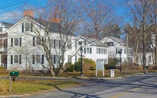
An overview of some of the best neighborhood running in Westchester County, featuring quiet, tree-lined streets and attractive homes. Includes Bronxville, Hastings-on Hudson, Scarsdale, White Plains, Rye, Larchmont, & Chappaqua.
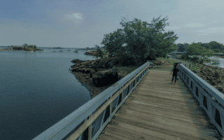
A nice run in New Rochelle, combining two waterfront parks. The 2-mile loop of Glen Island Park is especially nice. Can be combined with our route from New Rochelle-Five Islands Park-Larchmont route for an even longer run!
A pleasant run featuring waterfront sections of New Rochelle and upscale Larchmont, including the lovely Five Islands Park. Additional options to explore on the attractive residential streets of Larchmont and Mamaroneck.
The southern section of the ~35 mile paved multi-use path that runs the length of Westchester County. It's ~14.5 miles between the New York City Line and Eastview. Access to numerous parks & other routes. Follows the Saw Mill Parkway for most of its length.
The northern section of the ~35 mile paved multi-use path that runs the length of Westchester County. It's ~21 miles between Eastview and Baldwin Place. Access to numerous parks & other routes. More bucolic in the northern 12 miles from Millwood.
More multi-use paths that extend into Putnam County and our Hudson Valley running guide. From the northern end of the North County Trail, The Putnam Trailway goes for 11 miles to Brewster, and then the new Maybrook Trailway runs for 25 miles from Brewster to Hopewell Junction.
Follows a historic aqueduct for 20+ miles from Yonkers to Croton Dam. Mainly unpaved trail is a mix, winding through woods, towns, and historic sites. The southern section is most seamless, and the northern section has a few on-road connector sections.
A 15-mile off-road trail system connecting numerous parks in White Plains, Eastchester, and New Rochelle. There's an Outer Loop, Eastern Loop, & Western Loop option. Includes trails in Saxon Woods, Ward Acres Park, Sheldrake Lake, Twin Lakes County Park.
Pleasant trail running in mature hardwood forest with two marked loops adding up to 6 miles. Take a post-run dip in the county's largest pool! Can connect with the 15-mile Colonial Greenway/Leatherstocking Trail for a longer run.
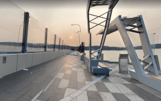
Running the Cuomo Bridge over one of the widest points of the Hudson River is a memorable experience! It's 3.5 miles between Westchester Landing and Rockland Landing. Scenic overlooks, interpretive displays, public art across its length. Add-ons both sides.
A nice, hilly 8-mile route, combining a loop around Tarrytown Lakes, and scenic trails of Pocantico Hills/Buttermilk Hill, the eastern section of Rockefeller SP. There are some road sections that lack a shoulder. Additional trails in Rockefeller SP.
The 45 miles of carriage trails at Rockefeller State Park are one of the running highlights of Westchester County. Wide, paths made of crushed stone through gorgeous hardwood forests, landscaped gardens, fields lakes. Great views of the Hudson.
Several parks and preserves that are nice for running in the Dobbs Ferry/Irvington/Ardsley area. The 400-acre Irvington Woods is the highlight, with a good variety of wooded trails. Can add on with Juhring Nature Preserve, VE Macy Park, S County Trailway.
These two parks in the Hartsdale/Scarsdale area combine for ~5 miles of pleasant, mainly wooded paths. Hart's Brook Park preserve is located on grounds of the former Gaisman Estate. Add on with some of the pleasant residential streets of this upscale area.
Best running options in White Plains are the residential streets east of downtown toward Silver Lake Park, the Bronx River Pathway, and Fisher Ave./Walworth Ave., which is a several-mile straight shot headed south toward Scarsdale.
Croton-on-Hudson is one of the best spots for a run along the Hudson River in Westchester County. Includes a loop of Croton Point Park, and paved multi-use path to Croton Landing and the 9/11 Memorial. Great water views and nearly all off-road.
A pleasant running route incorporating the wooded trails of Georges Island Park, and then a jaunt to Steam Boat Dock in Verplanck, with nice views of Lake Meahagh and the Hudson River.
This 4,315-acre preserve is Westchester County's largest park. There are 35 miles of trails, mainly wooded, but there are also some open sections with meadows, and several scenic overlooks. Trail map shows several blazed, color-coded loop options. Some hills!
Terrific waterfront running in this village just over the Cuomo Bridge. Highlight is trail at Nyack Beach State Park, which has great river views. There are also lake loops at nearby Rockland Lake and Congers Lake. You can also now run over the bridge to Tarrytown!
Share your feedback on this route and see that of other Great Runs users. Click on the image icon to upload a photo. And please let us know if there are notes or changes we should incorporate!
Subscribe
1 Comment
Oldest
Newest
Inline Feedbacks
View all comments
Essentials
15 miles of trails in the Reservation; Briarcliff-Peekskill Trailway is 8.7 miles (14 km) one-way
Outer loop is 863 feet (263m) one-way, south to north -- very rolling hills!
Good starting point is Visitor Center at Teatown Lake Reservation


Review or Comment on This Route/Share a Photo!
Share your feedback on this route and see that of other Great Runs users. Click on the image icon to upload a photo. And please let us know if there are notes or changes we should incorporate!